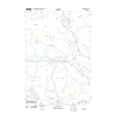
2011 Map of Cornish
USGS Topo · Published 2011About this map
The Saco River and Ossipee River converge near Cornish in this southern Maine landscape, where water power and river valleys historically dictated the pattern of settlement. Evidence of early industry is visible at the Hiram Falls Dam and Great Falls along the northern Saco. The quadrangle is exceptionally dense with small burial grounds, reflecting a deeply rooted rural genealogy; researchers can find numerous family-named plots including the Cotton Cemetery, Wadsworth Cemetery, Durgin Cemetery, and Gerrish Cemetery scattered through the hills.
Find a feature on this map
118 named features on this map. Tap any name to fly to it.
Don’t see what you’re looking for? This feature index may not catch every label — zoom into the map to look around manually.
Map Details
Editions of this 2011 Cornish Map
This is the sole edition of this map. No revisions or reprints were ever made.
Other maps of this area

1891 · Buxton
USGS Topo · 1:62,500

1891 · Newfield
USGS Topo · 1:62,500

1892 · Buxton
USGS Topo · 1:62,500

1893 · Buxton
USGS Topo · 1:62,500

1893 · Newfield
USGS Topo · 1:62,500

1896 · Sebago
USGS Topo · 1:62,500

1910 · Kezar Falls
USGS Topo · 1:48,000

1911 · Kezar Falls
USGS Topo · 1:62,500

1933 · Newfield
USGS Topo · 1:48,000

1937 · Newfield
USGS Topo · 1:62,500