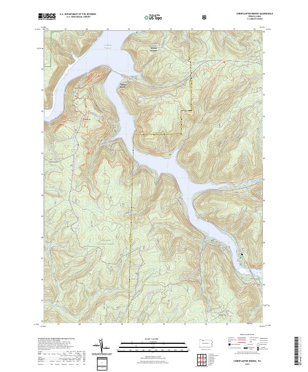
2023 Map of Cornplanter Bridge
USGS Topo · Published 2023About this map
Allegheny National Forest dominates this landscape along the border of Warren and McKean Counties, where the vast Allegheny Reservoir serves as a central geographical feature. Small residential clusters like Kinzua Heights and Swede Hill sit among the timbered ridges, while recreational sites such as Kinzua Beach and the overlook at Jakes Rocks emphasize the modern use of this rugged terrain. The map documents an extensive network of forestry and scenic roads, including Longhouse Scenic Dr, and specialized paths such as the Rimrock X-C Ski Trl and North Country National Scenic Trl. For genealogists and local historians, the Lone Pine Cem near the banks of Kinzua Creek provides a tangible link to the area's earlier inhabitants. Numerous tributaries, including Chappel Fork and Dutchman Run, carve through the deep valleys of the plateau, illustrating the complex drainage patterns that define this part of northern Pennsylvania.
Find a feature on this map
75 named features on this map. Tap any name to fly to it.
Don’t see what you’re looking for? This feature index may not catch every label — zoom into the map to look around manually.
Map Details
Editions of this 2023 Cornplanter Bridge Map
This is the sole edition of this map. No revisions or reprints were ever made.
Other maps of this area

1906 · Warren
USGS Topo · 1:62,500

1907 · Warren
USGS Topo · 1:62,500

1908 · Warren
USGS Topo · 1:62,500

1934 · Kane
USGS Topo · 1:48,000

1935 · Sheffield
USGS Topo · 1:48,000

1936 · Kinzua
USGS Topo · 1:48,000

1939 · Kane
USGS Topo · 1:62,500

1941 · Sheffield
USGS Topo · 1:62,500

1941 · Kinzua
USGS Topo · 1:62,500
1949 · Kinzua
USGS Topo · 1:62,500