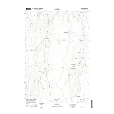
2015 Map of Cornwall
USGS Topo · Published 2015About this map
Otter Creek meanders through this portion of Addison County, defining the low-lying wetlands and agricultural stretches between the settlements of Cornwall and West Salisbury. The landscape is marked by a network of drainage and tributary systems, including Lemon Fair River and Bascom Brook, which have historically dictated the placement of homesteads and transport routes. Genealogists will find a high concentration of burial sites throughout the township, such as Evergreen Cem and Old South Cem, many located near early crossroads. Notable landmarks such as the Station Covered Bridge and Salisbury Station highlight the historic intersection of water, road, and rail that supported the local dairy and timber economies. Distinctive landforms like Bond Island and Hollands Pasture Island emerge from the floodplains, illustrating the intricate hydrology that has shaped this Vermont valley for generations.
Find a feature on this map
86 named features on this map. Tap any name to fly to it.
Don’t see what you’re looking for? This feature index may not catch every label — zoom into the map to look around manually.
Map Details
Editions of this 2015 Cornwall Map
This is the sole edition of this map. No revisions or reprints were ever made.
Other maps of this area

1894 · Port Henry
USGS Topo · 1:62,500

1894 · Ticonderoga
USGS Topo · 1:62,500

1896 · Ticonderoga
USGS Topo · 1:62,500

1898 · Port Henry
USGS Topo · 1:62,500

1902 · Ticonderoga
USGS Topo · 1:62,500

1902 · Brandon
USGS Topo · 1:62,500

1903 · Middlebury
USGS Topo · 1:62,500

1904 · Brandon
USGS Topo · 1:62,500

1905 · Middlebury
USGS Topo · 1:62,500

1920 · Brandon
USGS Topo · 1:62,500