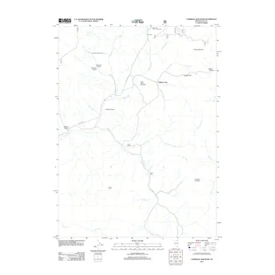
2012 Map of Cornwall Mountain
USGS Topo · Published 2012About this map
Island Mountain Post Office and the surrounding high country of the Ichabod Range define this high-altitude landscape in northeastern Elko County. The map details a network of ranching outposts and remote habitations, including Mink Ranch, F Baker Ranch, and the S Baker Ranch, scattered among the drainage systems of Gold Creek and Hay Meadow Creek. The geography is characterized by prominent peaks like Cornwall Mountain and Haystack Mountain, linked by routes such as Gold Creek Rd and FR 037. Evidence of seasonal and historic land use appears through the presence of Williams Cabin, Johnson Cabin, and the Gold Creek Public Campgrounds. These features reflect a legacy of isolated mountain settlement and the essential role of springs, such as Rosebud Spring and Fuzzie Spring, in supporting life and livestock in this arid terrain.
Find a feature on this map
36 named features on this map. Tap any name to fly to it.
Don’t see what you’re looking for? This feature index may not catch every label — zoom into the map to look around manually.
Map Details
Editions of this 2012 Cornwall Mountain Map
This is the sole edition of this map. No revisions or reprints were ever made.
Other maps of this area

1935 · Charleston
USGS Topo · 1:48,000

1936 · Mountain City
USGS Topo · 1:62,500

1936 · Rowland
USGS Topo · 1:48,000

1940 · Rowland
USGS Topo · 1:62,500

1940 · Mountain City
USGS Topo · 1:62,500

1942 · Mt. Velma
USGS Topo · 1:62,500

1955 · Wells
USGS Topo · 1:250,000

1956 · Wild Horse
USGS Topo · 1:62,500

1958 · Wells
USGS Topo · 1:250,000

1961 · Wells
USGS Topo · 1:250,000