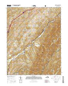
2016 Map of Cornwall
USGS Topo · Published 2016About this map
Cornwall and Marlbrook anchor this 2016 survey of the Blue Ridge foothills, where the South River and Irish Creek carve through a landscape of high ridges and deep hollows. The settlement pattern follows the drainages and gaps, with communities like Midvale and Riverside established along the watercourses. Local family history is preserved in sites such as McDowell Cem and Timber Ridge Cem, while the northern portion of the George Washington National Forest covers much of the eastern terrain. Significant elevation changes are marked by Whites Peak and Chimney Rock Mtn, while the Blue Ridge Parkway traces the crest of the mountains. This map documents the persistent rural character of Rockbridge Co and its neighboring Amherst Co, showing the enduring footprint of places like Blacksburg and Donaldsburg within the mountain valleys.
Find a feature on this map
107 named features on this map. Tap any name to fly to it.
Don’t see what you’re looking for? This feature index may not catch every label — zoom into the map to look around manually.
Map Details
Editions of this 2016 Cornwall Map
This is the sole edition of this map. No revisions or reprints were ever made.
Other maps of this area

1894 · Lexington
USGS Topo · 1:125,000

1932 · Lexington
USGS Topo · 1:48,000

1935 · Buena Vista
USGS Topo · 1:48,000

1935 · Amherst
USGS Topo · 1:48,000

1936 · Vesuvius
USGS Topo · 1:48,000

1937 · Lexington
USGS Topo · 1:62,500

1939 · Amherst
USGS Topo · 1:62,500

1939 · Buena Vista
USGS Topo · 1:62,500

1940 · Buena Vista
USGS Topo · 1:62,500

1941 · Vesuvius
USGS Topo · 1:62,500