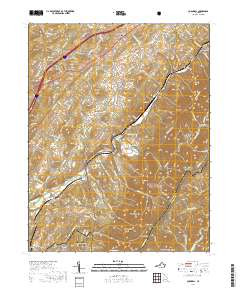
2019 Map of Cornwall
USGS Topo · Published 2019About this map
South River winds through the heart of this landscape, anchoring a series of small settlements and family-named ridges in the foothills of the Blue Ridge. The map details the rural character of communities like Cornwall, Donaldsburg, and Marlbrook, where local life is organized around the winding paths of Irish Creek and Whitesides Run. For genealogists, the survey identifies critical landmarks including McDowell Cem, Timber Ridge Cem, and Clarks Mountain Cem, offering precise locations for ancestral research. The eastern boundary is defined by the high elevations of South Mtn and the iconic route of the Blue Ridge Parkway, which traverses the ridge near Whites Peak and Whites Gap. Further south, the map captures the outskirts of Buena Vista, showing the transition from the forested reaches of the George Washington National Forest to more established residential streets and industrial tracts.
Find a feature on this map
121 named features on this map. Tap any name to fly to it.
Don’t see what you’re looking for? This feature index may not catch every label — zoom into the map to look around manually.
Map Details
Editions of this 2019 Cornwall Map
This is the sole edition of this map. No revisions or reprints were ever made.
Other maps of this area

1894 · Lexington
USGS Topo · 1:125,000

1932 · Lexington
USGS Topo · 1:48,000

1935 · Buena Vista
USGS Topo · 1:48,000

1935 · Amherst
USGS Topo · 1:48,000

1936 · Vesuvius
USGS Topo · 1:48,000

1937 · Lexington
USGS Topo · 1:62,500

1939 · Amherst
USGS Topo · 1:62,500

1939 · Buena Vista
USGS Topo · 1:62,500

1940 · Buena Vista
USGS Topo · 1:62,500

1941 · Vesuvius
USGS Topo · 1:62,500