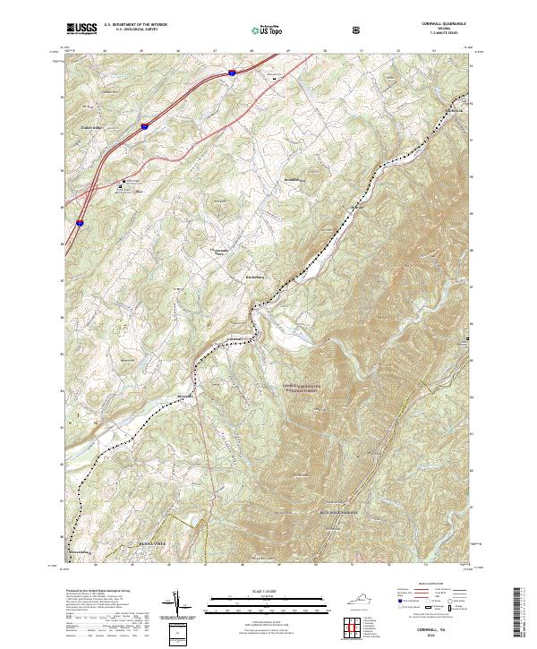
2022 Map of Cornwall
USGS Topo · Published 2022About this map
The South River defines the drainage of this Virginia landscape, carving a deep valley between the Blue Ridge and Timber Ridge. In this modern topographic study, the interface between the George Washington National Forest and local valley settlements is clearly visible, showing the clustered developments of Donaldsburg, Midvale, and Cornwall. The map serves as a vital genealogical resource for the Rockbridge County area, locating the McDowell Cem, Clarks Mountain Cem, and the Timber Ridge ARP Church Cem. Cultural landmarks like the Crossroads Store and Blacksburg sit near the northern hills, while the southern portion transitions toward the city limits of Buena Vista. High peaks such as Whites Peak and Chimney Rock Mtn dominate the eastern forest terrain, overlooking numerous creeks like Irish Creek and Whitesides Run.
Find a feature on this map
121 named features on this map. Tap any name to fly to it.
Don’t see what you’re looking for? This feature index may not catch every label — zoom into the map to look around manually.
Map Details
Editions of this 2022 Cornwall Map
This is the sole edition of this map. No revisions or reprints were ever made.
Other maps of this area

1894 · Lexington
USGS Topo · 1:125,000

1932 · Lexington
USGS Topo · 1:48,000

1935 · Buena Vista
USGS Topo · 1:48,000

1935 · Amherst
USGS Topo · 1:48,000

1936 · Vesuvius
USGS Topo · 1:48,000

1937 · Lexington
USGS Topo · 1:62,500

1939 · Amherst
USGS Topo · 1:62,500

1939 · Buena Vista
USGS Topo · 1:62,500

1940 · Buena Vista
USGS Topo · 1:62,500

1941 · Vesuvius
USGS Topo · 1:62,500