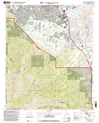
1997 Map of Corona South
USGS Topo · Published 2000About this map
The Corona city grid meets the steep northern slopes of the Santa Ana Mountains in this late 1990s revision. This area highlights a transitional landscape where suburban development from Home Gardens and El Cerrito presses against the protected wildlands of the Cleveland National Forest. Evidence of the region’s earlier transit history is preserved at the Butterfield Stage Sta Historical Marker near Temescal Wash, while the Atchison Topeka and Santa Fe RR continues to follow the established lowland corridors.
Find a feature on this map
60 named features on this map. Tap any name to fly to it.
Don’t see what you’re looking for? This feature index may not catch every label — zoom into the map to look around manually.
Map Details
Editions of this 1997 Corona South Map
This is the sole edition of this map. No revisions or reprints were ever made.
Other maps of this area

1901 · Southern California Sheet No. 1
USGS Topo · 1:250,000

1901 · Elsinore
USGS Topo · 1:125,000

1901 · Riverside
USGS Topo · 1:62,500

1902 · Corona
USGS Topo · 1:125,000

1904 · Southern California Sheet No. 1
USGS Topo · 1:250,000
1933 · Prado
USGS Topo · 1:31,680

1935 · El Toro
USGS Topo · 1:31,680
1941 · Prado
USGS Topo · 1:31,680

1942 · Lake Elsinore
USGS Topo · 1:62,500
1942 · Corona and Vicinity
USGS Topo · 1:31,680