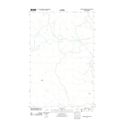
2011 Map of Corrigan Mountain
USGS Topo · Published 2011About this map
Corrigan Mountain and the surrounding high plains of Blaine County define this landscape as it appeared in the early 21st century. The map centers on a network of drainages that carve through the open terrain, including Peoples Creek and its tributary, South Branch Peoples Creek, along with Snake Creek to the north. These waterways dictate the local geography, with roads often tracing the lowlands or bridging the seasonal flows.
Find a feature on this map
15 named features on this map. Tap any name to fly to it.
Don’t see what you’re looking for? This feature index may not catch every label — zoom into the map to look around manually.
Map Details
Editions of this 2011 Corrigan Mountain Map
This is the sole edition of this map. No revisions or reprints were ever made.
Other maps of this area

1953 · Havre
USGS Topo · 1:250,000

1956 · Maddux
USGS Topo · 1:62,500

1956 · Rattlesnake
USGS Topo · 1:62,500

1956 · Lloyd
USGS Topo · 1:62,500

1956 · Cleveland
USGS Topo · 1:62,500

1957 · Havre
USGS Topo · 1:250,000

1958 · Havre
USGS Topo · 1:250,000
1987 · Cleveland
USGS Topo · 1:24,000
1987 · Runyan Bench
USGS Topo · 1:24,000
1987 · Scotty Butte
USGS Topo · 1:24,000