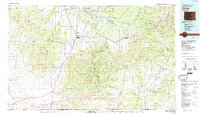
1982 Map of Cortez
USGS Topo · Published 1992About this map
Mesa Verde National Park anchors the central landscape of this 1982 survey, revealing the complex topography of Chapin Mesa, Moccasin Mesa, and Navajo Canyon. To the west, the Ute Mountain Indian Reservation includes the tribal headquarters at Towaoc, while the Southern Ute Indian Reservation extends to the southeast. The agricultural valley around Cortez and Mancos is defined by vital water sources like the McElmo Creek and the Dolores River in the north.
Find a feature on this map
41 named features on this map. Tap any name to fly to it.
Don’t see what you’re looking for? This feature index may not catch every label — zoom into the map to look around manually.
Map Details
Editions of this 1982 Cortez Map
This is the sole edition of this map. No revisions or reprints were ever made.
Other maps of this area

1886 · Abajo
USGS Topo · 1:250,000

1889 · Largo
USGS Topo · 1:250,000

1889 · Chaco
USGS Topo · 1:250,000

1892 · Abajo
USGS Topo · 1:250,000

1892 · Chaco
USGS Topo · 1:250,000

1892 · Canyon De Chelly
USGS Topo · 1:250,000

1893 · Abajo
USGS Topo · 1:250,000

1895 · Largo
USGS Topo · 1:250,000

1895 · La Plata
USGS Topo · 1:62,500

1897 · La Plata
USGS Topo · 1:62,500