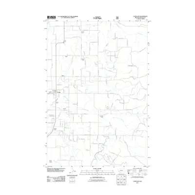
2011 Map of Corvallis
USGS Topo · Published 2011About this map
The settlement of Corvallis serves as the central hub of this Bitterroot Valley landscape, defined by a grid of agricultural lanes and irrigation drainage. This 2011 survey documents a mix of civic infrastructure and rural residential expansion, featuring the Corvallis Post Office and dual stations for the Corvallis Fire Dist Sta 1. To the south, the Ravalli County Airport occupies the level terrain near Gird Creek, while the Corvallis Cemetery sits tucked between Cow Creek and Willow Creek. The map provides excellent genealogical detail through family-named landmarks like Cobb, Quast, and Chaffin Butte. To the east, the terrain rises into the foothills, marked by several prominent drainages including Soft Rock Creek, Coalpit Creek, and Calf Creek. The presence of the Corvallis Siding indicates the historical importance of the rail corridor in moving the region's agricultural products.
Find a feature on this map
64 named features on this map. Tap any name to fly to it.
Don’t see what you’re looking for? This feature index may not catch every label — zoom into the map to look around manually.
Map Details
Editions of this 2011 Corvallis Map
This is the sole edition of this map. No revisions or reprints were ever made.
Other maps of this area

1901 · Hamilton
USGS Topo · 1:125,000

1909 · Sapphire
USGS Topo · 1:125,000

1947 · Butte
USGS Topo · 1:250,000

1956 · Hamilton
USGS Topo · 1:250,000

1958 · Butte
USGS Topo · 1:250,000

1959 · Hamilton
USGS Topo · 1:250,000

1960 · Butte
USGS Topo · 1:250,000

1960 · Hamilton
USGS Topo · 1:250,000

1962 · Butte
USGS Topo · 1:250,000

1964 · Hamilton
USGS Topo · 1:250,000