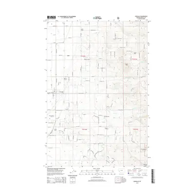
2014 Map of Corvallis
USGS Topo · Published 2014About this map
Corvallis and the smaller settlement of Cobb serve as the primary hubs in this Bitterroot Valley landscape during the early 21st century. The map reveals a transition from the agricultural flats along the Eastside Hwy to the rising foothills of the Bitterroot Nat For. This eastern edge of the valley is defined by numerous seasonal and perennial watercourses, including Willow Cr and Soft Rock Cr, which have carved out distinct terrain features like Coyote Gulch and Holloron Gulch.
Find a feature on this map
115 named features on this map. Tap any name to fly to it.
Don’t see what you’re looking for? This feature index may not catch every label — zoom into the map to look around manually.
Map Details
Editions of this 2014 Corvallis Map
This is the sole edition of this map. No revisions or reprints were ever made.
Other maps of this area

1901 · Hamilton
USGS Topo · 1:125,000

1909 · Sapphire
USGS Topo · 1:125,000

1947 · Butte
USGS Topo · 1:250,000

1956 · Hamilton
USGS Topo · 1:250,000

1958 · Butte
USGS Topo · 1:250,000

1959 · Hamilton
USGS Topo · 1:250,000

1960 · Butte
USGS Topo · 1:250,000

1960 · Hamilton
USGS Topo · 1:250,000

1962 · Butte
USGS Topo · 1:250,000

1964 · Hamilton
USGS Topo · 1:250,000