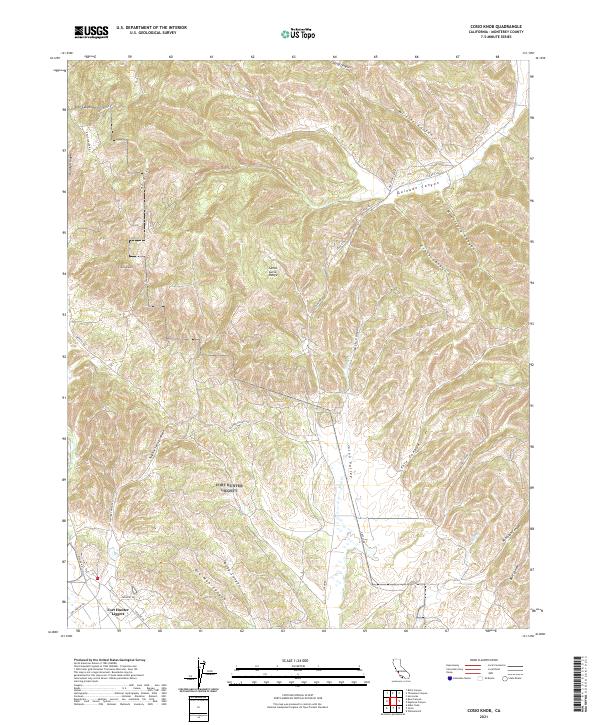
2021 Map of Cosio Knob
USGS Topo · Published 2021About this map
Fort Hunter Liggett occupies the southwestern corner of this study, positioned near the intersection of Mission Rd and Bradley Dr. The landscape is dominated by the high elevations of the Santa Lucia Range, where Cosio Knob serves as a prominent landmark. A complex network of drainage systems, including Sulphur Spring Canyon and Old Man Canyon, carves through the local topography, leading toward the Jolon Valley to the east. The map records the course of Jolon Cr as it traverses this valley floor, flanked by Pole Canyon and Kirk Canyon. Roadways such as Jolon Rd and the Old Jolon Grade provide access through the varying elevations of the Oak Hills and Rudolph Ridge, illustrating the modern transit routes through this section of Monterey County.
Find a feature on this map
37 named features on this map. Tap any name to fly to it.
Don’t see what you’re looking for? This feature index may not catch every label — zoom into the map to look around manually.
Map Details
Editions of this 2021 Cosio Knob Map
This is the sole edition of this map. No revisions or reprints were ever made.
Other maps of this area

1919 · King City
USGS Topo · 1:62,500

1919 · Junipero Serra
USGS Topo · 1:62,500

1919 · Bryson
USGS Topo · 1:62,500

1921 · Cape San Martin
USGS Topo · 1:62,500

1939 · King City
USGS Topo · 1:62,500

1941 · Cape San Martin
USGS Topo · 1:62,500

1941 · Junipero Serra
USGS Topo · 1:62,500

1941 · Bryson
USGS Topo · 1:62,500

1942 · Bryson
USGS Topo · 1:62,500

1942 · Cape San Martin
USGS Topo · 1:62,500