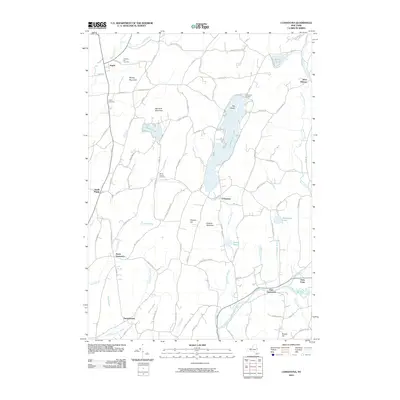
2010 Map of Cossayuna
USGS Topo · Published 2010About this map
Cossayuna Lake and its prominent Big Island serve as a central anchor for this part of Washington County, surrounded by a cluster of agricultural hamlets and highland terrain. The settlement pattern is defined by historic centers such as Argyle, South Argyle, and East Greenwich, which are connected by a network of rural roads bearing long-standing local names. The southern portion of the map is dominated by the winding course of the Batten Kill, where Fitch Point marks a distinct bend in the river. Genealogists will find significant value in the distribution of burial grounds across the landscape, including Prospect Hill Cemetery near Argyle and the South Argyle Cemetery. The topography transitions from the wetland flats of The Old Fly and Peat Swamp to the elevations of Barkley Mountain and Murdock Mountain, reflecting the varied geography of the upper Hudson Valley region.
Find a feature on this map
93 named features on this map. Tap any name to fly to it.
Don’t see what you’re looking for? This feature index may not catch every label — zoom into the map to look around manually.
Map Details
Editions of this 2010 Cossayuna Map
This is the sole edition of this map. No revisions or reprints were ever made.
Other maps of this area

1893 · Fort Ann
USGS Topo · 1:62,500

1895 · Cambridge
USGS Topo · 1:62,500

1895 · Fort Ann
USGS Topo · 1:62,500

1895 · Glens Falls
USGS Topo · 1:62,500

1897 · Glens Falls
USGS Topo · 1:62,500

1898 · Cambridge
USGS Topo · 1:62,500

1898 · Fort Ann
USGS Topo · 1:62,500

1900 · Schuylerville
USGS Topo · 1:62,500

1901 · Fort Ann
USGS Topo · 1:62,500

1901 · Cambridge
USGS Topo · 1:62,500