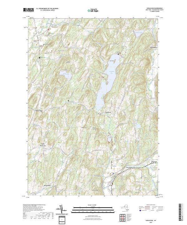
2023 Map of Cossayuna
USGS Topo · Published 2023About this map
Cossayuna Lake serves as a central anchor for this portion of Washington County, its waters framed by Big Island and the neighboring hills of Barkley Mountain and Murdock Mountain. This 2023 edition documents a landscape defined by small hamlets and significant genealogical markers, including Prospect Hill Cem, Old Scots Cem, and the Cossayuna Lake Cem. The terrain is shaped by glacial legacy, seen in the numerous ponds and wetlands like The Old Fly and the broad Peat Swamp to the west. To the south, the Batten Kill river valley marks the transition toward East Greenwich, while a network of rural roads such as McEachron Hill Rd and Co Rd 47 connects the dispersed settlements of Argyle, South Argyle, and Spraguetown. This map provides a clear view of the modern boundaries and land features in a region deeply rooted in agricultural and recreational history.
Find a feature on this map
117 named features on this map. Tap any name to fly to it.
Don’t see what you’re looking for? This feature index may not catch every label — zoom into the map to look around manually.
Map Details
Editions of this 2023 Cossayuna Map
This is the sole edition of this map. No revisions or reprints were ever made.
Other maps of this area

1893 · Fort Ann
USGS Topo · 1:62,500

1895 · Cambridge
USGS Topo · 1:62,500

1895 · Fort Ann
USGS Topo · 1:62,500

1895 · Glens Falls
USGS Topo · 1:62,500

1897 · Glens Falls
USGS Topo · 1:62,500

1898 · Cambridge
USGS Topo · 1:62,500

1898 · Fort Ann
USGS Topo · 1:62,500

1900 · Schuylerville
USGS Topo · 1:62,500

1901 · Fort Ann
USGS Topo · 1:62,500

1901 · Cambridge
USGS Topo · 1:62,500