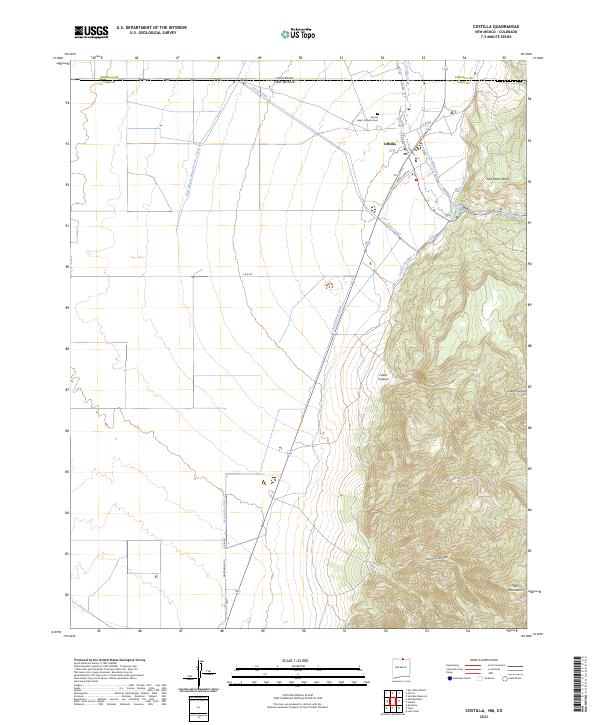
2023 Map of Costilla
USGS Topo · Published 2023About this map
Costilla lies at the edge of the Taos Mountains in this modern topographic study of the New Mexico-Colorado border. This high-altitude landscape is defined by its complex irrigation network, reflecting centuries of agricultural tradition. Essential water routes like the Acequia Madre, Cordillera Ditch, and Mesa Ditch diverge from Costilla Creek to sustain the valley floor. To the east, the terrain rises sharply into the San Pedro Mesa and deep cuts of Cedro Canyon and Jaroso Canyon. This map serves as a detailed record of the community's spiritual and local infrastructure, locating the Sacred Heart Catholic Cem and a dense web of rural roads such as Upper Plaza Rd and Mascarenas Rd. The presence of large-scale canals, including the Cerro Canal and its New Mexico Branch Cerro Canal, illustrates the engineered management of the desert's limited water resources.
Find a feature on this map
26 named features on this map. Tap any name to fly to it.
Don’t see what you’re looking for? This feature index may not catch every label — zoom into the map to look around manually.
Map Details
Editions of this 2023 Costilla Map
This is the sole edition of this map. No revisions or reprints were ever made.
Other maps of this area

1954 · Raton
USGS Topo · 1:250,000

1954 · Trinidad
USGS Topo · 1:250,000

1955 · Trinidad
USGS Topo · 1:250,000

1958 · Raton
USGS Topo · 1:250,000

1958 · Trinidad
USGS Topo · 1:250,000

1959 · Trinidad
USGS Topo · 1:250,000

1963 · Costilla
USGS Topo · 1:24,000

1963 · Amalia
USGS Topo · 1:24,000

1963 · Cerro
USGS Topo · 1:24,000

1963 · Ute Mountain
USGS Topo · 1:24,000