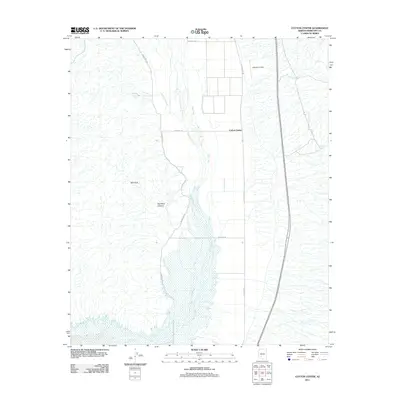
2011 Map of Cotton Center
USGS Topo · Published 2011About this map
Cotton Center sits as a central agricultural and residential node within the arid Maricopa County landscape, defined largely by the engineering of the Enterprise Canal. This waterway parallels the Gila River, which dominates the lower half of the quadrangle with its wide, braided riverbed and associated riparian zones. The interplay between the natural watercourse and the irrigation canal illustrates the region's historical reliance on managed water for desert survival and cultivation. To the west, the terrain rises toward the distinct formations of Red Rock and Red Rock Canyon, offering a stark contrast to the flat basin floor. Local aviation and transportation are represented by Lakeside Airpark and the historic route of Old US Hwy 80, which tracks north-south through the valley, anchoring the settlement patterns and providing connection between the river valley and the northern residential tracts.
Find a feature on this map
12 named features on this map. Tap any name to fly to it.
Don’t see what you’re looking for? This feature index may not catch every label — zoom into the map to look around manually.
Map Details
Editions of this 2011 Cotton Center Map
This is the sole edition of this map. No revisions or reprints were ever made.
Other maps of this area

1950 · Theba
USGS Topo · 1:62,500

1951 · Gila Bend
USGS Topo · 1:62,500

1951 · Theba
USGS Topo · 1:62,500

1951 · Cotton Center
USGS Topo · 1:62,500

1951 · Woolsey Peak
USGS Topo · 1:62,500

1953 · Ajo
USGS Topo · 1:250,000

1954 · Phoenix
USGS Topo · 1:250,000

1957 · Ajo
USGS Topo · 1:250,000

1957 · Phoenix
USGS Topo · 1:250,000

1958 · Ajo
USGS Topo · 1:250,000