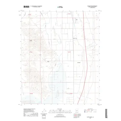
2018 Map of Cotton Center
USGS Topo · Published 2018About this map
Gila River irrigation networks define the agriculture-heavy landscape of this Maricopa County corridor. The Gila Bend Canal and Enterprise Canal parallel the river's course, supporting the rural settlement of Cotton Center and the western edge of Gila Bend. To the west, the arid peaks of the Gila Bend Mountains rise sharply above the basin, cut by features like Red Rock Canyon and the smaller settlement at Red Rock. This survey records a landscape where modern transportation and heritage meet, showing the current alignment of highways alongside the historic S Old US80. The proximity of Lakeside Airpark to the river's bend illustrates the ongoing role of this transit corridor in the modern era.
Find a feature on this map
21 named features on this map. Tap any name to fly to it.
Don’t see what you’re looking for? This feature index may not catch every label — zoom into the map to look around manually.
Map Details
Editions of this 2018 Cotton Center Map
This is the sole edition of this map. No revisions or reprints were ever made.
Other maps of this area

1950 · Theba
USGS Topo · 1:62,500

1951 · Gila Bend
USGS Topo · 1:62,500

1951 · Theba
USGS Topo · 1:62,500

1951 · Cotton Center
USGS Topo · 1:62,500

1951 · Woolsey Peak
USGS Topo · 1:62,500

1953 · Ajo
USGS Topo · 1:250,000

1954 · Phoenix
USGS Topo · 1:250,000

1957 · Ajo
USGS Topo · 1:250,000

1957 · Phoenix
USGS Topo · 1:250,000

1958 · Ajo
USGS Topo · 1:250,000