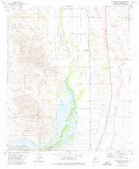
1973 Map of Cotton Center
USGS Topo · Published 1976About this map
The Gila River corridor dominates this desert landscape, serving as a vital artery for agricultural development and historic transit in Maricopa County. The settlement of Cotton Center is situated along Old U S Highway Eighty, which runs parallel to the Gila Bend Canal, reflecting the region's reliance on managed water systems and traditional road networks. To the west, the Gila Bend Mountains rise sharply, dissected by features like Red Rock Canyon, while the southern portion of the sheet reveals deeper layers of history within the Gila Bend Indian Reservation. The presence of Petroglyphs and the Butterfield Stage Route indicates this area's long-standing importance as a cultural and transportation passage. Scattered Ruins and numerous named wells, such as Poyner Water and Rad Water, further document the human effort to inhabit and navigate this arid environment.
Find a feature on this map
25 named features on this map. Tap any name to fly to it.
Don’t see what you’re looking for? This feature index may not catch every label — zoom into the map to look around manually.
Map Details
Editions of this 1973 Cotton Center Map
This is the sole edition of this map. No revisions or reprints were ever made.
Other maps of this area

1950 · Theba
USGS Topo · 1:62,500

1951 · Gila Bend
USGS Topo · 1:62,500

1951 · Theba
USGS Topo · 1:62,500

1951 · Cotton Center
USGS Topo · 1:62,500

1951 · Woolsey Peak
USGS Topo · 1:62,500

1953 · Ajo
USGS Topo · 1:250,000

1954 · Phoenix
USGS Topo · 1:250,000

1957 · Ajo
USGS Topo · 1:250,000

1957 · Phoenix
USGS Topo · 1:250,000

1958 · Ajo
USGS Topo · 1:250,000