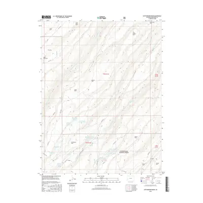
2016 Map of Cottonwood Basin
USGS Topo · Published 2016About this map
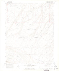
Sawmill Mesa and its network of water management features dominate this portion of Montrose County within the Uncompahgre National Forest. This high-altitude landscape is defined by an intricate system of catchments and diversions, including the Little Monitor Headgate and a series of numbered reservoirs such as Big Monitor Reservoir Number 1, Middle Monitor Reservoir, and Hawkins Reservoir Number 2. The terrain is characterized by dramatic elevation shifts from Dry Mesa and Peach Orchard Point down into the deep incisions of Dry Fork Escalante Cr and Cottonwood Cr. These features reflect the long-standing importance of water rights and ranching infrastructure in the region, where roads like Dry Mesa Rd and the Cottonwood Trail provide access to cattle grazing allotments and remote forest resources.
Find a feature on this map
46 named features on this map. Tap any name to fly to it.
Don’t see what you’re looking for? This feature index may not catch every label — zoom into the map to look around manually.
Map Details
Editions of this 2016 Cottonwood Basin Map
This is the sole edition of this map. No revisions or reprints were ever made.
Other maps of this area

1956 · Moab
USGS Topo · 1:250,000

1959 · Moab
USGS Topo · 1:250,000

1960 · Moab
USGS Topo · 1:250,000

1962 · Moab
USGS Topo · 1:250,000

1964 · Moab
USGS Topo · 1:250,000

1965 · Moab
USGS Topo · 1:250,000
1969 · Roubideau
USGS Topo · 1:24,000
1969 · Good Point
USGS Topo · 1:24,000
1973 · Camel Back
USGS Topo · 1:24,000
1973 · Moore Mesa
USGS Topo · 1:24,000