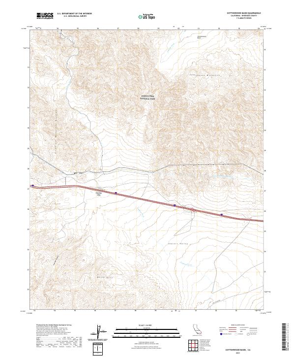
2021 Map of Cottonwood Basin
USGS Topo · Published 2021About this map
Joshua Tree National Park dominates the northern reaches of this Colorado Desert landscape, where the Cottonwood Mountains meet the eastern edge of the Little San Bernardino Mountains. The terrain transitions from the elevated Cottonwood Basin through complex ridge systems down into Shavers Valley. Central to the map's infrastructure is the Colorado River Aqueduct, a critical water lifeline that skirts the foothills of the Mecca Hills as it moves westward. The small settlement of Cactus City sits along the interstate corridor, serving as a rare outpost of human activity in an area otherwise defined by natural drainage systems like Pinkham Wash and the dramatic geological formations of Painted Canyon. Modern access is provided by Frontage Rd and Box Canyon Rd, which navigate the desert floor and provide entry points to the surrounding protected wilderness.
Find a feature on this map
19 named features on this map. Tap any name to fly to it.
Don’t see what you’re looking for? This feature index may not catch every label — zoom into the map to look around manually.
Map Details
Editions of this 2021 Cottonwood Basin Map
This is the sole edition of this map. No revisions or reprints were ever made.
Other maps of this area

1904 · Indio
USGS Topo · 1:125,000

1940 · Cottonwood Spring
USGS Topo · 1:62,500

1941 · Coachella
USGS Topo · 1:62,500

1943 · Coachella
USGS Topo · 1:62,500

1943 · Pinkham Well
USGS Topo · 1:62,500

1944 · Cottonwood Spring
USGS Topo · 1:62,500

1944 · Pinkham Well
USGS Topo · 1:62,500

1944 · Pinyon Well
USGS Topo · 1:62,500

1947 · Santa Ana
USGS Topo · 1:250,000

1949 · Santa Ana
USGS Topo · 1:250,000