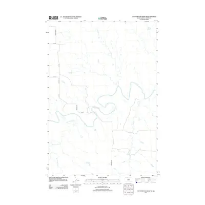
2012 Map of Cottonwood Creek NW
USGS Topo · Published 2012About this map
The meandering Grand River defines the central topography of this Corson County landscape, carving a wide valley through the Rock Creek District. This 2012 survey documents a sparsely populated expanse of South Dakota rangeland, where the river's path is joined by northern tributaries like Cedar Boy Cr and the winding Meadow Cr to the south. The road network is strictly rectilinear, following section lines with routes such as Morristown Rd and 218th Ave providing the primary access through the drainage basin of Black Horse Butte Cr. The map captures the quiet character of the plains, where the relationship between the natural hydrology and the modern rural grid remains the primary geographic feature.
Find a feature on this map
9 named features on this map. Tap any name to fly to it.
Don’t see what you’re looking for? This feature index may not catch every label — zoom into the map to look around manually.
Map Details
Editions of this 2012 Cottonwood Creek NW Map
This is the sole edition of this map. No revisions or reprints were ever made.
Other maps of this area

1953 · McIntosh
USGS Topo · 1:250,000

1956 · Cottonwood Creek NE
USGS Topo · 1:24,000

1956 · Cottonwood Creek SE
USGS Topo · 1:24,000

1956 · Cottonwood Creek NW
USGS Topo · 1:24,000

1956 · Cottonwood Creek SW
USGS Topo · 1:24,000

1958 · McIntosh
USGS Topo · 1:250,000

1972 · Morristown SE
USGS Topo · 1:24,000

1972 · Skull Butte
USGS Topo · 1:24,000

1972 · Thunder Hawk SE
USGS Topo · 1:24,000

1972 · Twin Butte
USGS Topo · 1:24,000