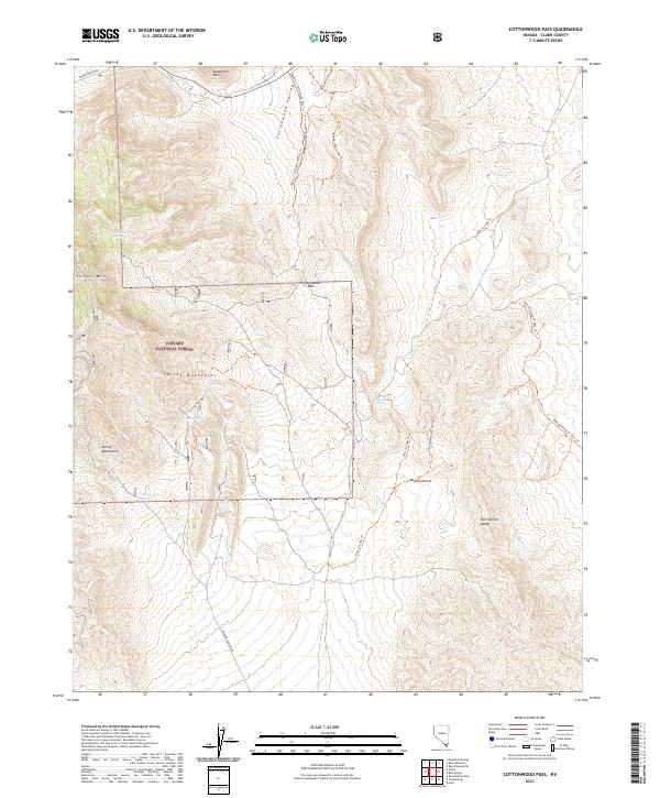
2021 Map of Cottonwood Pass
USGS Topo · Published 2021About this map
Spring Mountains and the northern reaches of the Mojave Desert dominate this Clark County landscape, where elevation shifts dramatically across ridges and canyons. The map centers on the high point of Potosi Mtn and the strategic Cottonwood Pass, which provides a natural transit corridor through the steep terrain. This area within the Toiyabe National Forest is characterized by its vital water sources, such as Wilson Spring and Hampton Spring, which have long been essential markers for travelers in this arid environment. The network of trails, including the Cottonwood Pass Trl and Badger Pass Loop Trl, suggests a modern reliance on historic travel routes. Significant geological features like Sandstone Bluff and the Bird Spring Range define the eastern boundaries of Cottonwood Valley, illustrating the complex topography that has shaped movement through this part of Nevada.
Find a feature on this map
26 named features on this map. Tap any name to fly to it.
Don’t see what you’re looking for? This feature index may not catch every label — zoom into the map to look around manually.
Map Details
Editions of this 2021 Cottonwood Pass Map
This is the sole edition of this map. No revisions or reprints were ever made.
Other maps of this area

1907 · Las Vegas
USGS Topo · 1:250,000

1908 · Las Vegas
USGS Topo · 1:250,000

1910 · Ivanpah
USGS Topo · 1:250,000

1912 · Ivanpah
USGS Topo · 1:250,000

1942 · Ivanpah
USGS Topo · 1:250,000

1947 · Kingman
USGS Topo · 1:250,000

1948 · Kingman
USGS Topo · 1:250,000

1952 · Blue Diamond
USGS Topo · 1:62,500

1954 · Las Vegas
USGS Topo · 1:250,000

1954 · Kingman
USGS Topo · 1:250,000