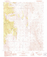
1989 Map of Cottonwood Pass
USGS Topo · Published 1990About this map
Bird Spring Range and the Spring Mountains dominate this high-desert landscape in southern Nevada, where mining activity defined the late twentieth-century character of the terrain. The map reveals an intricate network of mineral extraction sites concentrated near Potosi Mountain, including the Double Up Mine, Dawn Mine, and Pauline Mine. These workings, along with numerous unnamed prospects and adits, point to a history of geological exploration in the canyons flanking Cottonwood Valley.
Find a feature on this map
29 named features on this map. Tap any name to fly to it.
Don’t see what you’re looking for? This feature index may not catch every label — zoom into the map to look around manually.
Map Details
Editions of this 1989 Cottonwood Pass Map
This is the sole edition of this map. No revisions or reprints were ever made.
Other maps of this area

1907 · Las Vegas
USGS Topo · 1:250,000

1908 · Las Vegas
USGS Topo · 1:250,000

1910 · Ivanpah
USGS Topo · 1:250,000

1912 · Ivanpah
USGS Topo · 1:250,000

1942 · Ivanpah
USGS Topo · 1:250,000

1947 · Kingman
USGS Topo · 1:250,000

1948 · Kingman
USGS Topo · 1:250,000

1952 · Blue Diamond
USGS Topo · 1:62,500

1954 · Las Vegas
USGS Topo · 1:250,000

1954 · Kingman
USGS Topo · 1:250,000