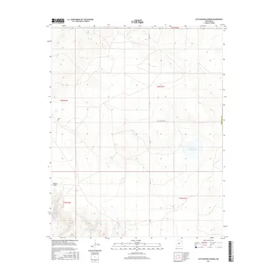
2017 Map of Cottonwood Springs
USGS Topo · Published 2017About this map
Cottonwood Springs anchors this high-plains landscape in northeast New Mexico, where the topography transitions between mesas and open range. The water sources here are critical landmarks in a semi-arid environment, including Bobby Lake, Cone Lake, and the sprawling Laguna Tierra Amatosa. These features, along with Pedernal Cr and the Arroyo de la Cejita, illustrate the natural drainage patterns of a region where water dictated the placement of ranching infrastructure and early travel routes.
Find a feature on this map
17 named features on this map. Tap any name to fly to it.
Don’t see what you’re looking for? This feature index may not catch every label — zoom into the map to look around manually.
Map Details
Editions of this 2017 Cottonwood Springs Map
This is the sole edition of this map. No revisions or reprints were ever made.
Other maps of this area

1954 · Tucumcari
USGS Topo · 1:250,000

1954 · Dalhart
USGS Topo · 1:250,000

1958 · Tucumcari
USGS Topo · 1:250,000

1958 · Dalhart
USGS Topo · 1:250,000

1962 · Dalhart
USGS Topo · 1:250,000

1966 · Skull Mesa
USGS Topo · 1:24,000

1966 · Pedernal Creek
USGS Topo · 1:24,000

1966 · Rosebud
USGS Topo · 1:24,000

1966 · Ione
USGS Topo · 1:24,000

1966 · Hayden
USGS Topo · 1:24,000