
1966 Map of Ione
USGS Topo · Published 1968About this map
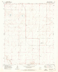
Ione sits within a high-plains landscape defined by its vital water sources and the boundary between Harding and Union Counties. Mapped in the mid-1960s, this area of northeastern New Mexico reveals a reliance on isolated water points such as Big Well, South Hobart Well, and West Well to sustain life and livestock across the arid terrain. The drainage systems of Bob Creek and Entrania Creek carve subtle paths through the landscape, while the North Fork and main branch of Minneosa Creek provide critical topographic definition. The presence of named landmarks like Mitchil and Entrania Spring suggests a history of localized activity in a region primarily dedicated to ranching, where surveyor-noted fence lines segment the open country into distinct parcels.
Find a feature on this map
13 named features on this map. Tap any name to fly to it.
Don’t see what you’re looking for? This feature index may not catch every label — zoom into the map to look around manually.
Map Details
Editions of this 1966 Ione Map
This is the sole edition of this map. No revisions or reprints were ever made.
Other maps of this area

1954 · Tucumcari
USGS Topo · 1:250,000

1958 · Tucumcari
USGS Topo · 1:250,000

1966 · Rosebud
USGS Topo · 1:24,000

1966 · Hayden
USGS Topo · 1:24,000

1966 · Cherokee Valley
USGS Topo · 1:24,000

1966 · Cottonwood Springs
USGS Topo · 1:24,000

1966 · Mc Cloy Ranch
USGS Topo · 1:24,000

1971 · Kerlin Hill
USGS Topo · 1:24,000

1971 · Centerville Corner
USGS Topo · 1:24,000
1971 · Amistad
USGS Topo · 1:24,000