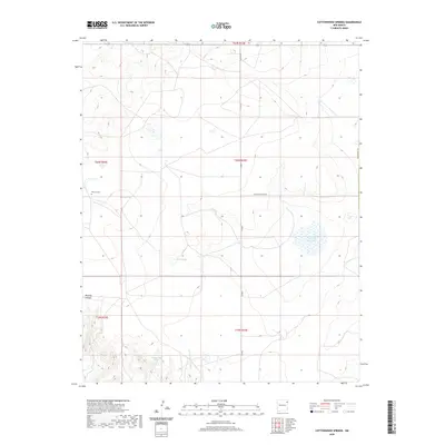
2020 Map of Cottonwood Springs
USGS Topo · Published 2020About this map
Cottonwood Springs anchors this high plains terrain on the border of Union and Harding counties, where seasonal water sources dictate the movement across the landscape. The arid character of the region is defined by ephemeral features such as Arroyo de la Cejita and Pedernal Cr, which carve through the land alongside landmarks like Bootleg Canyon. For local historians and genealogists, the map preserves the location of the Maytum Cem, a quiet record of early 20th-century ranching life. The presence of several catchment basins, including Bobby Lake, Cone Lake, and the larger Laguna de la Tierra Amatosa, underscores the importance of surface water management in this cattle-grazing country. Human activity is largely concentrated along a handful of routes such as Antelope Springs Rd and Co Rd G, which follow the grid of the Public Land Survey System.
Find a feature on this map
17 named features on this map. Tap any name to fly to it.
Don’t see what you’re looking for? This feature index may not catch every label — zoom into the map to look around manually.
Map Details
Editions of this 2020 Cottonwood Springs Map
This is the sole edition of this map. No revisions or reprints were ever made.
Other maps of this area

1954 · Tucumcari
USGS Topo · 1:250,000

1954 · Dalhart
USGS Topo · 1:250,000

1958 · Tucumcari
USGS Topo · 1:250,000

1958 · Dalhart
USGS Topo · 1:250,000

1962 · Dalhart
USGS Topo · 1:250,000

1966 · Skull Mesa
USGS Topo · 1:24,000

1966 · Pedernal Creek
USGS Topo · 1:24,000

1966 · Rosebud
USGS Topo · 1:24,000

1966 · Ione
USGS Topo · 1:24,000

1966 · Hayden
USGS Topo · 1:24,000