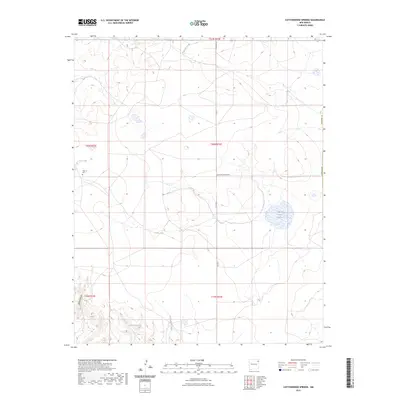
2023 Map of Cottonwood Springs
USGS Topo · Published 2023About this map
Cottonwood Springs serves as a vital focal point in this high-plains landscape of Harding County, where water sources dictate the placement of local landmarks and infrastructure. The map reveals a network of intermittent water bodies and drainage systems, including the notable Laguna Tierra Amatosa and the winding course of Pedernal Creek. For local historians and genealogists, the Maytum Cem stands as a significant cultural anchor near the western edge of the quadrangle. The terrain is further defined by Bootleg Canyon in the southwest and a series of small basins such as Cone Lake and Bobby Lake, illustrating the arid but geographically diverse character of northeastern New Mexico. Long, straight rural routes like Antelope Springs Rd and Rosebud Rd provide the primary framework for contemporary navigation through these wide-open townships.
Find a feature on this map
18 named features on this map. Tap any name to fly to it.
Don’t see what you’re looking for? This feature index may not catch every label — zoom into the map to look around manually.
Map Details
Editions of this 2023 Cottonwood Springs Map
This is the sole edition of this map. No revisions or reprints were ever made.
Other maps of this area

1954 · Tucumcari
USGS Topo · 1:250,000

1954 · Dalhart
USGS Topo · 1:250,000

1958 · Tucumcari
USGS Topo · 1:250,000

1958 · Dalhart
USGS Topo · 1:250,000

1962 · Dalhart
USGS Topo · 1:250,000

1966 · Skull Mesa
USGS Topo · 1:24,000

1966 · Pedernal Creek
USGS Topo · 1:24,000

1966 · Rosebud
USGS Topo · 1:24,000

1966 · Ione
USGS Topo · 1:24,000

1966 · Hayden
USGS Topo · 1:24,000