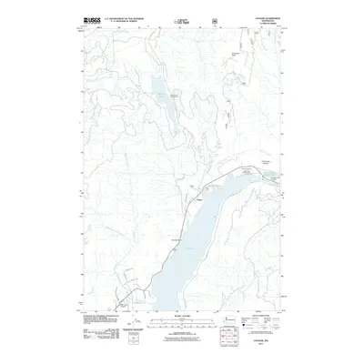
2011 Map of Cougar
USGS Topo · Published 2011About this map
Yale Lake and the Lewis River corridor define this 2011 survey of the southern Washington Cascades, centered on the small community of Cougar. The landscape is dominated by heavy industrial water management and recreation, anchored by the Swift Number Two Dam and its associated Swift Number Two Forebay. Along the shoreline, established recreational sites like Beaver Bay Park and Yale Park sit at the base of steep terrain leading to Cinnamon Peak.
Find a feature on this map
40 named features on this map. Tap any name to fly to it.
Don’t see what you’re looking for? This feature index may not catch every label — zoom into the map to look around manually.
Map Details
Editions of this 2011 Cougar Map
This is the sole edition of this map. No revisions or reprints were ever made.
Other maps of this area

1919 · Mount St Helens
USGS Topo · 1:125,000

1940 · Lookout Mtn
USGS Topo · 1:62,500

1941 · Yacolt
USGS Topo · 1:62,500

1948 · Vancouver
USGS Topo · 1:250,000

1950 · Vancouver
USGS Topo · 1:250,000

1950 · Vancouver
USGS Topo · 1:250,000

1953 · Hoquiam
USGS Topo · 1:250,000

1953 · Lookout Mtn
USGS Topo · 1:62,500

1953 · Cougar
USGS Topo · 1:62,500
1956 · Yacolt
USGS Topo · 1:62,500