
1953 Map of Cougar
USGS Topo · Published 1958About this map
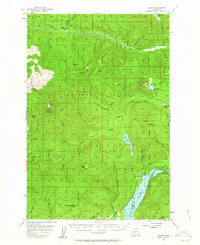
Gifford Pinchot National Forest dominates this mid-century landscape, a terrain of steep volcanic slopes and drainage networks before modern development reshaped the region. The small settlement of Cougar sits near the Lewis River, serving as a gateway to the surrounding peaks like Goat Mtn and Cinnamon Pk. A Sawmill at the edge of town and the presence of the Kalama Ranger Sta and North Fork Ranger Sta point to an economy and management structure deeply rooted in timber and conservation. Significant water bodies including Merrill Lake and the northern reaches of Yale Lake are documented alongside specialized sites like Herrington Place (Site) and Goat Marsh. The map also captures an era of backcountry access through a network of Jeep Trails and the Coldspring Trail, cutting through the watersheds of the South Fork Toutle River and Kalama River.
Find a feature on this map
56 named features on this map. Tap any name to fly to it.
Don’t see what you’re looking for? This feature index may not catch every label — zoom into the map to look around manually.
Map Details
Editions of this 1953 Cougar Map
4 editions found
Other maps of this area

1919 · Mount St Helens
USGS Topo · 1:125,000

1940 · Lookout Mtn
USGS Topo · 1:62,500

1940 · La Center
USGS Topo · 1:62,500

1941 · Yacolt
USGS Topo · 1:62,500

1942 · Toutle
USGS Topo · 1:62,500

1943 · Pigeon Springs
USGS Topo · 1:62,500

1948 · Vancouver
USGS Topo · 1:250,000

1950 · Vancouver
USGS Topo · 1:250,000

1950 · Vancouver
USGS Topo · 1:250,000

1953 · Hoquiam
USGS Topo · 1:250,000