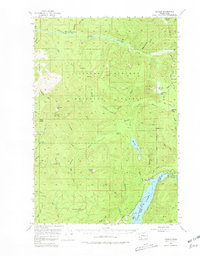
1953 Map of Cougar
USGS Topo · Published 1981About this map
Cougar sits at the northern edge of Yale Lake on the Clark and Cowlitz county line, serving as a hub for the drainage basins of the Kalama River and the South Fork Toutle River. This 1950s survey captures the area within the Gifford Pinchot National Forest when forestry and conservation infrastructure was densifying. The map identifies the Kalama Ranger Sta and the North Fork Ranger Sta (Abandoned), alongside industry markers like a Sawmill and a Fish Hatchery near the lake.
Find a feature on this map
71 named features on this map. Tap any name to fly to it.
Don’t see what you’re looking for? This feature index may not catch every label — zoom into the map to look around manually.
Map Details
Editions of this 1953 Cougar Map
4 editions found

Other maps of this area

1919 · Mount St Helens
USGS Topo · 1:125,000

1940 · Lookout Mtn
USGS Topo · 1:62,500

1940 · La Center
USGS Topo · 1:62,500

1941 · Yacolt
USGS Topo · 1:62,500

1942 · Toutle
USGS Topo · 1:62,500

1943 · Pigeon Springs
USGS Topo · 1:62,500

1948 · Vancouver
USGS Topo · 1:250,000

1950 · Vancouver
USGS Topo · 1:250,000

1950 · Vancouver
USGS Topo · 1:250,000

1953 · Hoquiam
USGS Topo · 1:250,000