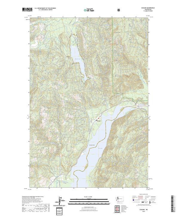
2023 Map of Cougar
USGS Topo · Published 2023About this map
Lewis River and the small settlement of Cougar define the southern reaches of this landscape, where the waters of Yale Lake and Merrill Lake dominate the terrain. This modern survey illustrates the complex geography of the volcanic region, showing the intersection of the Gifford Pinchot National Forest and the Mount Saint Helens National Volcanic Monument. The rugged hydrography is detailed through features like Kalama Falls on the Kalama River and the steep drainages of Christmas Canyon and Cougar Creek. Transportation and access for forestry and recreation are traced along the Natl Forest Develop Road 81 Rd and Lewis River Rd. Significant vertical relief is marked by summits such as Cinnamon Peak and the vantage of Cooney Point overlooking the reservoir system.
Find a feature on this map
32 named features on this map. Tap any name to fly to it.
Don’t see what you’re looking for? This feature index may not catch every label — zoom into the map to look around manually.
Map Details
Editions of this 2023 Cougar Map
This is the sole edition of this map. No revisions or reprints were ever made.
Other maps of this area

1919 · Mount St Helens
USGS Topo · 1:125,000

1940 · Lookout Mtn
USGS Topo · 1:62,500

1941 · Yacolt
USGS Topo · 1:62,500

1948 · Vancouver
USGS Topo · 1:250,000

1950 · Vancouver
USGS Topo · 1:250,000

1950 · Vancouver
USGS Topo · 1:250,000

1953 · Hoquiam
USGS Topo · 1:250,000

1953 · Lookout Mtn
USGS Topo · 1:62,500

1953 · Cougar
USGS Topo · 1:62,500
1956 · Yacolt
USGS Topo · 1:62,500