
1984 Map of Coulter Coulee
USGS Topo · Published 1984About this map
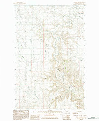
The rugged drainage patterns of the Montana prairie define this landscape along the Phillips Co Valley Co boundary. Central to the topography is Frenchman Creek, which winds through the western half of the map, fed by a series of deeply etched coulees such as School Section Coulee and Shed Coulee. The naming conventions reflect the practicalities of ranching and land management in the mid-1980s, with features like Big Toe Flat and Morgan Reservoir indicating the essential role of water catchment and open range in this arid environment. To the east, the terrain shifts toward the systems of Big Snake Creek and Little Snake Creek, illustrating the complex network of intermittent streams and natural depressions that dominate this portion of the northern plains.
Find a feature on this map
13 named features on this map. Tap any name to fly to it.
Don’t see what you’re looking for? This feature index may not catch every label — zoom into the map to look around manually.
Map Details
Editions of this 1984 Coulter Coulee Map
This is the sole edition of this map. No revisions or reprints were ever made.
Other maps of this area

1954 · Glasgow
USGS Topo · 1:250,000

1957 · Glasgow
USGS Topo · 1:250,000

1958 · Glasgow
USGS Topo · 1:250,000

1984 · Thoeny Hills East
USGS Topo · 1:24,000

1984 · Snake Creek School
USGS Topo · 1:24,000

1984 · Black Calf Reservoir
USGS Topo · 1:24,000

1984 · Dead Horse Coulee
USGS Topo · 1:24,000

1984 · Crow Creek Dam
USGS Topo · 1:24,000
1984 · Papoose Hills
USGS Topo · 1:24,000
1984 · Genevieve
USGS Topo · 1:24,000