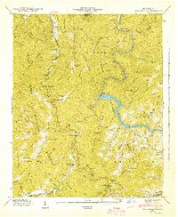
1942 Map of Cove Creek Gap
USGS Topo · Published 1942About this map
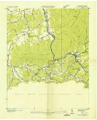
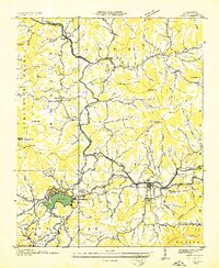
Great Smoky Mountains National Park and Pisgah National Forest converge on this 1942 survey, revealing the remote communities and infrastructure of the North Carolina high country during the early war years. The landscape is defined by the steep ridges of Longarm Mountain and Whiteoak Mountain, where small mountain settlements like Ola, Cataloochee, and Nellie are connected by narrow tracks and State Route 284. This map documents a period of transition as traditional mountain life intersected with modern utility projects and federal land management.
Find a feature on this map
114 named features on this map. Tap any name to fly to it.
Don’t see what you’re looking for? This feature index may not catch every label — zoom into the map to look around manually.
Map Details
Editions of this 1942 Cove Creek Gap Map
This is the sole edition of this map. No revisions or reprints were ever made.
Other maps of this area

1893 · Mt Guyot
USGS Topo · 1:125,000

1894 · Asheville
USGS Topo · 1:125,000

1901 · Asheville
USGS Topo · 1:125,000

1912 · Mt Guyot
USGS Topo · 1:125,000

1935 · Newport
USGS Topo · 1:48,000
1935 · Hartford
USGS Topo · 1:24,000

1935 · Dellwood
USGS Topo · 1:24,000
1935 · Clyde
USGS Topo · 1:24,000

1935 · Lemon Gap
USGS Topo · 1:24,000

1936 · Bunches Bald
USGS Topo · 1:24,000