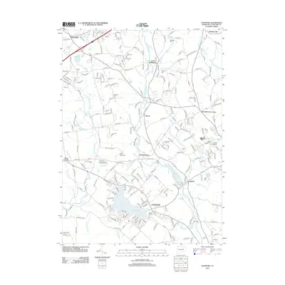
2012 Map of Coventry
USGS Topo · Published 2012About this map
Wangumbaug Lake anchors the southern landscape of this 2012 survey, where the town of Coventry has grown around its shores. To the northeast, the sprawling campus of the University of Connecticut and the University of Connecticut Experiment Farm signal the region's educational and agricultural prominence. The Willimantic River carves a corridor through the center of the sheet, followed closely by the tracks of the Central Vermont RR, connecting the historic mill and depot hamlets of South Willington, Merrow, and Mansfield Depot. Genealogists will find several notable burial grounds, including the Nathan Hale Cem near the lake and Tolland Cem in the north. The terrain is marked by significant rises such as Riley Mountain and Cassidy Hill, which overlook a network of tributary streams including Brigham Tavern Brook and Skungamaug River.
Find a feature on this map
93 named features on this map. Tap any name to fly to it.
Don’t see what you’re looking for? This feature index may not catch every label — zoom into the map to look around manually.
Map Details
Editions of this 2012 Coventry Map
This is the sole edition of this map. No revisions or reprints were ever made.
Other maps of this area

1892 · Woodstock
USGS Topo · 1:62,500

1892 · Tolland
USGS Topo · 1:62,500

1892 · Norwich
USGS Topo · 1:62,500

1892 · Gilead
USGS Topo · 1:62,500

1921 · Tolland
USGS Topo · 1:62,500

1921 · Woodstock
USGS Topo · 1:62,500

1944 · Marlboro
USGS Topo · 1:31,680

1944 · South Coventry
USGS Topo · 1:31,680

1944 · Columbia
USGS Topo · 1:31,680
1944 · Rockville
USGS Topo · 1:31,680