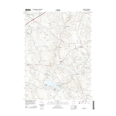
2015 Map of Coventry
USGS Topo · Published 2015About this map
Wangumbaug Lake and the surrounding villages of South Coventry and Coventry Lake define this central Connecticut landscape. The Willimantic River flows south through the center of the terrain, passing through the historic rail-era settlements of Merrow, Mansfield Depot, and Eagleville. Local history and genealogy are anchored by several notable burial sites, including the Nathan Hale Cem and Tolland Cem.
Find a feature on this map
84 named features on this map. Tap any name to fly to it.
Don’t see what you’re looking for? This feature index may not catch every label — zoom into the map to look around manually.
Map Details
Editions of this 2015 Coventry Map
This is the sole edition of this map. No revisions or reprints were ever made.
Other maps of this area

1892 · Woodstock
USGS Topo · 1:62,500

1892 · Tolland
USGS Topo · 1:62,500

1892 · Norwich
USGS Topo · 1:62,500

1892 · Gilead
USGS Topo · 1:62,500

1921 · Tolland
USGS Topo · 1:62,500

1921 · Woodstock
USGS Topo · 1:62,500

1944 · Marlboro
USGS Topo · 1:31,680

1944 · South Coventry
USGS Topo · 1:31,680

1944 · Columbia
USGS Topo · 1:31,680
1944 · Rockville
USGS Topo · 1:31,680