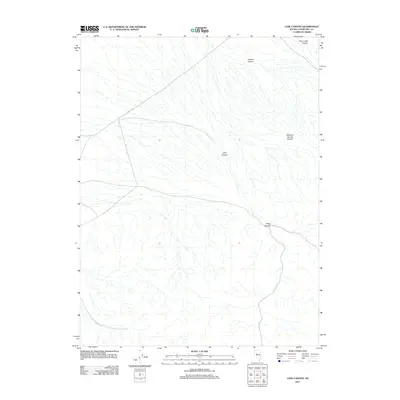
2011 Map of Cow Canyon
USGS Topo · Published 2011About this map
Cow Canyon and Deep Canyon dominate this high-desert drainage system in Churchill County during the early 2010s. The landscape is defined by an intricate network of intermittent washes that feed into broader valleys from the surrounding high ground. Transportation in this arid region is limited to arterial routes like E Valley Rd, which cuts across the northwestern portion of the map. The naming conventions of the terrain, including Meadow Spring Canyon and Granite Canyon, suggest a landscape historically shaped by its proximity to seasonal water sources and distinct geological formations. This survey captures the topographical character of the Nevada desert before significant modern development, emphasizing the natural erosion patterns of the Deer Lodge Canyon area.
Find a feature on this map
6 named features on this map. Tap any name to fly to it.
Don’t see what you’re looking for? This feature index may not catch every label — zoom into the map to look around manually.
Map Details
Editions of this 2011 Cow Canyon Map
This is the sole edition of this map. No revisions or reprints were ever made.
Other maps of this area

1908 · Carson Sink
USGS Topo · 1:250,000

1910 · Carson Sink
USGS Topo · 1:250,000

1955 · Millett
USGS Topo · 1:250,000

1957 · Reno
USGS Topo · 1:250,000

1959 · Reno
USGS Topo · 1:250,000

1959 · Millett
USGS Topo · 1:250,000

1960 · Reno
USGS Topo · 1:250,000

1966 · Clan Alpine Ranch
USGS Topo · 1:62,500

1966 · Humboldt Salt Marsh
USGS Topo · 1:62,500

1966 · Dixie Hot Springs
USGS Topo · 1:62,500