
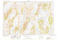
1955 Map of Millett
USGS Topo · Published 1963About this map
Reese River and the high basins of central Nevada define this mid-century landscape of ranching and mining. In the western reaches, the Yomba Indian Reservation sits within the Toiyabe National Forest, while the wide Big Smoky Valley is punctuated by unique geothermal features like Dianas Punch Bowl and Spruce Hot Springs. This era shows a network of remote family-run operations such as Burtens Ranch, McClusky Ranch, and Siri Ranch scattered across the Grass Valley and Kobeh Valley. Economic activity is anchored by the Mount Hope Mine and McCoy Mining Camp, with transport moving through the high-elevation Railroad Pass. From the Diamond Mountains in the east to the Humboldt Salt Marsh in the west, the map details a region where water sources and mountain passes dictated the survival of isolated settlements.
Find a feature on this map
105 named features on this map. Tap any name to fly to it.
Don’t see what you’re looking for? This feature index may not catch every label — zoom into the map to look around manually.
Map Details
Editions of this 1955 Millett Map
4 editions found
Other maps of this area

1907 · Tonopah
USGS Topo · 1:250,000

1908 · Tonopah
USGS Topo · 1:250,000

1908 · Carson Sink
USGS Topo · 1:250,000

1909 · Hawthorne
USGS Topo · 1:250,000

1910 · Carson Sink
USGS Topo · 1:250,000

1911 · Hawthorne
USGS Topo · 1:250,000

1915 · Hawthorne
USGS Topo · 1:250,000

1926 · Roberts Mountains
USGS Topo · 1:250,000

1929 · Roberts Mountains
USGS Topo · 1:250,000

1931 · Lovelock
USGS Topo · 1:250,000