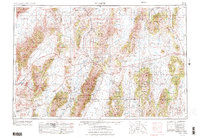
1955 Map of Millett
USGS Topo · Published 1974About this map
The Reese River Valley serves as the central artery of this high-desert landscape, where isolated homesteads and ranching stations anchor a vast basin-and-range topography. In the mid-1950s, the area's human geography was defined by remote outposts such as Millett Ranch, Dieringer Ranch, and the Yomba Indian Reservation. The mining history of central Nevada is evident at Austin and various unnamed Mining Camp locations tucked into the surrounding ranges. Natural landmarks like the Humboldt Salt Marsh and the Carico Lake Valley illustrate the complex drainage patterns of the Great Basin. This survey also documents the extensive boundaries of the Toiyabe National Forest, showing how federal land management intersected with private landholdings like Iowa Canyon Ranch and historic transit points like Peterson Station along the corridor of Route 50.
Find a feature on this map
100 named features on this map. Tap any name to fly to it.
Don’t see what you’re looking for? This feature index may not catch every label — zoom into the map to look around manually.
Map Details
Editions of this 1955 Millett Map
4 editions found

Other maps of this area

1907 · Tonopah
USGS Topo · 1:250,000

1908 · Tonopah
USGS Topo · 1:250,000

1908 · Carson Sink
USGS Topo · 1:250,000

1909 · Hawthorne
USGS Topo · 1:250,000

1910 · Carson Sink
USGS Topo · 1:250,000

1911 · Hawthorne
USGS Topo · 1:250,000

1915 · Hawthorne
USGS Topo · 1:250,000

1926 · Roberts Mountains
USGS Topo · 1:250,000

1929 · Roberts Mountains
USGS Topo · 1:250,000

1931 · Lovelock
USGS Topo · 1:250,000