Old Maps of Lander County, Nevada
Explore 711 old maps of Lander County, spanning from 1882 to today. These high-resolution historic maps reveal how streets, neighborhoods, landmarks, and natural features evolved over time — perfect for genealogy, metal detecting, research, and local history exploration.
What you can do with these maps:
- See how Lander County changed over time: Compare historical maps to modern-day views to trace roads, homesites, rail lines & more.
- View detailed metadata: Each map includes creators, publishers, year, scale, and archive source.
- Overlay maps with satellite & LiDAR: Visualize the past alongside modern tools to explore terrain & human change.
- Trusted historical sources: Maps sourced from the USGS, Library of Congress, and other archives.
- Access maps your way: View online, download high-res files, or order prints for personal or research use.
Start exploring old maps of Lander County to uncover forgotten places, hidden landmarks, and the deep history beneath your feet.
Lander County, NV maps
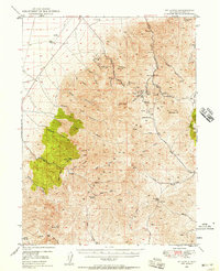
(711)- 1882 Map of Paradise
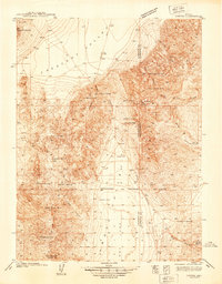
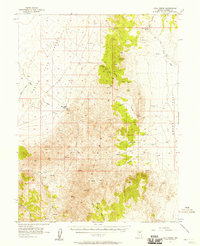
 1882 Paradise1882 Print · USGSHumboldt County in the early 1880s remains a frontier landscape of isolated stage stations and high mountain peaks. Genealogists and researchers can trace the early transit network between Paradise City and remote stops like Cane Springs Station and Flynn Station.
 - 1893 Map of Paradise
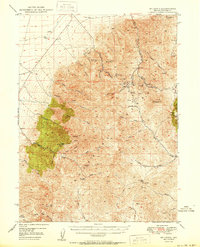
 1893 Paradise1893 Print · USGSHumboldt County was a landscape of remote outposts and high-desert ranges in the late nineteenth century. Researchers can trace the early stage and freight routes connecting Paradise City to vital waystations such as Cane Springs Station and Willow Point Station.6 unique versions available
 - 1926 Map of Roberts Mountains, 1955 Print
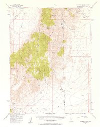
 1926 Roberts Mountains1955 Print · USGSCentral Nevada in the mid-1920s is a landscape of remote mountain ranges and isolated valley ranching. Genealogists and historians can trace family-named locations like Hall Creek Ranch, Sadler Sch, and the Keystone Mine across the high desert.
 - 1929 Map of Roberts Mountains
 1929 Roberts Mountains1929 Print · USGSCentral Nevada in the late 1920s reveals a vast ranching and mining landscape organized around vital water sources. Researchers can trace early family outposts like Roberts Creek Ranch and Grubbs Ranch or locate remote schools such as Simpson Park Sch.4 unique versions available
 - 1932 Map of Sonoma Range, 1955 Print
 1932 Sonoma Range1955 Print · USGSNorthern Nevada in the early thirties is captured here along the Humboldt River and its flanking desert ranges. Genealogists and historians can trace numerous family-named landmarks like Prida Ranch and Childress Ranch, or locate the Site of Old Indian Fort and Barber Sch.5 unique versions available
 - 1938 Map of Cortez
 1938 Cortez1938 Print · USGSThe high-desert mining district of Lander and Eureka counties is captured here in the late 1930s. Researchers can locate remote mountain infrastructure like the Cortez Mine, Mill Canyon Sch, and several family-named outposts including Caetano Ranch.4 unique versions available
 - 1939 Map of Sonoma Range
 1939 Sonoma Range1939 Print · USGSHigh-desert ranching and deep-earth mining define this Nevada landscape during the late thirties. Researchers can trace historical family holdings like Seven Devils Ranch, early educational sites such as Pearce Sch, and industrial landmarks including the Copper Canyon Mine.5 unique versions available
 - 1940 Map of Antler Peak, 1960 Print
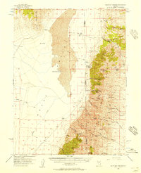
 1940 Antler Peak1960 Print · USGSThe Battle Mountains were a hive of mineral extraction and remote ranching in the years before the war. Researchers can trace dozens of early workings like the Marigold Mine and Buckingham Camp alongside family outposts like Oyarbi de Ranch.3 unique versions available
 - 1943 Map of Antler Peak
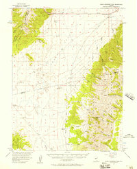
 1943 Antler Peak1943 Print · USGSIn the early 1940s, the high basins of Lander County were defined by a booming mineral economy and isolated desert ranching. Genealogists and historians can trace the foundations of Buckingham Camp, the Marigold Mine, and remote family outposts like Oyarbi de Ranch.3 unique versions available
 - 1944 Map of Cortez
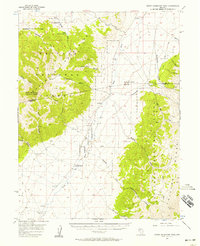
 1944 Cortez1944 Print · USGSLander and Eureka counties are documented here in the early 1940s, highlighting the mining and ranching outposts of the Great Basin. Genealogists and historians can trace family locations at Caetano Ranch or explore industrial sites like the Cortez Mine and the Mill Canyon Sch.2 unique versions available
 - 1949 Map of Crescent Valley, 1958 Print
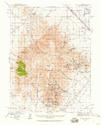
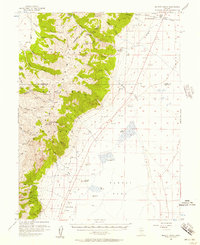
 1949 Crescent Valley1958 Print · USGSCrescent Valley and the surrounding ranges are shown here in the late 1940s as a landscape of mining and ranching. Trace old mining operations at the Gold Acres Mine, find the Lander (Site), or locate the Dean Ranch.2 unique versions available
 - 1949 Map of Mt. Lewis, 1958 Print
 1949 Mt. Lewis1958 Print · USGSThe Shoshone Range in the late 1940s was a landscape of high-elevation mining and ranching at the peak of the post-war era. Researchers can trace the remnants of the local mining economy at the Utah Mine Camp or locate old family holdings like the Shwin Ranch and Home Ranch.2 unique versions available
 - 1950 Map of Mt. Lewis
 1950 Mt. Lewis1950 Print · USGSLander County mining history is preserved here in the mid-twentieth century, centered on the high peaks of the Shoshone Range. Genealogists and researchers can trace old ranching boundaries at Home Ranch or locate historic mineral sites like the Betty O'Neal Mine and Utah Mine Camp.
 - 1950 Map of Crescent Valley
 1950 Crescent Valley1950 Print · USGSCrescent Valley at the mid-century reveals a landscape of active gold mining and earlier silver-era relics. Researchers can trace the lineage of local mining at the Gold Acres Mine or locate the historic town of Tenabo and the Lander (Site).2 unique versions available
 - 1955 Map of McDermitt
 1955 McDermitt1955 Print · USGSNorthern Nevada in the mid-fifties shows a landscape of mining camps and vast cattle ranges. Trace the early footprints of Tuscarora or the remote Cordero Mine and National Mine tucked into the high desert peaks.3 unique versions available
 - 1955 Map of Millett, 1963 Print
 1955 Millett1963 Print · USGSCentral Nevada in the mid-fifties is a landscape of high-desert basins and remote outposts. Researchers can trace historic ranching sites like Petersons Mill and Grass Valley Ranch or locate the McCoy Mining Camp.4 unique versions available
 - 1955 Map of Winnemucca, 1968 Print
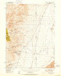
 1955 Winnemucca1968 Print · USGSNorthern Nevada's high desert corridor is captured here in the mid-fifties, centered on the river-and-rail hub of Winnemucca. Researchers can trace the dual tracks of the Southern Pacific and Western Pacific railroads through towns like Golconda and Valmy.3 unique versions available
 - 1956 Map of Mount Callaghan, 1957 Print
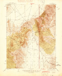
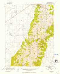
 1956 Mount Callaghan1957 Print · USGSLander County's high-altitude ranching country is captured here during the mid-fifties, showing the remote stations and water sources of the Great Basin. You can trace the historic boundaries of the Callaghan Ranch and find isolated springs like Rye Patch Spring and Cottonwood Spring.3 unique versions available
 - 1956 Map of Walti Hot Springs, 1957 Print
 1956 Walti Hot Springs1957 Print · USGSThe high desert of central Nevada is captured here in the mid-1950s, showing the remote ranching outposts along the Simpson Park Range. You can trace early jeep trails and family landmarks like Walti Ranch, Keystone Mine, and the thermal Hot Springs.2 unique versions available
 - 1956 Map of South Shoshone Peak, 1957 Print
 1956 South Shoshone Peak1957 Print · USGSThe central Nevada high desert comes into focus during the mid-fifties as ranchers and miners navigated the great basins between the Paradise Range and the Desatoya Mountains. Researchers can locate remote outposts like Peterson Station and Idlewild or trace water sources through Lebeau Creek and Midas Spr.3 unique versions available
 - 1956 Map of North Shoshone Peak, 1957 Print
 1956 North Shoshone Peak1957 Print · USGSCentral Nevada's high-desert interior comes to life in the 1950s as the Reese River valley and Toiyabe Mountains are mapped in detail. Genealogists can locate family landmarks like O'Toole Ranch and follow the old Marysville Trail through the canyons.3 unique versions available
 - 1956 Map of Millett Ranch, 1957 Print
 1956 Millett Ranch1957 Print · USGSSmoky Valley and the Toiyabe Range are shown here in the mid-fifties, capturing a landscape of high-altitude peaks and valley ranches. Genealogists and historians can trace family sites at Schmidtlein Ranch and McLeod Ranch or locate the Smoky Valley Sch.2 unique versions available
 - 1956 Map of Hall Creek, 1957 Print
 1956 Hall Creek1957 Print · USGSHigh-desert ranching and remote Nevada valleys are captured in the mid-fifties, centered on the Shoshone Range. Researchers can trace the layout of early livestock operations at Hall Creek Ranch and find the site of Cowboy Rest among the springs of Grass Valley.3 unique versions available
 - 1956 Map of Ackerman Canyon, 1957 Print
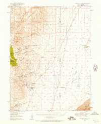
 1956 Ackerman Canyon1957 Print · USGSLander and Eureka Counties in the mid-1950s remained a frontier of isolated ranching and mining. Local historians can trace early property sites like Indian Ranch and Dry Creek Ranch or locate the remote Goober Mine and its neighboring landing field.4 unique versions available
 - 1956 Map of Austin, 1958 Print
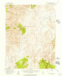
 1956 Austin1958 Print · USGSThe mining town of Austin sits at the edge of the Toiyabe National Forest during the mid-fifties. Genealogists and historians can trace family-named properties like Gandolfo Ranch and local landmarks such as Stokes Castle.3 unique versions available
Showing maps 1-25 of 711
Top cities of Lander County
Frequently asked questions
- What are the different types of historical maps available for Lander County?
- What is the oldest map of Lander County?
- Where can I purchase historical maps of Lander County for my home or office?
- Where can I download high-res historical maps of Lander County?
- Are there historical topographic maps available for Lander County?
- Is there historical aerial imagery available for Lander County?
- Where are historical maps of Lander County sourced from?