1960s Maps of Lander County, Nevada
Explore 57 historic maps of Lander County from the 1960s. These maps offer a rare glimpse into what life looked like during the 1960s — showing old roads, neighborhoods, homes, and landmarks that have changed or disappeared over time.
Whether you're researching your family's past, planning a metal detecting trip, or studying how Lander County's landscape evolved across the 1960s, these high-resolution maps are a powerful tool for exploring the history of this region.
- Focus on a specific era: All maps on this page are from the 1960s, giving you a focused view of this time period.
- See what’s changed: Compare century-old streets, trails, and buildings to today's modern landscape using overlays and satellite layers.
- Research with precision: Use these maps for genealogy, historical research, land use analysis, or educational projects.
- View, download, or print: Maps are fully viewable online in high resolution, and can be downloaded or printed for your own records.
Start exploring Lander County's history through authentic maps from the 1960s. This is your window into the past.
Lander County, NV maps
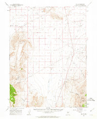
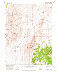
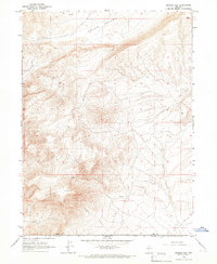
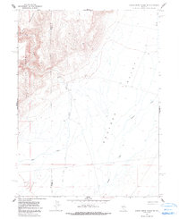
(57)- 1960 Map of Hickison Summit, 1961 Print
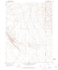
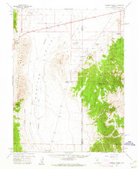 1960 Hickison Summit1961 Print · USGSCentral Nevada's high basins and ranges are captured here in the early sixties as the ranching and grazing industry shaped the land. Researchers can trace the isolated locations of Grimes Ranch and Potts Well or locate mountain springs like Lazarus Spring.3 unique versions available
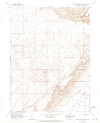
 - 1960 Map of Spencer Hot Springs, 1961 Print
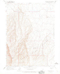
 1960 Spencer Hot Springs1961 Print · USGSSmoky Valley and the Simpson Park Mountains appear here in the early 1960s, a landscape where historical travel routes and mining meet. Locate the Cape Horn Overland Stage Station (Site) or trace the path of the Pony Express Route past the Lowboy Mine.3 unique versions available
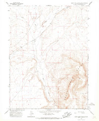
 - 1960 Map of Dianas Punch Bowl, 1962 Print
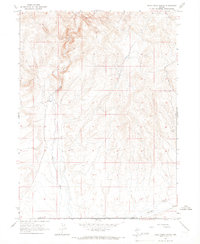
 1960 Dianas Punch Bowl1962 Print · USGSCentral Nevada's high basin and range country is documented here during the early sixties, showing a landscape of remote cattle operations and geothermal features. Researchers can find old homesteads and water rights including Potts Ranch, Dianas Punch Bowl, and the Willow Creek Ranch.3 unique versions available
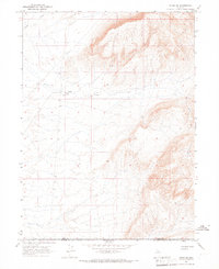
 - 1960 Map of Wildcat Peak, 1962 Print
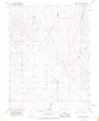
 1960 Wildcat Peak1962 Print · USGSIn the early 1960s, the high desert of the Nye and Lander county line was a landscape defined by remote ranching and mining. Researchers can trace the water sources and trails that sustained life here, from the Bronco Mine and Indian Ranch to the prehistoric Toquima Cave.2 unique versions available
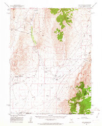
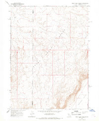
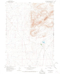
 - 1961 Map of McCoy, 1962 Print
 1961 McCoy1962 Print · USGSLander County mining and water rights come into focus in the early 1960s as the high desert landscape transitions from rail to road transit. Trace the Old Railroad Grade through the valley or locate remote family-named landmarks like Pickett Well and the McCoy Mine.3 unique versions available
 - 1961 Map of Cain Mountain, 1963 Print
 1961 Cain Mountain1963 Print · USGSPershing County's high-desert basins and rugged ranges are captured here in the early sixties, showing a landscape defined by thermal activity and remote cattle stations. Researchers can trace the heritage of isolated outposts like Seven Devils Ranch, McCoy Ranch, and the geothermal waters of Sou Hot Springs.2 unique versions available
 - 1961 Map of The Cedars, 1963 Print
 1961 The Cedars1963 Print · USGSLander County's high-desert basins and mountain ranges are documented here in the early 1960s as a landscape of remote ranches and old transit corridors. Researchers can trace the Old Railroad Grade through the valley or locate historic water sites like Fish Creek Ranch and Hot Springs.3 unique versions available
 - 1961 Map of Mt. Moses, 1963 Print
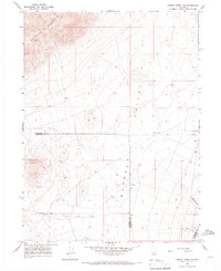
 1961 Mt. Moses1963 Print · USGSThe high-desert terrain of central Nevada is charted here during the early sixties, showing the remote borderlands between Pershing and Lander Counties. Researchers can locate isolated water sources and natural transit points like Hess Spring, Home Station Gap, and Cottonwood Pass.3 unique versions available
 - 1962 Map of Winnemucca
 1962 Winnemucca1962 Print · USGSNorthern Nevada's high desert comes alive in the mid-1950s as a vital transportation and mining corridor following the Humboldt River. Trace the early rail-and-ranch economy through stops like Palisade, find old workings at the Adelaide Mine, and see the layout of Winnemucca before the interstate era.
 - 1962 Map of Carico Lake, 1964 Print
 1962 Carico Lake1964 Print · USGSLander County ranching and water rights take center stage in this early 1960s survey of the Nevada desert. Genealogists and historians can trace legacy land holdings like Wholey Ranch and Horse Ranch, alongside remote features such as Laborde Well and a lone grave.
 - 1962 Map of Buffalo Springs, 1964 Print
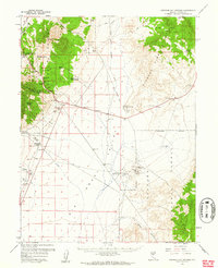
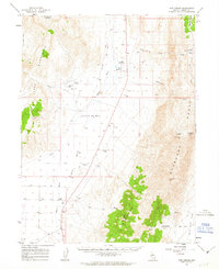
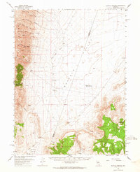 1962 Buffalo Springs1964 Print · USGSPershing and Lander counties meet in this high-desert basin during the early 1960s, a time when remote ranching outposts defined the landscape. Genealogists and historians can trace the locations of the Buffalo Ranch, Anderson Homestead, and the geothermal Buffalo Valley Hot Springs.3 unique versions available
 - 1965 Map of Izzenhood Gap, 1967 Print
 1965 Izzenhood Gap1967 Print · USGSLander County's high desert terrain is captured here in the mid-1960s, showing the critical water points and mountain passes of the region. Researchers can trace the drainage of Sixmile Creek or locate the remote Izzenhood Well and Izzenhood Gap.
 - 1965 Map of Russells, 1967 Print
 1965 Russells1967 Print · USGSLander County's high desert landscape comes into focus during the mid-sixties, showing the ranching and rail infrastructure of the Great Basin. Genealogists and historians can trace the remote settlement of Russells and a network of water sources including Russells Well No 2 and McIntyre Slough.
 - 1965 Map of Sixmile Hill, 1967 Print
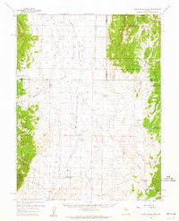
 1965 Sixmile Hill1967 Print · USGSElko and Lander counties remain largely undeveloped in the mid-1960s, defined by the high-desert terrain of the Great Basin. Local historians can trace the course of Sixmile Creek and locate several isolated spring sites near Sixmile Hill.
 - 1965 Map of Sheep Creek Range SW, 1967 Print
 1965 Sheep Creek Range SW1967 Print · USGSLander County in the mid-1960s is defined here by the steep slopes of the Sheep Creek Range as they descend into the high desert plains. Researchers can trace early infrastructure through the road network and find vital water sources like Rock Creek and a localized Well in the Boulder Valley.
 - 1965 Map of Sheep Creek Range NE, 1967 Print
 1965 Sheep Creek Range NE1967 Print · USGSThe high ridges of the Sheep Creek Range meet the northern Boulder Valley in the mid-1960s. Researchers can trace remote transit routes across the Lander Co line, including a lonely Landing Strip and several winding Jeep Trails.2 unique versions available
 - 1965 Map of Cherry Creek NE, 1967 Print
 1965 Cherry Creek NE1967 Print · USGSHumboldt County in the mid-sixties reveals a landscape of high-desert basins and remote mining activity. Researchers can locate early industrial sites like several prospects and gravel pits or trace the path of Trenton Creek near the county lines.2 unique versions available
 - 1965 Map of Sheep Creek Range SE, 1967 Print
 1965 Sheep Creek Range SE1967 Print · USGSThe high desert border of Lander and Eureka counties comes into focus during the mid-1960s, showing a landscape defined by mountain ranges and valley basins. Researchers can trace early hydrological infrastructure like the Gaging Station and Ditch networks along Rock Creek.2 unique versions available
 - 1965 Map of Sheep Creek Range NW, 1967 Print
 1965 Sheep Creek Range NW1967 Print · USGSHigh-desert ranching and the eastern slopes of the Nevada mountains define this area in the mid-sixties. Researchers can trace land use through features like Wire Corral Ranch, the isolated Corral, and the winding Jeep Trail.
 - 1965 Map of Midas SW, 1967 Print
 1965 Midas SW1967 Print · USGSElko and Lander Counties were primarily open rangeland in the mid-sixties, punctuated only by essential water improvements. Local history researchers can trace the boundary between Elko and Lander while locating the Guard Corral and Evans Creek.
 - 1965 Map of Izzenhood Ranch, 1967 Print
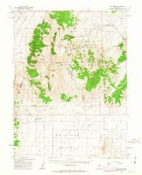
 1965 Izzenhood Ranch1967 Print · USGSLander County ranching country is captured in the mid-sixties, showing a landscape defined by isolated outposts and high-desert terrain. Researchers can locate the Izzenhood Ranch headquarters and trace routes like Izzenhood Road and the Roosters Comb ridgeline.2 unique versions available
 - 1965 Map of Hot Pot, 1967 Print
 1965 Hot Pot1967 Print · USGSThe Nevada desert interior comes to life in the mid-1960s along the Humboldt Co border. Local history researchers can locate the geothermal mound of the Hot Pot and trace routes to the Izzenhood Ranch and nearby Hot Springs.2 unique versions available
 - 1965 Map of Izzenhood Spring, 1967 Print
 1965 Izzenhood Spring1967 Print · USGSThe high-desert terrain of Lander County comes into focus in the mid-1960s, showing a landscape where water and topography dictated movement. Researchers can locate vital water sources like Izzenhood Spring and chart the heights of Workhorse Butte and Sterritt Peak.
 - 1965 Map of Rock Creek Ranch, 1967 Print
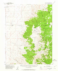
 1965 Rock Creek Ranch1967 Print · USGSThe high desert border of Elko and Lander counties comes into focus in the mid-1960s, showing a landscape shaped by ranching and mineral exploration. Researchers can trace the waters of Rock Creek past Rock Creek Ranch or locate the site of the Silver Cloud Mine.
 - 1965 Map of Cherry Creek SE, 1967 Print
 1965 Cherry Creek SE1967 Print · USGSPershing and Humboldt counties meet in this mid-1960s survey of the high desert, centered on the wide expanse of Buffalo Valley. Researchers can trace the path of Cherry Creek and locate a solitary Prospect in the southeastern hills.2 unique versions available
Showing maps 1-25 of 57
Top cities of Lander County
Frequently asked questions
- What are the different types of historical maps available for Lander County?
- What is the oldest map of Lander County?
- Where can I purchase historical maps of Lander County for my home or office?
- Where can I download high-res historical maps of Lander County?
- Are there historical topographic maps available for Lander County?
- Is there historical aerial imagery available for Lander County?
- Where are historical maps of Lander County sourced from?