1980s Maps of Lander County, Nevada
Explore 73 historic maps of Lander County from the 1980s. These maps offer a rare glimpse into what life looked like during the 1980s — showing old roads, neighborhoods, homes, and landmarks that have changed or disappeared over time.
Whether you're researching your family's past, planning a metal detecting trip, or studying how Lander County's landscape evolved across the 1980s, these high-resolution maps are a powerful tool for exploring the history of this region.
- Focus on a specific era: All maps on this page are from the 1980s, giving you a focused view of this time period.
- See what’s changed: Compare century-old streets, trails, and buildings to today's modern landscape using overlays and satellite layers.
- Research with precision: Use these maps for genealogy, historical research, land use analysis, or educational projects.
- View, download, or print: Maps are fully viewable online in high resolution, and can be downloaded or printed for your own records.
Start exploring Lander County's history through authentic maps from the 1980s. This is your window into the past.
Lander County, NV maps
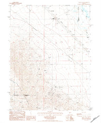
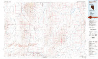
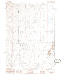
(73)- 1980 Map of Elevenmile Well, 1981 Print
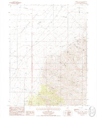
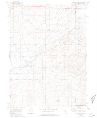 1980 Elevenmile Well1981 Print · USGSThe high desert of northern Nevada at the start of the 1980s reveals a landscape of remote cattle operations and thermal springs. Researchers can trace the ranching history of Hot Springs Ranch and Lower Clover Ranch or locate Elevenmile Well.2 unique versions available
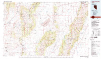
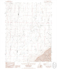
 - 1982 Map of Fish Creek Mts, 1983 Print
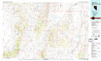 1982 Fish Creek Mts1983 Print · USGSPershing and Lander counties in the early 1980s reveal a landscape of mining camps and geothermal springs nestled between high mountain ranges. Local historians can trace mining operations at McCoy Mine or locate the remote Kyle Hot Springs and Home Station Gap.2 unique versions available
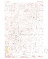
 - 1982 Map of Tuscarora, 1983 Print
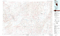 1982 Tuscarora1983 Print · USGSNortheastern Nevada in the early eighties reveals a landscape shaped by mining and high-desert hydrology. Trace the locations of historic extraction sites like Silver Cloud Mine or the Falcon Mines and find remote landmarks such as Hot Sulphur Springs.
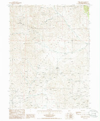
 - 1983 Map of Edwards Creek Valley
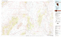 1983 Edwards Creek Valley1983 Print · USGSCentral Nevada in the early eighties was a landscape of remote mineral claims and vast desert basins. You can trace early mining sites like McCoy Mine and Skookum Mine or locate high-desert landmarks such as Humboldt Salt Marsh.
 - 1984 Map of Snow Gulch
 1984 Snow Gulch1984 Print · USGSHumboldt and Lander Counties are defined by high-desert mining and the path of the Southern Pacific railroad in the early eighties. Researchers can trace historic extraction sites including the Bailey Day Mine, DeWitt Mine, and the Brand M Placers.
 - 1984 Map of Antler Peak
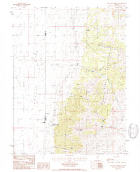
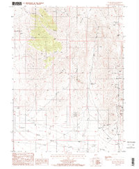 1984 Antler Peak1984 Print · USGSLander County mining operations are captured in detail during the early 1980s, showcasing a landscape shaped by mineral extraction. Researchers can locate specific sites like the Copper Canyon Mine, the settlement of Galena, and the remote Buffalo Valley Mine.2 unique versions available
 - 1984 Map of North Peak
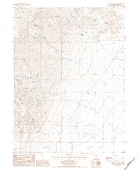
 1984 North Peak1984 Print · USGSThe high desert of northern Nevada in the early eighties reveals a landscape shaped by mineral exploration and high-altitude ranching. Trace the industrial footprint of the Marigold Mine and locate remote landmarks like the Corral and Ames Spring.
 - 1984 Map of Galena Canyon
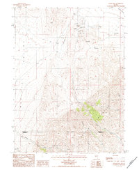
 1984 Galena Canyon1984 Print · USGSBattle Mountain mining operations are captured here during the mid-1980s, showcasing a landscape defined by extraction and desert peaks. Researchers can locate specific sites like the Copper Queen Mine, the settlement of Bannock, and the winding Reese River.
 - 1985 Map of Osgood Mts
 1985 Osgood Mts1985 Print · USGSHumboldt County in the mid-eighties was a hub of high-desert mining and remote ranching outposts. Trace the industrial footprint of the Getchell Mine, locate historic settlements like Amos, and follow the rail lines through Winnemucca.
 - 1985 Map of Smith Creek Valley
 1985 Smith Creek Valley1985 Print · USGSCentral Nevada in the mid-eighties shows a high-desert landscape of isolated mining sites and remote rangeland. Researchers can trace old operations like the Double Eagle Mine and Hasbrouck Mine or locate the Yomba Indian Reservation and Peterson Station.2 unique versions available
 - 1985 Map of Mud Spring Gulch
 1985 Mud Spring Gulch1985 Print · USGSThe Shoshone Range in the mid-eighties reveals a landscape of intensive mineral exploration across Lander County. Trace old mining operations from the Mud Spring Mine to family-named landmarks like Myers Hill and Rosebud Gulch.
 - 1985 Map of Ferris Creek
 1985 Ferris Creek1985 Print · USGSThe Shoshone Range in the mid-1980s reveals a high-altitude landscape of Nevada mining and exploration. Researchers can trace historical mineral work at the Utah Mine Camp, the Clipper Mine, and dozens of isolated Prospects near Ferris Creek.
 - 1985 Map of Crescent Valley, 1986 Print
 1985 Crescent Valley1986 Print · USGSIn the mid-1980s, this high-desert valley was a hub of mining exploration and geothermal activity. Genealogists and historians can trace the settlement of Crescent Valley, the local Landing Strip, and numerous Prospect sites near Hot Springs Point.
 - 1985 Map of East of Tenabo, 1986 Print
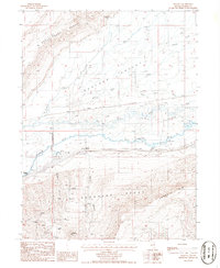
 1985 East of Tenabo1986 Print · USGSCrescent Valley in the mid-1980s shows a landscape defined by Great Basin ranching and mining. Trace the remote operations at the Mud Spring Mine, the historic Dean Ranch, and the sharp rise of the Cortez Mountains.
 - 1985 Map of The Geysers, 1986 Print
 1985 The Geysers1986 Print · USGSGeothermal and mineral activity dominate the Lander and Eureka county border in the mid-1980s. Researchers can locate remote industrial sites like the Sansinena Mine and trace the thermal features at The Geysers and Hot Springs.
 - 1985 Map of Goat Peak, 1986 Print
 1985 Goat Peak1986 Print · USGSThe high Shoshone Range in the mid-1980s reveals a landscape of ranching and heavy mineral extraction. Researchers can trace the development of the Greystone Mine, find the remote Shwin Ranch, and locate numerous prospects tucked into canyons like Hancock Canyon.
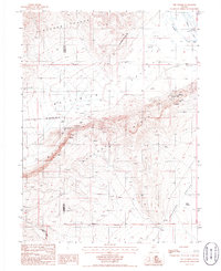
 - 1985 Map of Battle Mountain, 1986 Print
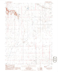
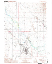 1985 Battle Mountain1986 Print · USGSThe Humboldt River valley in the mid-eighties reveals a landscape shaped by river hydrology and deep historical roots. Genealogists and local historians can trace family-named sites like Welch Ranch, the Battle Mountain Indian Colony, and the historic Old California Trail.2 unique versions available
 - 1985 Map of Stony Point, 1986 Print
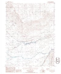 1985 Stony Point1986 Print · USGSLander County's river-and-rail corridor is documented here in the mid-1980s, showcasing a landscape shaped by mining and migration. You can trace the historic Old Calif Trail alongside industrial sites like the Snowstorm Mine and the rail stop at Argenta Siding.
 - 1985 Map of Mule Canyon, 1986 Print
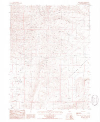 1985 Mule Canyon1986 Print · USGSLander County in the mid-1980s reveals a landscape of industrial exploration and high-desert terrain. Miners and geologists can trace the locations of the Bante Mine, Miller Mine, and various prospects within the Shoshone Range.
 - 1985 Map of Mt. Lewis, 1986 Print
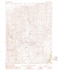 1985 Mt. Lewis1986 Print · USGSThe Shoshone Range in the early 1980s reveals a high-desert landscape defined by silver and gold prospecting. Genealogists and historians can trace numerous specific workings like the Pittsburg Mine, Kattenhorn Mine, and the summit at Maysville.
 - 1985 Map of Crippen Canyon, 1986 Print
 1985 Crippen Canyon1986 Print · USGSThe Shoshone Range was a center of industrial activity in the mid-eighties, dominated by mining and historic transit routes. Genealogists and historians can trace old mining sites like the Betty O' Neal Mine and the path of the Old Railroad Grade.
 - 1985 Map of Blossom Spring, 1986 Print
 1985 Blossom Spring1986 Print · USGSLander County's Reese River Valley in the mid-1980s reveals a landscape shaped by both pioneer migration and industrial utility. Genealogists and historians can trace the Old Calif Trail and find local landmarks such as Marvel Ranch, Blossom Spring, and an old Cem.
 - 1985 Map of Argenta, 1986 Print
 1985 Argenta1986 Print · USGSBoulder Valley in the mid-1980s reveals a rugged Nevada landscape centered on the Humboldt River and the Southern Pacific rail corridor. Researchers can trace the industrial footprint of the Argenta Mine and Shelton Mine or locate early rural sites like Kampos and the T-S Ranch.
 - 1985 Map of Tenabo, 1986 Print
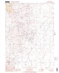 1985 Tenabo1986 Print · USGSLander County mining claims are captured in detail during the mid-1980s as industrial operations expanded across the Shoshone Range. Genealogists and historians can trace specific workings like the Gold Quartz Mine, the settlement at Tenabo, and the extensive tailings ponds near Gold Acres.2 unique versions available
 - 1986 Map of Walti Hot Springs
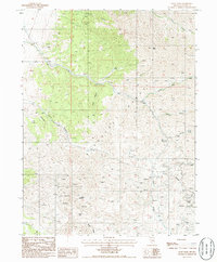
 1986 Walti Hot Springs1986 Print · USGSGrass Valley and the Simpson Park Mountains are captured here in the mid-1980s during a period of active ranching and research. Trace the history of high-desert outposts like the Gund Ranch or the Keystone Mine.
Showing maps 1-25 of 73
Top cities of Lander County
Frequently asked questions
- What are the different types of historical maps available for Lander County?
- What is the oldest map of Lander County?
- Where can I purchase historical maps of Lander County for my home or office?
- Where can I download high-res historical maps of Lander County?
- Are there historical topographic maps available for Lander County?
- Is there historical aerial imagery available for Lander County?
- Where are historical maps of Lander County sourced from?