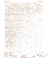
1984 Map of Galena Canyon
USGS Topo · Published 1984About this map
Industrial extraction dominates the landscape of Battle Mountain on this mid-1980s provisional survey. The western slopes are honeycombed with workings including the Lucky Strike Mine, Butte Mine, and numerous unnamed Mine Tunnels and Mineshafts. This density of labor is most apparent near Copper Basin and the Buckingham Mine, while the small settlement at Bannock sits along the road network near the mouth of Philadelphia Canyon. The eastern half of the map reveals a stark topographical shift into the Reese River Valley, where the terrain flattens toward the Reese River. This contrast between the high, mineral-rich peaks like Long Peak and the low alluvial plains highlights the distinct geological boundaries that defined Nevada's silver and copper mining districts during the late twentieth century.
Find a feature on this map
38 named features on this map. Tap any name to fly to it.
Don’t see what you’re looking for? This feature index may not catch every label — zoom into the map to look around manually.
Map Details
Editions of this 1984 Galena Canyon Map
This is the sole edition of this map. No revisions or reprints were ever made.
Other maps of this area

1932 · Sonoma Range
USGS Topo · 1:250,000

1939 · Sonoma Range
USGS Topo · 1:250,000

1940 · Antler Peak
USGS Topo · 1:62,500

1943 · Antler Peak
USGS Topo · 1:62,500

1949 · Mt. Lewis
USGS Topo · 1:62,500

1950 · Mt. Lewis
USGS Topo · 1:62,500

1955 · Winnemucca
USGS Topo · 1:250,000

1957 · Battle Mountain
USGS Topo · 1:62,500

1958 · Winnemucca
USGS Topo · 1:250,000

1961 · McCoy
USGS Topo · 1:62,500