
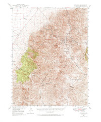
1949 Map of Mt. Lewis
USGS Topo · Published 1958About this map
Mt Lewis stands as the central landmark in this 1949 survey of the Shoshone Range, an area defined by its mid-century mining activity and high-elevation ranching. The landscape is etched with the canyons and summits that hosted a network of silver and barium operations, including the Betty O'Neal Mine, the Kattenhorn Mine, and the Hilltop Barium Mine. While most mines on this sheet were noted as inactive by the late 1940s, the infrastructure of the era remains visible through the Utah Mine Camp and the winding Maysville Trail. Water sources like Trout Creek and Mill Creek supported localized ranching, represented here by the Home Ranch and Shwin Ranch. The map captures a high-desert industrial frontier in transition, where old claims like the Blue Dick Mine and Red Top Mine mark the rugged slopes between Lewis Pk and Havingdon Pk.
Find a feature on this map
55 named features on this map. Tap any name to fly to it.
Don’t see what you’re looking for? This feature index may not catch every label — zoom into the map to look around manually.
Map Details
Editions of this 1949 Mt. Lewis Map
2 editions found
Other maps of this area

1932 · Sonoma Range
USGS Topo · 1:250,000

1938 · Cortez
USGS Topo · 1:48,000

1939 · Sonoma Range
USGS Topo · 1:250,000

1940 · Antler Peak
USGS Topo · 1:62,500

1943 · Antler Peak
USGS Topo · 1:62,500

1944 · Cortez
USGS Topo · 1:62,500

1949 · Crescent Valley
USGS Topo · 1:62,500

1950 · Mt. Lewis
USGS Topo · 1:62,500

1950 · Crescent Valley
USGS Topo · 1:62,500

1955 · Winnemucca
USGS Topo · 1:250,000