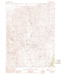
1985 Map of Mt. Lewis
USGS Topo · Published 1986About this map
Shoshone Range peaks and the high canyons of Lander County dominate this mid-1980s survey, revealing a landscape deeply etched by mining history. Centered on the rugged slopes of Mt Lewis, the map documents an extensive network of mineral exploration, from the isolated Barse Mine in the north to the Gray Eagle Mine near Granite Mtn in the southeast. A dense concentration of activity appears around the West Fork Canyon, where the Pittsburg Mine, Kattenhorn Mine, and Blue Dick Mine sit near the high pass of Maysville Summit.
Find a feature on this map
41 named features on this map. Tap any name to fly to it.
Don’t see what you’re looking for? This feature index may not catch every label — zoom into the map to look around manually.
Map Details
Editions of this 1985 Mt. Lewis Map
This is the sole edition of this map. No revisions or reprints were ever made.
Other maps of this area

1949 · Crescent Valley
USGS Topo · 1:62,500

1949 · Mt. Lewis
USGS Topo · 1:62,500

1950 · Mt. Lewis
USGS Topo · 1:62,500

1950 · Crescent Valley
USGS Topo · 1:62,500

1955 · Winnemucca
USGS Topo · 1:250,000

1957 · Dunphy
USGS Topo · 1:62,500

1957 · Battle Mountain
USGS Topo · 1:62,500

1958 · Winnemucca
USGS Topo · 1:250,000

1962 · Winnemucca
USGS Topo · 1:250,000

1985 · Mud Spring Gulch
USGS Topo · 1:24,000