
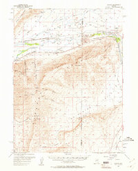
1957 Map of Dunphy
USGS Topo · Published 1958About this map
The Humboldt River corridor defines this mid-century Nevada landscape, where the Southern Pacific railroad follows the historic path of the California Trail. This intersection of transportation eras is anchored by the settlement of Dunphy and the Argenta Siding, points of vital connection in the high desert of the late 1950s. To the south, the Argenta Rim rises sharply, separating the river valley from the geothermal activity at The Geysers and the broad expanse of Whirlwind Valley.
Find a feature on this map
42 named features on this map. Tap any name to fly to it.
Don’t see what you’re looking for? This feature index may not catch every label — zoom into the map to look around manually.
Map Details
Editions of this 1957 Dunphy Map
2 editions found
Other maps of this area

1949 · Crescent Valley
USGS Topo · 1:62,500

1949 · Mt. Lewis
USGS Topo · 1:62,500

1950 · Mt. Lewis
USGS Topo · 1:62,500

1950 · Crescent Valley
USGS Topo · 1:62,500

1955 · Winnemucca
USGS Topo · 1:250,000

1957 · Frenchie Creek
USGS Topo · 1:62,500

1957 · Beowawe
USGS Topo · 1:62,500

1957 · Battle Mountain
USGS Topo · 1:62,500

1958 · Winnemucca
USGS Topo · 1:250,000

1962 · Winnemucca
USGS Topo · 1:250,000