
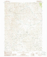
1985 Map of Mud Spring Gulch
USGS Topo · Published 1985About this map
The Shoshone Range dominates this 1985 survey of central Nevada, revealing a landscape defined by industrial exploration and steep drainage systems. This era of activity is marked by an extensive network of prospects and mine shafts concentrated around the southern peaks. The Mud Spring Mine serves as a focal point near the head of Mud Spring Gulch, illustrating the era's mining footprint across the high desert terrain. Notable elevations include Bald Mtn and Granite Mtn, which frame the many canyons and gulches that channel seasonal water toward the lower flats.
Find a feature on this map
24 named features on this map. Tap any name to fly to it.
Don’t see what you’re looking for? This feature index may not catch every label — zoom into the map to look around manually.
Map Details
Editions of this 1985 Mud Spring Gulch Map
This is the sole edition of this map. No revisions or reprints were ever made.
Other maps of this area

1949 · Crescent Valley
USGS Topo · 1:62,500

1949 · Mt. Lewis
USGS Topo · 1:62,500

1950 · Mt. Lewis
USGS Topo · 1:62,500

1950 · Crescent Valley
USGS Topo · 1:62,500

1955 · Winnemucca
USGS Topo · 1:250,000

1957 · Dunphy
USGS Topo · 1:62,500

1957 · Battle Mountain
USGS Topo · 1:62,500

1958 · Winnemucca
USGS Topo · 1:250,000

1962 · Winnemucca
USGS Topo · 1:250,000
1985 · Ferris Creek
USGS Topo · 1:24,000