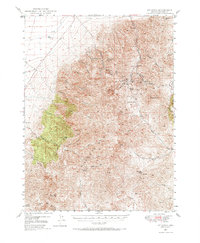
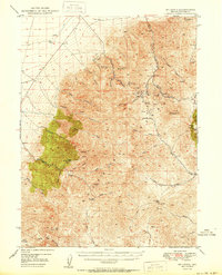
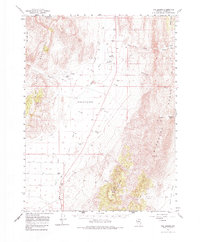
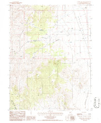
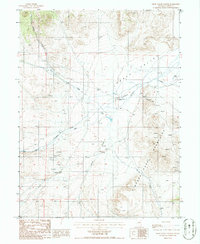
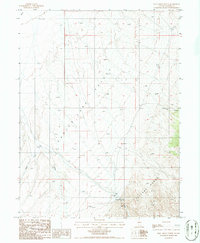
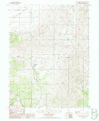
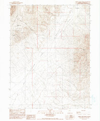
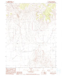
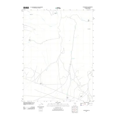
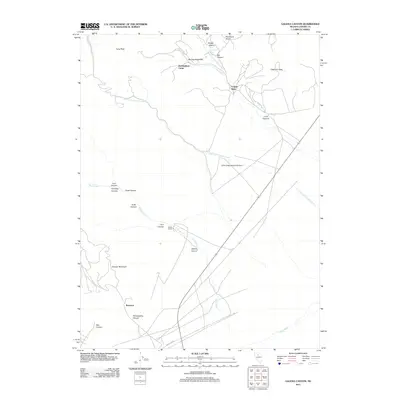
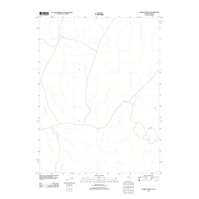
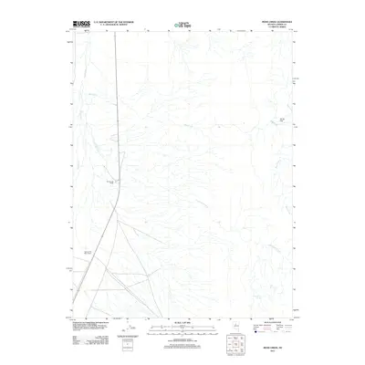
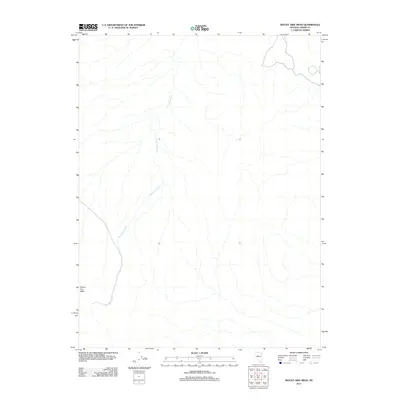
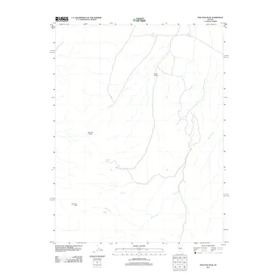
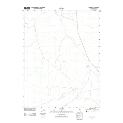
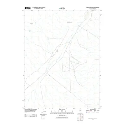
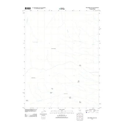
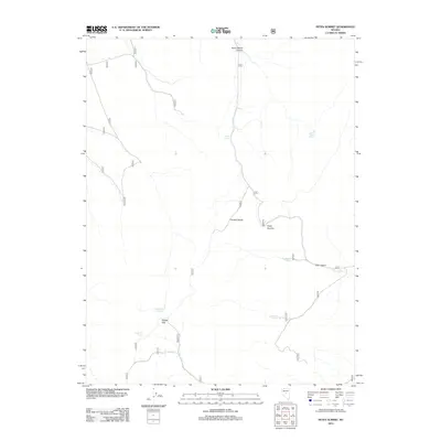
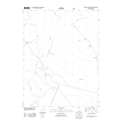
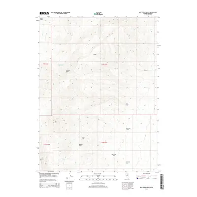
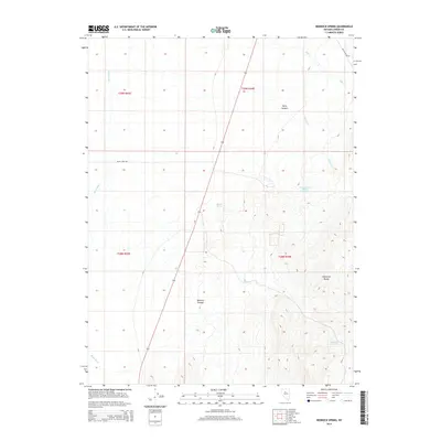
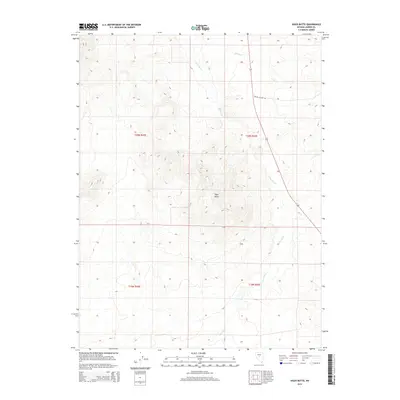
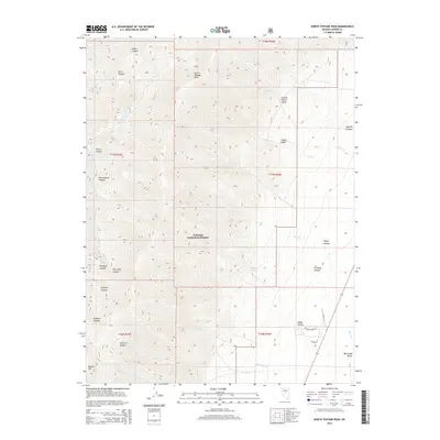
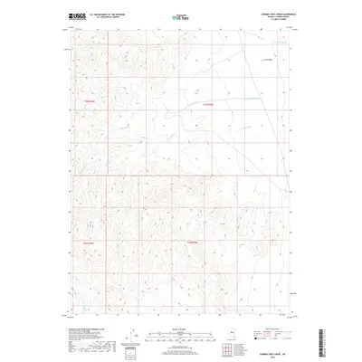
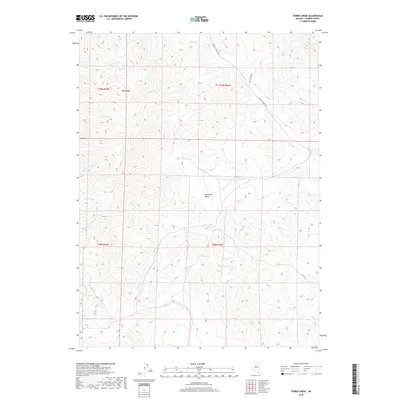
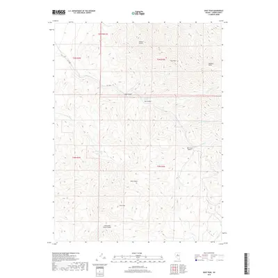
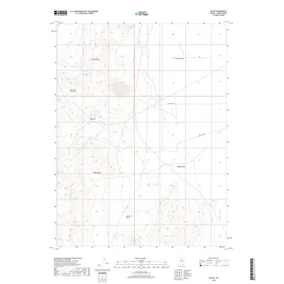
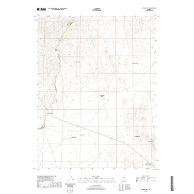
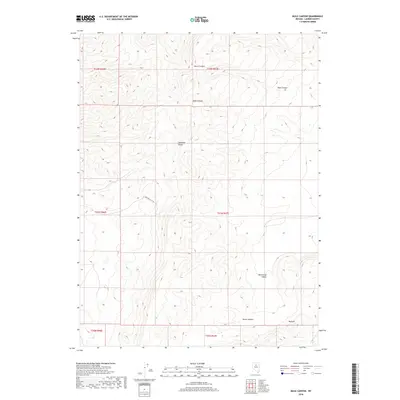
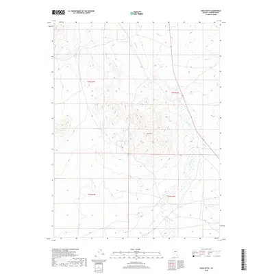
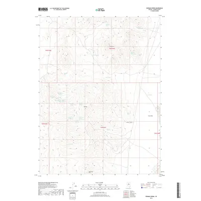
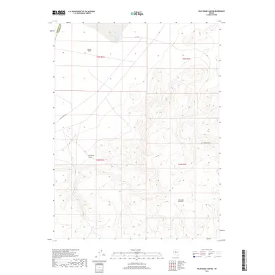
1985 Map of Ferris Creek
USGS Topo · Published 1985About this map
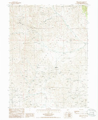
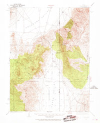
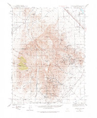
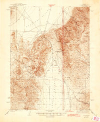
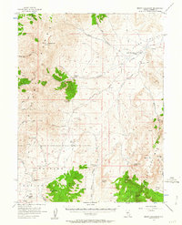
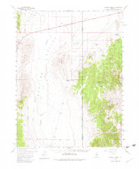
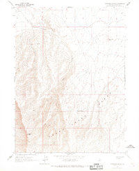
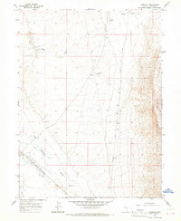
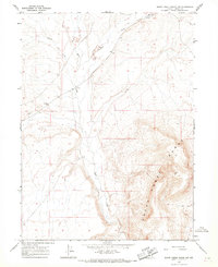
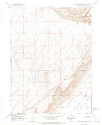
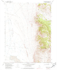
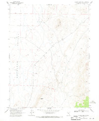
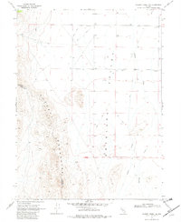
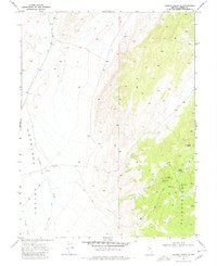
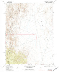
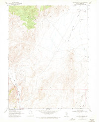
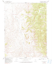
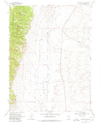
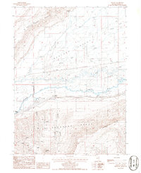
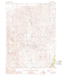
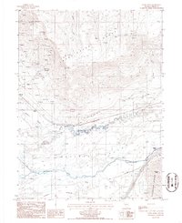
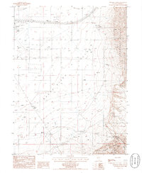
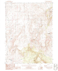
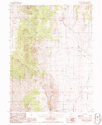
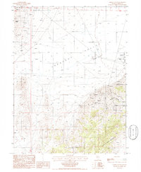
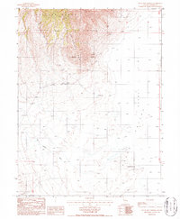
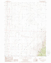
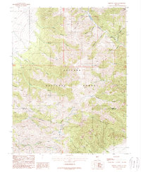
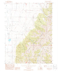
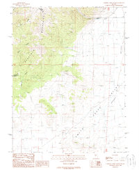
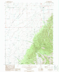
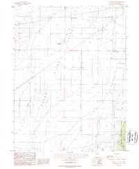
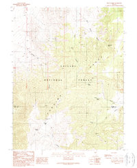
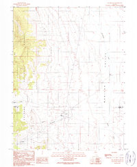
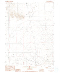
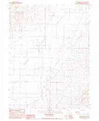
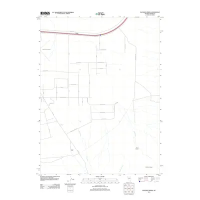
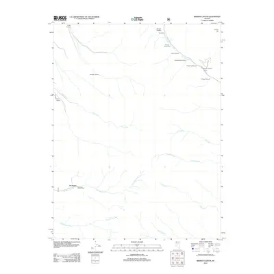
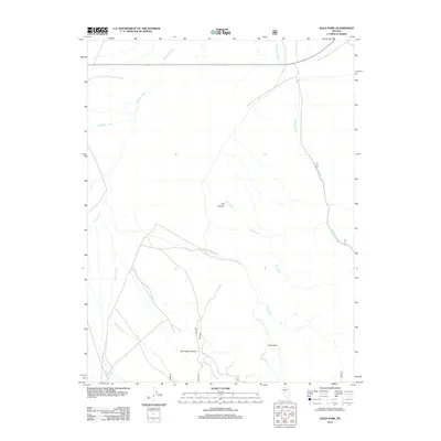
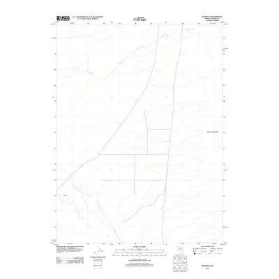
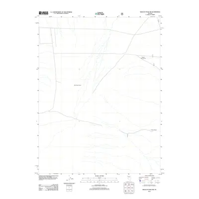
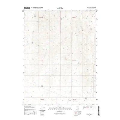
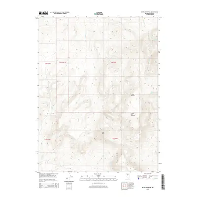
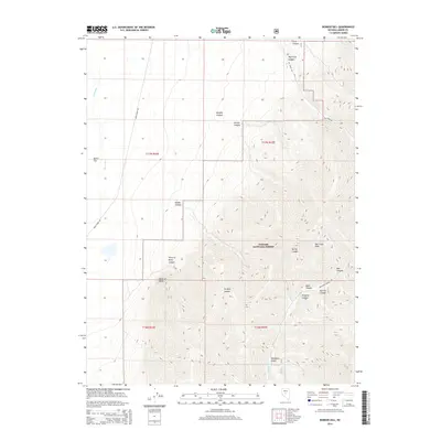
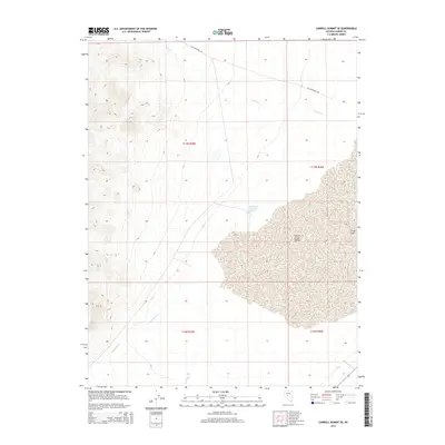
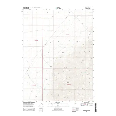
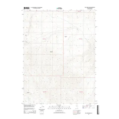
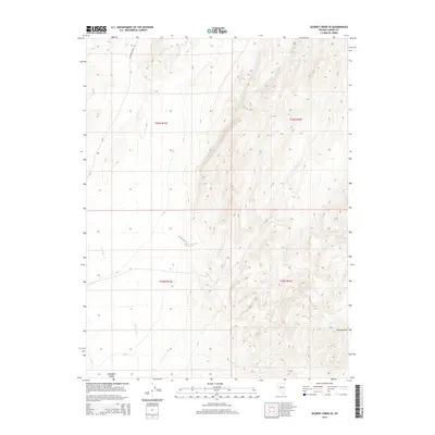
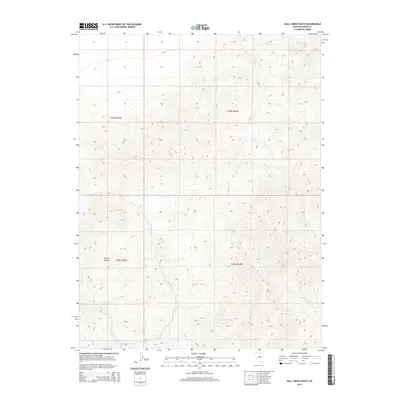
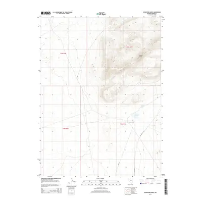
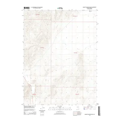
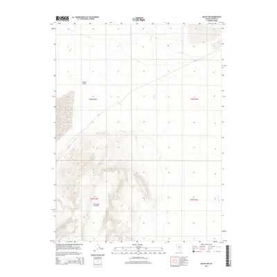
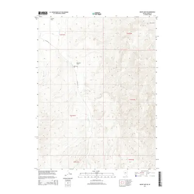
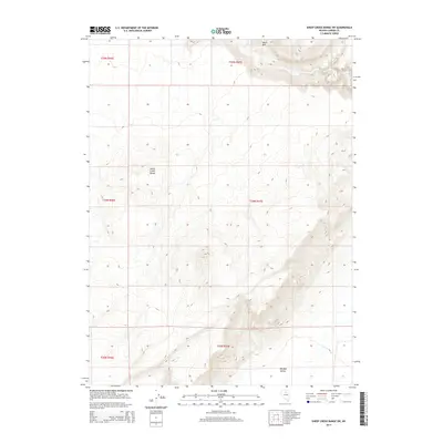
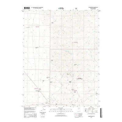
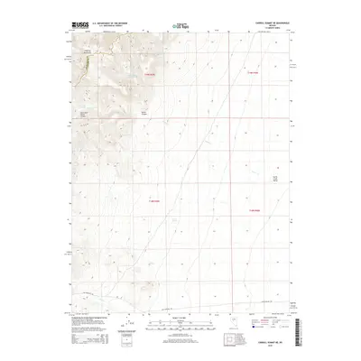
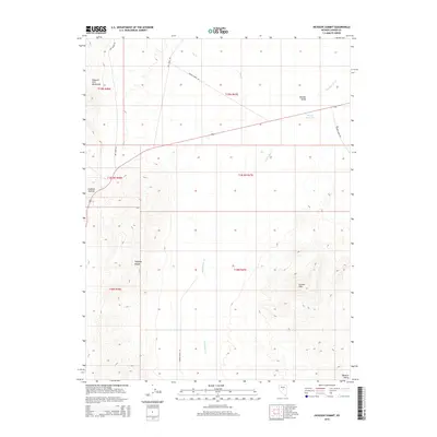
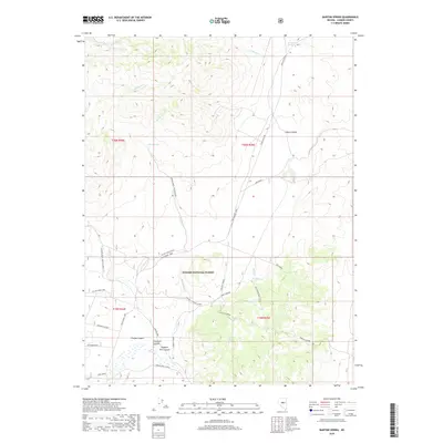
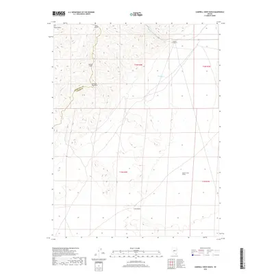
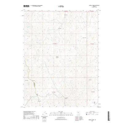
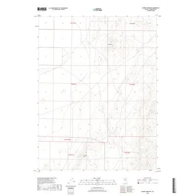
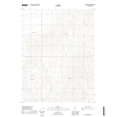
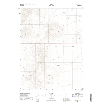
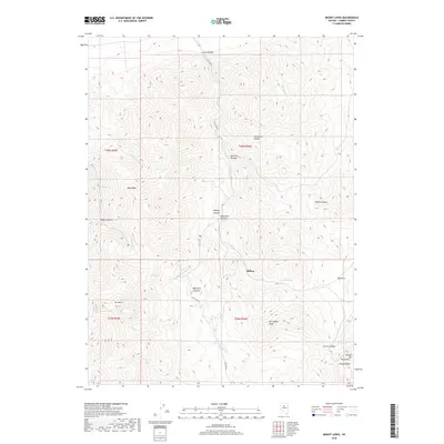
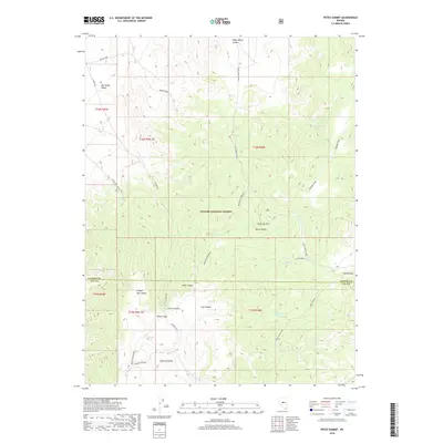
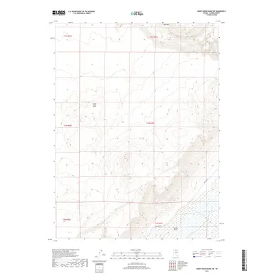
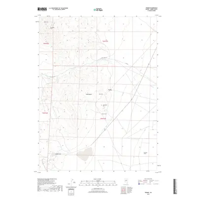
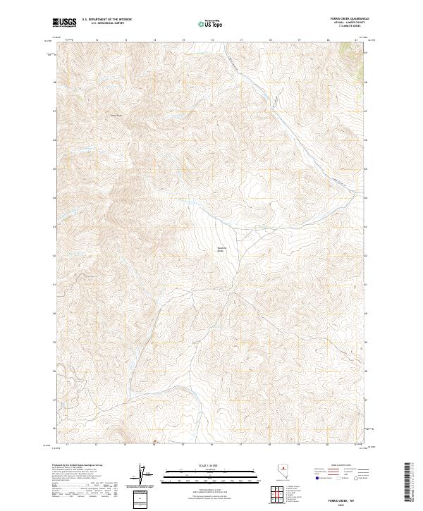
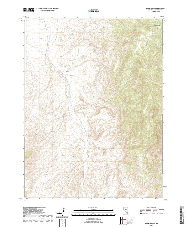
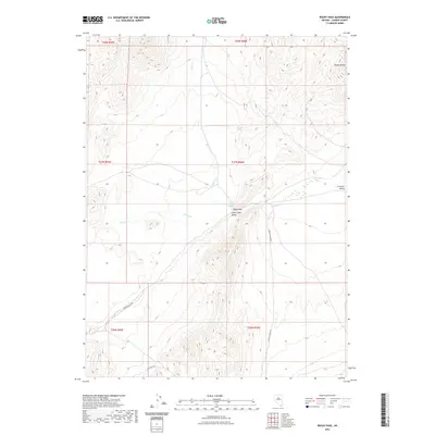
The high slopes of the Shoshone Range dominate this Nevada landscape, revealing a region defined by late-twentieth-century mineral exploration and extraction. Centered on the Utah Mine Camp, the map documents a network of mining operations including the Clipper Mine, the Utah Mine, and numerous Mine Shaft locations. The terrain is deeply incised by a drainage system comprising Grouse Creek, Chicken Creek, and Indian Creek, with small seasonal water sources like North Fork Mill Creek and Ferris Creek carving through the mountain slopes. The abundance of labels marked Prospects and Prospect across the topography suggests an era of intense geological survey and potential development. Industrial features such as a Tailings Pond and various Open Pit sites appear alongside signs of rangeland use like a Corral, illustrating the dual utility of this Lander County environment.
Find a feature on this map
23 named features on this map. Tap any name to fly to it.
Don’t see what you’re looking for? This feature index may not catch every label — zoom into the map to look around manually.
Map Details
Editions of this 1985 Ferris Creek Map
This is the sole edition of this map. No revisions or reprints were ever made.
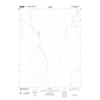
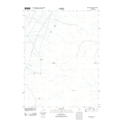
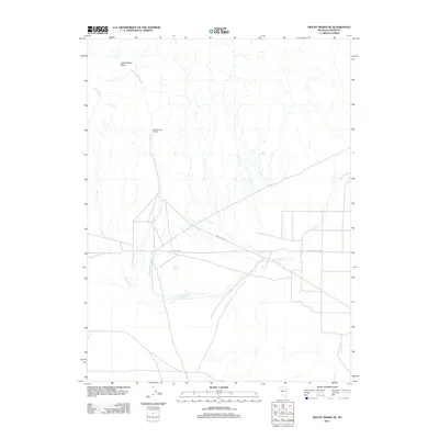
Historical Maps of Lander County Through Time
477 maps found
1938 Cortez
Lander County, NV
1940 Antler Peak
Lander County, NV

1943 Antler Peak
Lander County, NV
1944 Cortez
Lander County, NV
1949 Mt. Lewis
Lander County, NV
1950 Mt. Lewis
Lander County, NV
1955 Millett
Lander County, NV
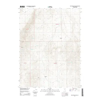
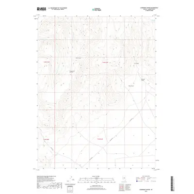
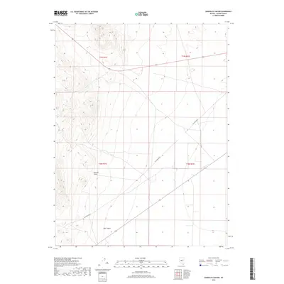
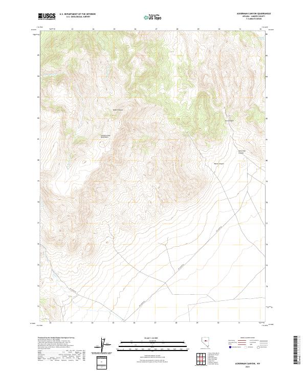
1956 Ackerman Canyon
Lander County, NV

1956 Hall Creek
Lander County, NV
1956 Mount Callaghan
Lander County, NV
1956 South Shoshone Peak
Lander County, NV
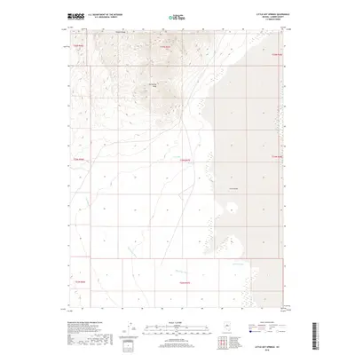
1956 Walti Hot Springs
Lander County, NV
1957 Dunphy
Lander County, NV

1959 Millett
Lander County, NV
1960 Hickison Summit
Lander County, NV
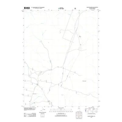
1960 Spencer Hot Springs
Lander County, NV
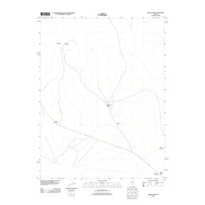
1961 Mc Coy
Lander County, NV
1961 Mt. Moses
Lander County, NV
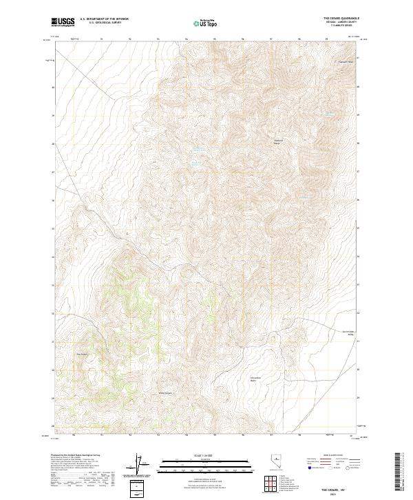
1961 The Cedars
Lander County, NV
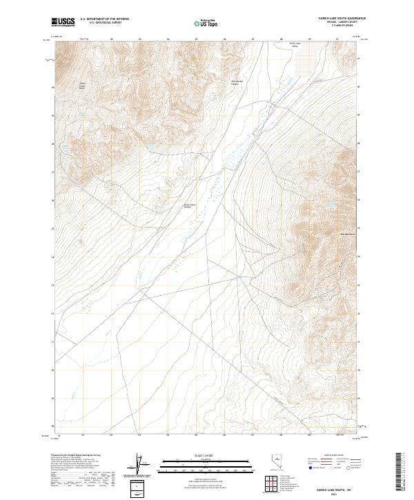
1962 Carico Lake
Lander County, NV
1965 Izzenhood Gap
Lander County, NV
1965 Izzenhood Ranch
Lander County, NV
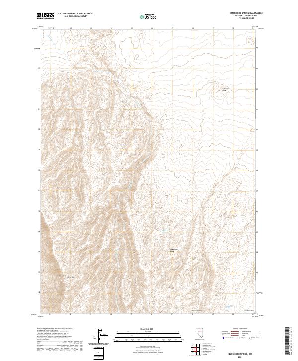
1965 Izzenhood Spring
Lander County, NV
1965 Russells
Lander County, NV
1965 Sheep Creek Range NW
Lander County, NV
1965 Sheep Creek Range SW
Lander County, NV
1969 Carroll Summit
Lander County, NV
1969 Carroll Summit NE
Lander County, NV
1969 Carroll Summit SE
Lander County, NV
1969 Dutch Flat
Lander County, NV
1969 Emigrant Peak
Lander County, NV

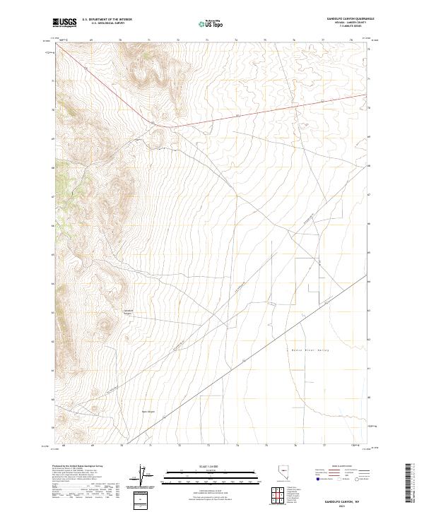
1969 Gandolfo Canyon
Lander County, NV
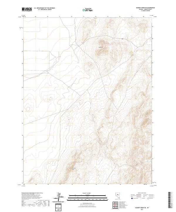
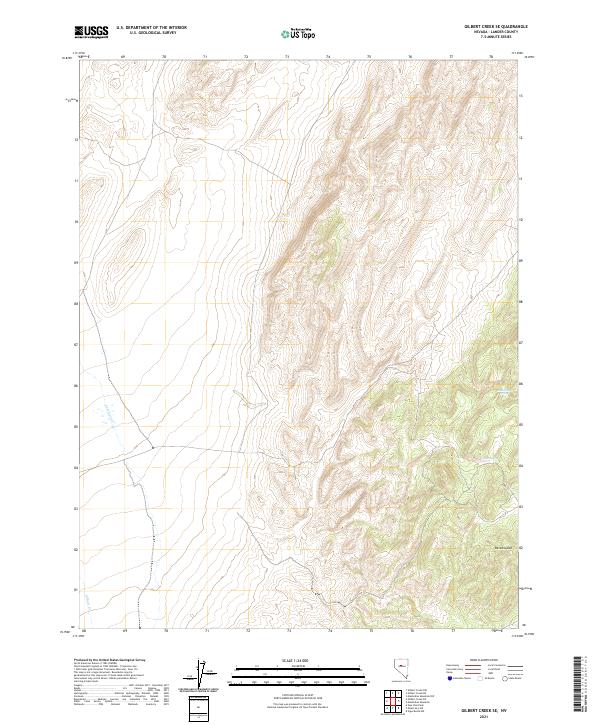
1969 Gilbert Creek NE
Lander County, NV
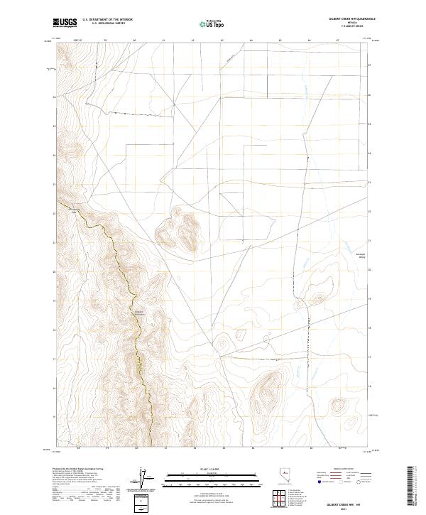
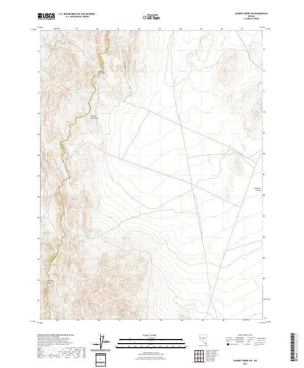
1969 Gilbert Creek NW
Lander County, NV
1969 Gilbert Creek SE
Lander County, NV
1969 Gilbert Creek SW
Lander County, NV
1969 Iron Mountain
Lander County, NV
1969 Joe Eason Mtn
Lander County, NV
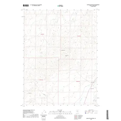
1969 Manhattan Mtn
Lander County, NV
1969 Manhattan Mtn NE
Lander County, NV
1969 Manhattan Mtn NW
Lander County, NV
1969 Mount Airy
Lander County, NV
1969 Mount Airy Mesa
Lander County, NV
1969 Mount Airy NE
Lander County, NV
1969 New Pass Peak
Lander County, NV
1969 Vigus Butte
Lander County, NV
1969 Vigus Butte NE
Lander County, NV
1969 Vigus Butte NW
Lander County, NV
1969 Yankee Blade
Lander County, NV
1984 Antler Peak
Lander County, NV
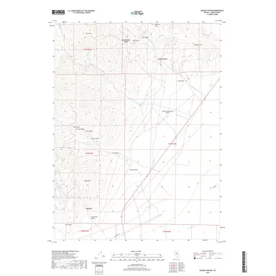
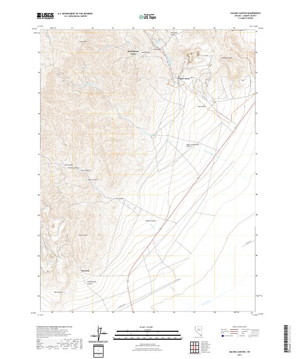
1984 Galena Canyon
Lander County, NV
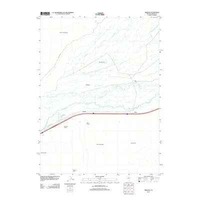
1985 Argenta
Lander County, NV
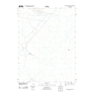
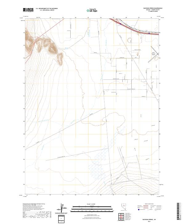
1985 Blossom Spring
Lander County, NV
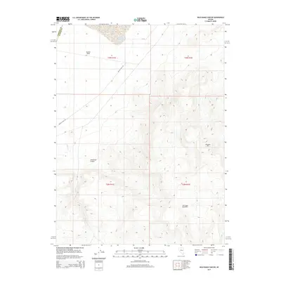
1985 Crippen Canyon
Lander County, NV
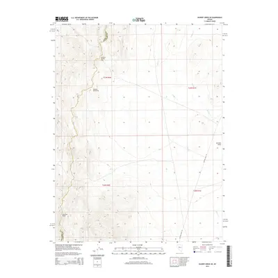
1985 Ferris Creek
Lander County, NV
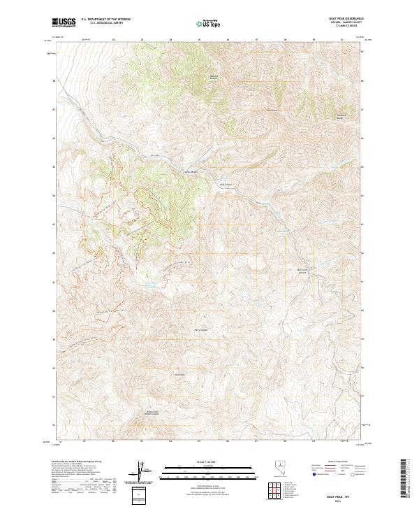
1985 Goat Peak
Lander County, NV
1985 Mt. Lewis
Lander County, NV
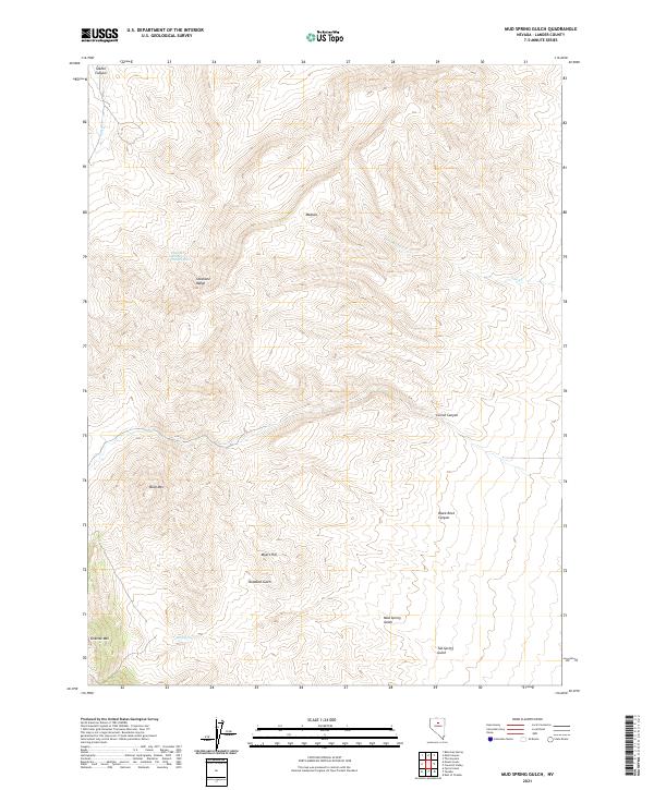
1985 Mud Spring Gulch
Lander County, NV
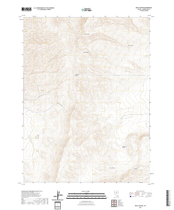
1985 Mule Canyon
Lander County, NV
1985 Smith Creek Valley
Lander County, NV
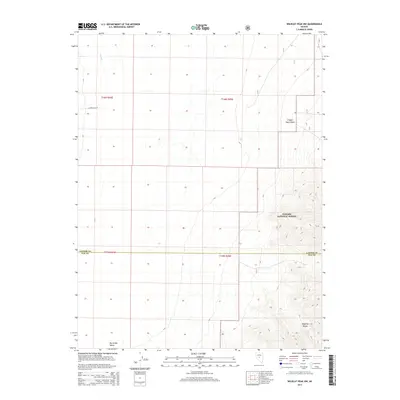
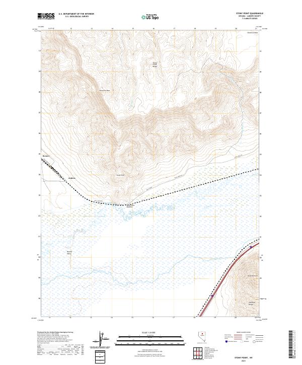
1985 Stony Point
Lander County, NV
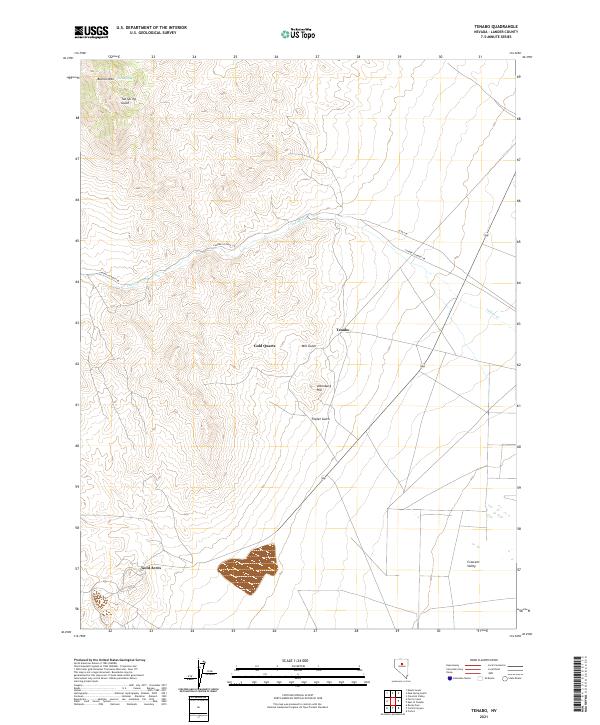
1985 Tenabo
Lander County, NV
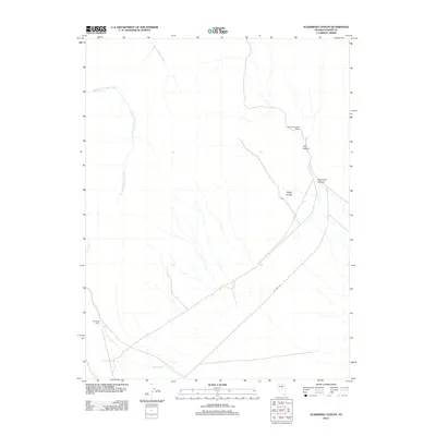
1986 Ackerman Canyon
Lander County, NV
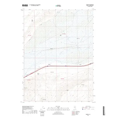
1986 Barton Spring
Lander County, NV
1986 Bateman Spring
Lander County, NV
1986 Bates Mountain
Lander County, NV
1986 Corral Canyon
Lander County, NV
1986 Cortez Canyon
Lander County, NV
1986 Cowboy Rest Creek
Lander County, NV
1986 Grass Valley Ranch
Lander County, NV
1986 Hall Creek North
Lander County, NV
1986 Hall Creek South
Lander County, NV
1986 Little Hot Springs
Lander County, NV
1986 Mount Callaghan
Lander County, NV
1986 Salt Marsh Canyon
Lander County, NV
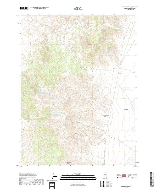
1986 Wenban Spring
Lander County, NV
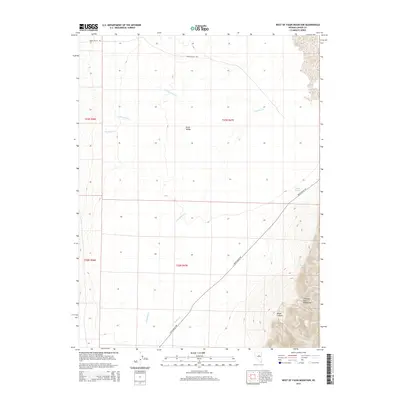
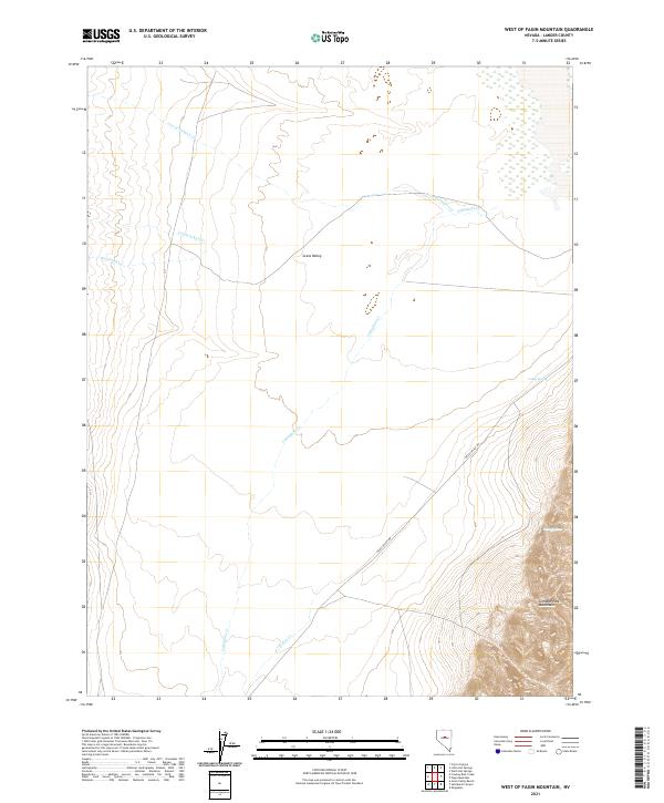
1986 West of Fagin Mtn
Lander County, NV
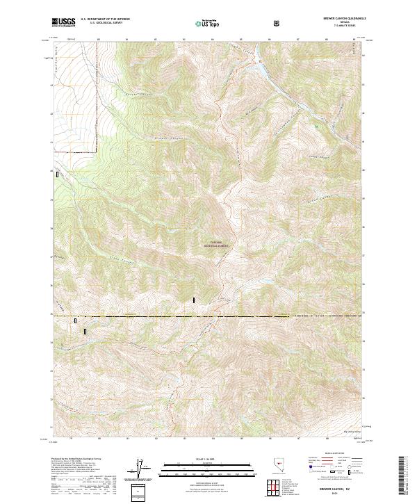
1988 Brewer Canyon
Lander County, NV
1988 Bunker Hill
Lander County, NV
1988 Campbell Creek Ranch
Lander County, NV
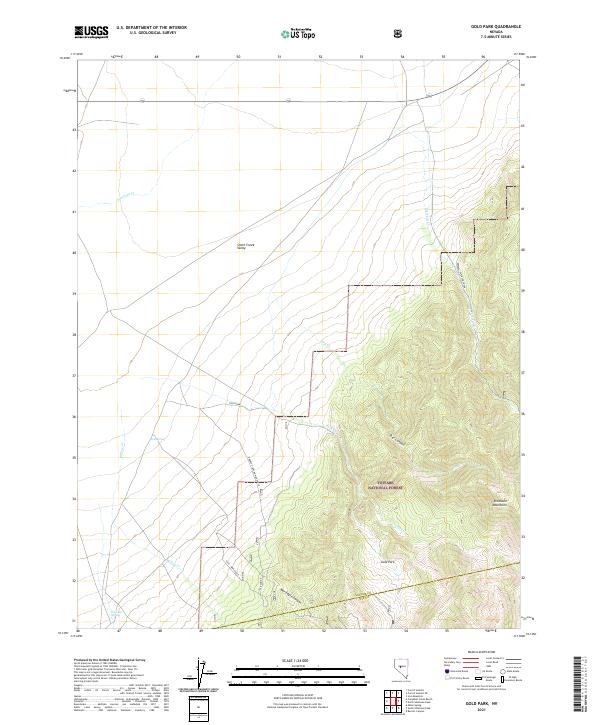
1988 Gold Park
Lander County, NV
1988 North Shoshone Peak
Lander County, NV
1988 North Toiyabe Peak
Lander County, NV
1988 Reese River Butte
Lander County, NV
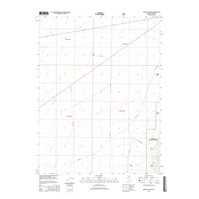
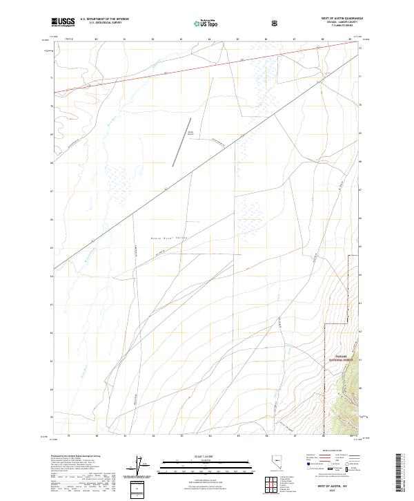
1988 West of Austin
Lander County, NV
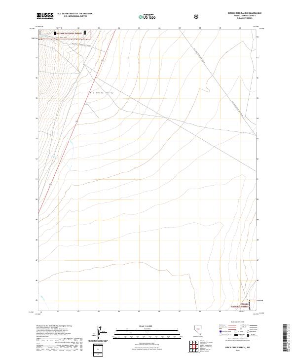
1989 Birch Creek Ranch
Lander County, NV
1989 Cape Horn
Lander County, NV
1989 Hickison Summit
Lander County, NV
1989 Petes Summit
Lander County, NV
1989 Potts Well
Lander County, NV
1989 Simpson Park Canyon
Lander County, NV
1989 Spencer Hot Springs
Lander County, NV
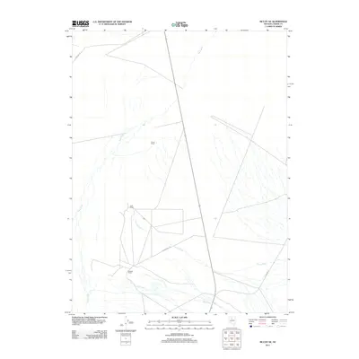
1989 The Monitor
Lander County, NV
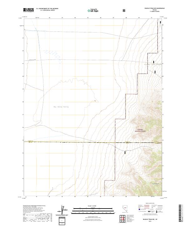
1989 Wildcat Peak NW
Lander County, NV
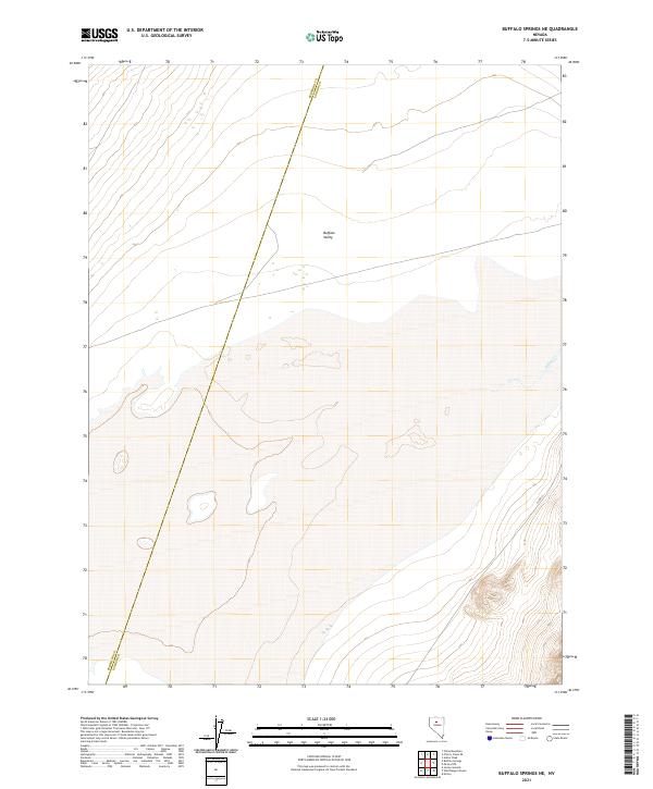
1990 Buffalo Springs NE
Lander County, NV
1990 Carico Lake North
Lander County, NV
1990 Carico Lake South
Lander County, NV
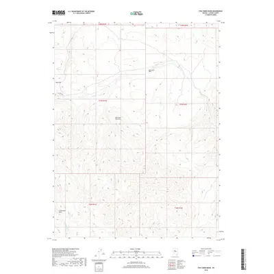
1990 Fish Creek Basin
Lander County, NV
1990 Home Station Gap
Lander County, NV
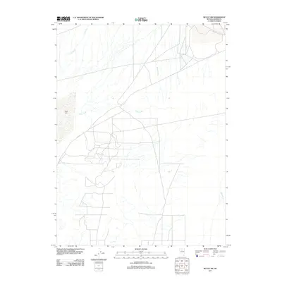
1990 McCoy
Lander County, NV
1990 McCoy NE
Lander County, NV
1990 McCoy NW
Lander County, NV
1990 Moss Creek
Lander County, NV
1990 Mt. Moses
Lander County, NV
1990 Mt. Moses SE
Lander County, NV
1990 Redrock Spring
Lander County, NV
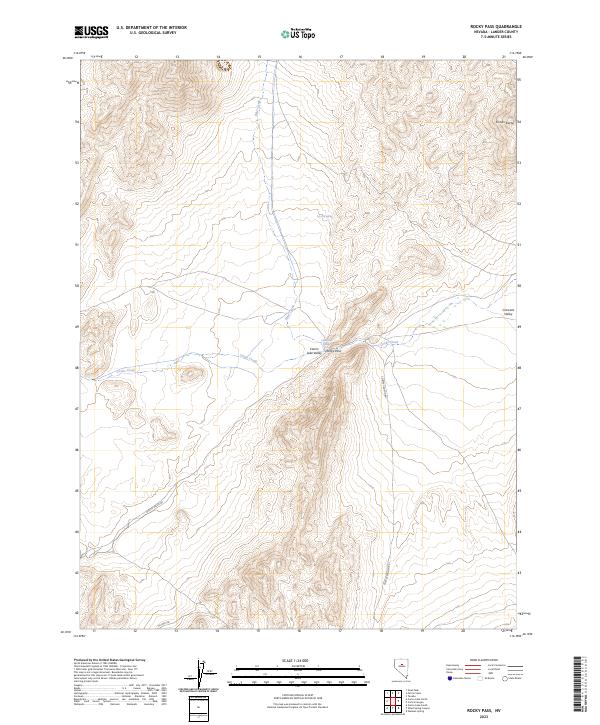
1990 Rocky Pass
Lander County, NV
1990 The Cedars
Lander County, NV
1990 The Cedars SW
Lander County, NV
1990 Watts
Lander County, NV
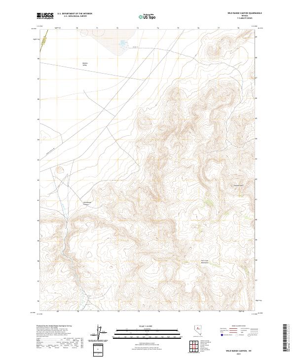
1990 Wild Range Canyon
Lander County, NV
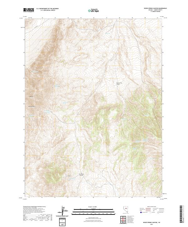
1990 Wood Spring Canyon
Lander County, NV
2011 Antler Peak
Lander County, NV
2011 Buffalo Springs NE
Lander County, NV
2011 Campbell Creek Ranch
Lander County, NV
2011 Carroll Summit
Lander County, NV
2011 Carroll Summit NE
Lander County, NV
2011 Carroll Summit SE
Lander County, NV
2011 Emigrant Peak
Lander County, NV
2011 Fish Creek Basin
Lander County, NV
2011 Galena Canyon
Lander County, NV
2011 Gandolfo Canyon
Lander County, NV
2011 Gilbert Creek NE
Lander County, NV
2011 Gilbert Creek NW
Lander County, NV
2011 Gilbert Creek SE
Lander County, NV
2011 Gilbert Creek SW
Lander County, NV
2011 Home Station Gap
Lander County, NV
2011 Joe Eason Mountain
Lander County, NV
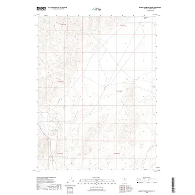
2011 Manhattan Mountain
Lander County, NV
2011 Manhattan Mountain NE
Lander County, NV
2011 Manhattan Mountain NW
Lander County, NV
2011 McCoy
Lander County, NV
2011 McCoy NE
Lander County, NV
2011 McCoy NW
Lander County, NV
2011 Moss Creek
Lander County, NV
2011 Mount Airy
Lander County, NV
2011 Mount Airy Mesa
Lander County, NV
2011 Mount Airy NE
Lander County, NV
2011 Mount Moses
Lander County, NV
2011 Mount Moses SE
Lander County, NV
2011 New Pass Peak
Lander County, NV
2011 Redrock Spring
Lander County, NV
2011 The Cedars
Lander County, NV
2011 The Cedars SW
Lander County, NV
2011 Vigus Butte
Lander County, NV
2011 Vigus Butte NE
Lander County, NV
2011 Vigus Butte NW
Lander County, NV
2011 Watts
Lander County, NV
2011 Wild Range Canyon
Lander County, NV
2012 Ackerman Canyon
Lander County, NV
2012 Argenta
Lander County, NV
2012 Barton Spring
Lander County, NV
2012 Bateman Spring
Lander County, NV
2012 Bates Mountain
Lander County, NV
2012 Birch Creek Ranch
Lander County, NV
2012 Blossom Spring
Lander County, NV
2012 Brewer Canyon
Lander County, NV
2012 Bunker Hill
Lander County, NV
2012 Cape Horn
Lander County, NV
2012 Carico Lake North
Lander County, NV
2012 Carico Lake South
Lander County, NV
2012 Corral Canyon
Lander County, NV
2012 Cortez Canyon
Lander County, NV
2012 Cowboy Rest Creek
Lander County, NV
2012 Crippen Canyon
Lander County, NV
2012 Dutch Flat
Lander County, NV
2012 Ferris Creek
Lander County, NV
2012 Goat Peak
Lander County, NV
2012 Gold Park
Lander County, NV
2012 Grass Valley Ranch
Lander County, NV
2012 Hall Creek North
Lander County, NV
2012 Hall Creek South
Lander County, NV
2012 Hickison Summit
Lander County, NV
2012 Iron Mountain
Lander County, NV
2012 Izzenhood Gap
Lander County, NV
2012 Izzenhood Ranch
Lander County, NV
2012 Izzenhood Spring
Lander County, NV
2012 Little Hot Springs
Lander County, NV
2012 Mount Callaghan
Lander County, NV
2012 Mount Lewis
Lander County, NV
2012 Mud Spring Gulch
Lander County, NV
2012 Mule Canyon
Lander County, NV
2012 North Shoshone Peak
Lander County, NV
2012 North Toiyabe Peak
Lander County, NV
2012 Petes Summit
Lander County, NV
2012 Potts Well
Lander County, NV
2012 Reese River Butte
Lander County, NV
2012 Rocky Pass
Lander County, NV
2012 Russells
Lander County, NV
2012 Salt Marsh Canyon
Lander County, NV
2012 Sheep Creek Range NW
Lander County, NV
2012 Sheep Creek Range SW
Lander County, NV
2012 Simpson Park Canyon
Lander County, NV
2012 Spencer Hot Springs
Lander County, NV
2012 Stony Point
Lander County, NV
2012 Tenabo
Lander County, NV
2012 The Monitor
Lander County, NV
2012 Wenban Spring
Lander County, NV
2012 West of Austin
Lander County, NV
2012 West of Fagin Mountain
Lander County, NV
2012 Wildcat Peak NW
Lander County, NV
2012 Wood Spring Canyon
Lander County, NV
2012 Yankee Blade
Lander County, NV
2014 Ackerman Canyon
Lander County, NV
2014 Antler Peak
Lander County, NV
2014 Argenta
Lander County, NV
2014 Barton Spring
Lander County, NV
2014 Bateman Spring
Lander County, NV
2014 Bates Mountain
Lander County, NV
2014 Birch Creek Ranch
Lander County, NV
2014 Blossom Spring
Lander County, NV
2014 Buffalo Springs NE
Lander County, NV
2014 Bunker Hill
Lander County, NV
2014 Cape Horn
Lander County, NV
2014 Carico Lake North
Lander County, NV
2014 Carico Lake South
Lander County, NV
2014 Carroll Summit SE
Lander County, NV
2014 Corral Canyon
Lander County, NV
2014 Cortez Canyon
Lander County, NV
2014 Cowboy Rest Creek
Lander County, NV
2014 Crippen Canyon
Lander County, NV
2014 Dutch Flat
Lander County, NV
2014 Emigrant Peak
Lander County, NV
2014 Ferris Creek
Lander County, NV
2014 Fish Creek Basin
Lander County, NV
2014 Galena Canyon
Lander County, NV
2014 Gandolfo Canyon
Lander County, NV
2014 Gilbert Creek NE
Lander County, NV
2014 Gilbert Creek SE
Lander County, NV
2014 Gilbert Creek SW
Lander County, NV
2014 Goat Peak
Lander County, NV
2014 Hall Creek North
Lander County, NV
2014 Hall Creek South
Lander County, NV
2014 Home Station Gap
Lander County, NV
2014 Iron Mountain
Lander County, NV
2014 Izzenhood Gap
Lander County, NV
2014 Izzenhood Ranch
Lander County, NV
2014 Izzenhood Spring
Lander County, NV
2014 Joe Eason Mountain
Lander County, NV
2014 Little Hot Springs
Lander County, NV
2014 Manhattan Mountain NE
Lander County, NV
2014 Manhattan Mountain NW
Lander County, NV
2014 McCoy
Lander County, NV
2014 McCoy NE
Lander County, NV
2014 McCoy NW
Lander County, NV
2014 Moss Creek
Lander County, NV
2014 Mount Airy
Lander County, NV
2014 Mount Airy Mesa
Lander County, NV
2014 Mount Airy NE
Lander County, NV
2014 Mount Lewis
Lander County, NV
2014 Mount Moses
Lander County, NV
2014 Mount Moses SE
Lander County, NV
2014 Mud Spring Gulch
Lander County, NV
2014 Mule Canyon
Lander County, NV
2014 New Pass Peak
Lander County, NV
2014 Potts Well
Lander County, NV
2014 Redrock Spring
Lander County, NV
2014 Rocky Pass
Lander County, NV
2014 Russells
Lander County, NV
2014 Sheep Creek Range NW
Lander County, NV
2014 Sheep Creek Range SW
Lander County, NV
2014 Simpson Park Canyon
Lander County, NV
2014 Spencer Hot Springs
Lander County, NV
2014 Stony Point
Lander County, NV
2014 Tenabo
Lander County, NV
2014 The Cedars
Lander County, NV
2014 The Cedars SW
Lander County, NV
2014 The Monitor
Lander County, NV
2014 Vigus Butte
Lander County, NV
2014 Vigus Butte NE
Lander County, NV
2014 Vigus Butte NW
Lander County, NV
2014 Wenban Spring
Lander County, NV
2014 West of Austin
Lander County, NV
2014 Wildcat Peak NW
Lander County, NV
2014 Wild Range Canyon
Lander County, NV
2014 Wood Spring Canyon
Lander County, NV
2014 Yankee Blade
Lander County, NV
2015 Brewer Canyon
Lander County, NV
2015 Campbell Creek Ranch
Lander County, NV
2015 Carroll Summit
Lander County, NV
2015 Carroll Summit NE
Lander County, NV
2015 Gilbert Creek NW
Lander County, NV
2015 Gold Park
Lander County, NV
2015 Grass Valley Ranch
Lander County, NV
2015 Hickison Summit
Lander County, NV
2015 Manhattan Mountain
Lander County, NV
2015 Mount Callaghan
Lander County, NV
2015 North Shoshone Peak
Lander County, NV
2015 North Toiyabe Peak
Lander County, NV
2015 Petes Summit
Lander County, NV
2015 Reese River Butte
Lander County, NV
2015 Salt Marsh Canyon
Lander County, NV

2015 Watts
Lander County, NV
2015 West of Fagin Mountain
Lander County, NV
2018 Ackerman Canyon
Lander County, NV
2018 Antler Peak
Lander County, NV
2018 Argenta
Lander County, NV
2018 Barton Spring
Lander County, NV
2018 Bateman Spring
Lander County, NV
2018 Bates Mountain
Lander County, NV
2018 Birch Creek Ranch
Lander County, NV
2018 Blossom Spring
Lander County, NV
2018 Brewer Canyon
Lander County, NV
2018 Buffalo Springs NE
Lander County, NV
2018 Bunker Hill
Lander County, NV
2018 Campbell Creek Ranch
Lander County, NV
2018 Cape Horn
Lander County, NV
2018 Carico Lake North
Lander County, NV
2018 Carico Lake South
Lander County, NV
2018 Carroll Summit
Lander County, NV
2018 Carroll Summit NE
Lander County, NV
2018 Carroll Summit SE
Lander County, NV

2018 Corral Canyon
Lander County, NV
2018 Cortez Canyon
Lander County, NV
2018 Cowboy Rest Creek
Lander County, NV
2018 Crippen Canyon
Lander County, NV
2018 Dutch Flat
Lander County, NV
2018 Emigrant Peak
Lander County, NV
2018 Ferris Creek
Lander County, NV
2018 Fish Creek Basin
Lander County, NV
2018 Galena Canyon
Lander County, NV
2018 Gandolfo Canyon
Lander County, NV
2018 Gilbert Creek NE
Lander County, NV
2018 Gilbert Creek NW
Lander County, NV
2018 Gilbert Creek SE
Lander County, NV
2018 Gilbert Creek SW
Lander County, NV
2018 Goat Peak
Lander County, NV
2018 Gold Park
Lander County, NV
2018 Grass Valley Ranch
Lander County, NV
2018 Hall Creek North
Lander County, NV
2018 Hall Creek South
Lander County, NV
2018 Hickison Summit
Lander County, NV
2018 Home Station Gap
Lander County, NV
2018 Iron Mountain
Lander County, NV
2018 Izzenhood Gap
Lander County, NV
2018 Izzenhood Ranch
Lander County, NV
2018 Izzenhood Spring
Lander County, NV
2018 Joe Eason Mountain
Lander County, NV
2018 Little Hot Springs
Lander County, NV
2018 Manhattan Mountain
Lander County, NV
2018 Manhattan Mountain NE
Lander County, NV
2018 Manhattan Mountain NW
Lander County, NV
2018 McCoy
Lander County, NV
2018 McCoy NE
Lander County, NV
2018 McCoy NW
Lander County, NV
2018 Moss Creek
Lander County, NV
2018 Mount Airy
Lander County, NV
2018 Mount Airy Mesa
Lander County, NV
2018 Mount Airy NE
Lander County, NV
2018 Mount Callaghan
Lander County, NV
2018 Mount Lewis
Lander County, NV
2018 Mount Moses
Lander County, NV
2018 Mount Moses SE
Lander County, NV
2018 Mud Spring Gulch
Lander County, NV
2018 Mule Canyon
Lander County, NV
2018 New Pass Peak
Lander County, NV
2018 North Shoshone Peak
Lander County, NV
2018 North Toiyabe Peak
Lander County, NV
2018 Petes Summit
Lander County, NV
2018 Potts Well
Lander County, NV
2018 Redrock Spring
Lander County, NV
2018 Reese River Butte
Lander County, NV
2018 Rocky Pass
Lander County, NV
2018 Russells
Lander County, NV
2018 Salt Marsh Canyon
Lander County, NV
2018 Sheep Creek Range NW
Lander County, NV
2018 Sheep Creek Range SW
Lander County, NV
2018 Simpson Park Canyon
Lander County, NV
2018 Spencer Hot Springs
Lander County, NV
2018 Stony Point
Lander County, NV
2018 Tenabo
Lander County, NV
2018 The Cedars
Lander County, NV
2018 The Cedars SW
Lander County, NV
2018 The Monitor
Lander County, NV
2018 Vigus Butte
Lander County, NV
2018 Vigus Butte NE
Lander County, NV
2018 Vigus Butte NW
Lander County, NV
2018 Watts
Lander County, NV
2018 Wenban Spring
Lander County, NV
2018 West of Austin
Lander County, NV
2018 West of Fagin Mountain
Lander County, NV
2018 Wildcat Peak NW
Lander County, NV
2018 Wild Range Canyon
Lander County, NV
2018 Wood Spring Canyon
Lander County, NV
2018 Yankee Blade
Lander County, NV
2021 Ackerman Canyon
Lander County, NV
2021 Antler Peak
Lander County, NV

2021 Argenta
Lander County, NV
2021 Barton Spring
Lander County, NV
2021 Bateman Spring
Lander County, NV
2021 Bates Mountain
Lander County, NV
2021 Birch Creek Ranch
Lander County, NV
2021 Blossom Spring
Lander County, NV
2021 Brewer Canyon
Lander County, NV
2021 Buffalo Springs NE
Lander County, NV
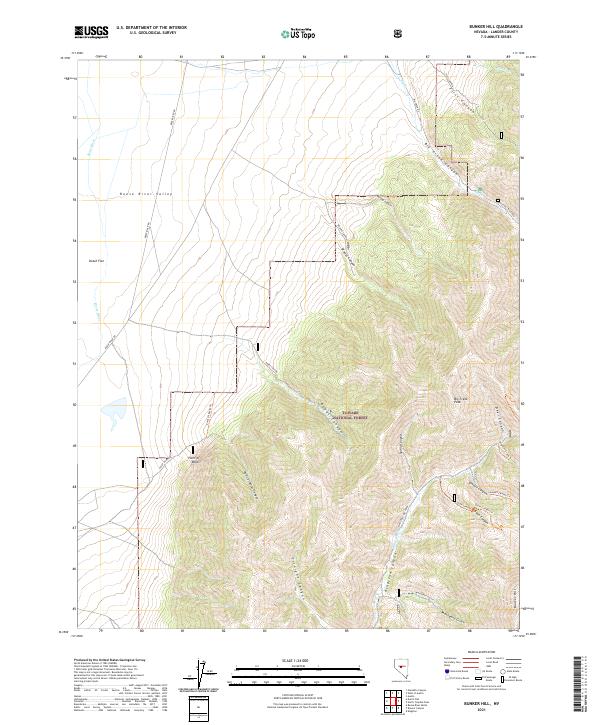
2021 Bunker Hill
Lander County, NV
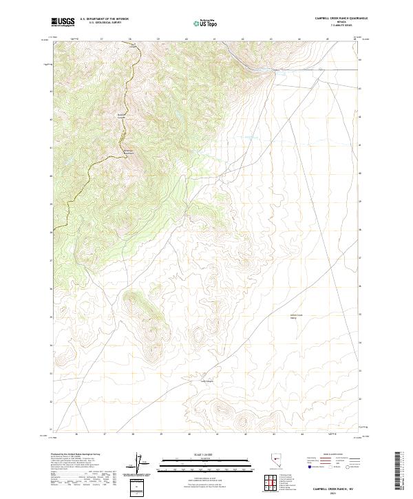
2021 Campbell Creek Ranch
Lander County, NV
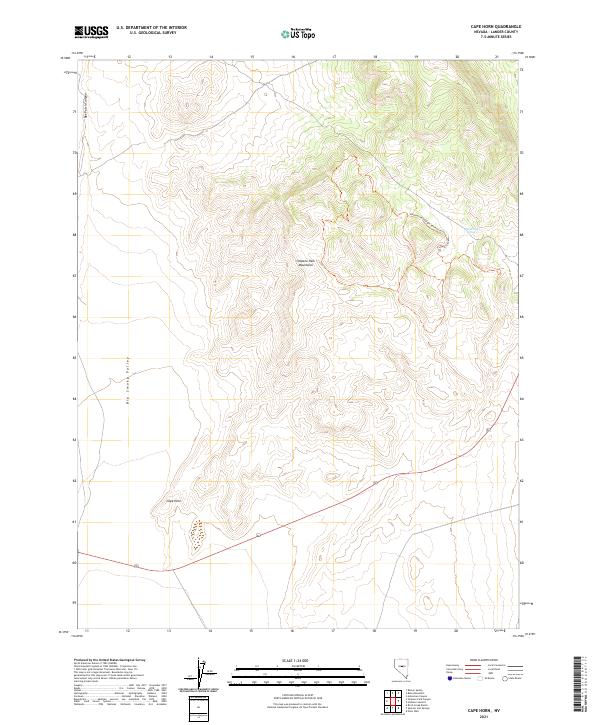
2021 Cape Horn
Lander County, NV
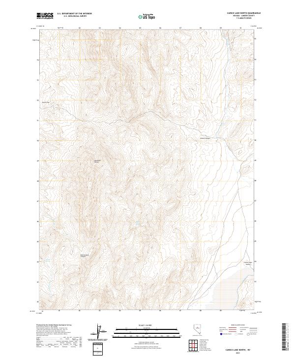
2021 Carico Lake North
Lander County, NV
2021 Carico Lake South
Lander County, NV
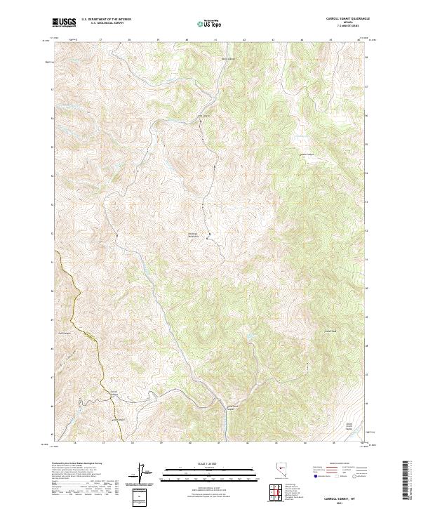
2021 Carroll Summit
Lander County, NV
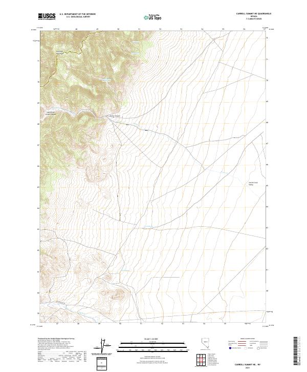
2021 Carroll Summit NE
Lander County, NV
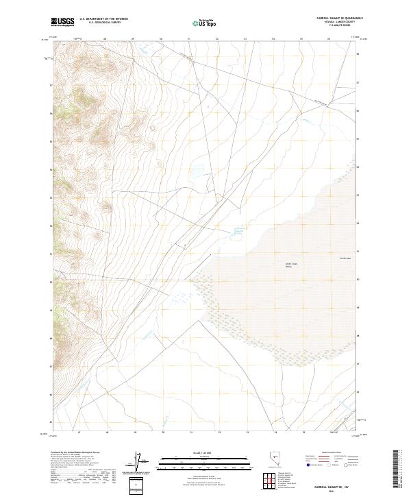
2021 Carroll Summit SE
Lander County, NV
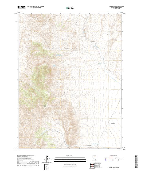
2021 Corral Canyon
Lander County, NV
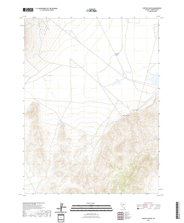
2021 Cortez Canyon
Lander County, NV
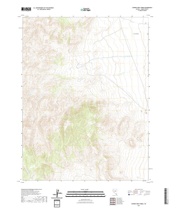
2021 Cowboy Rest Creek
Lander County, NV
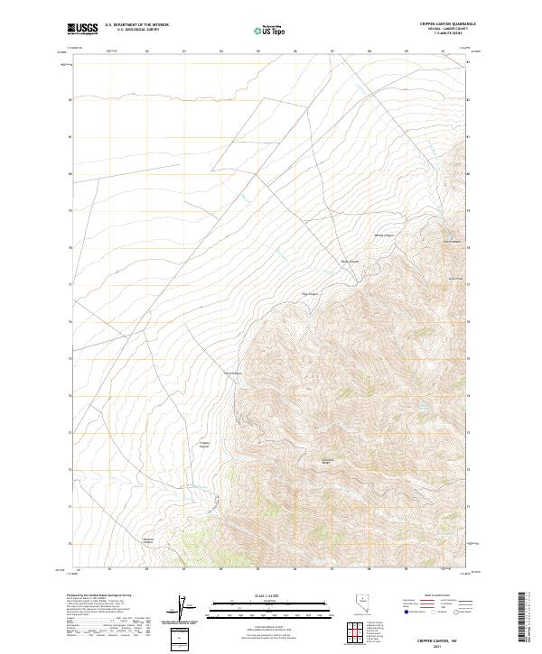
2021 Crippen Canyon
Lander County, NV
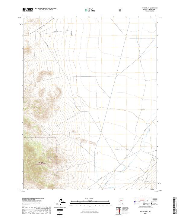
2021 Dutch Flat
Lander County, NV
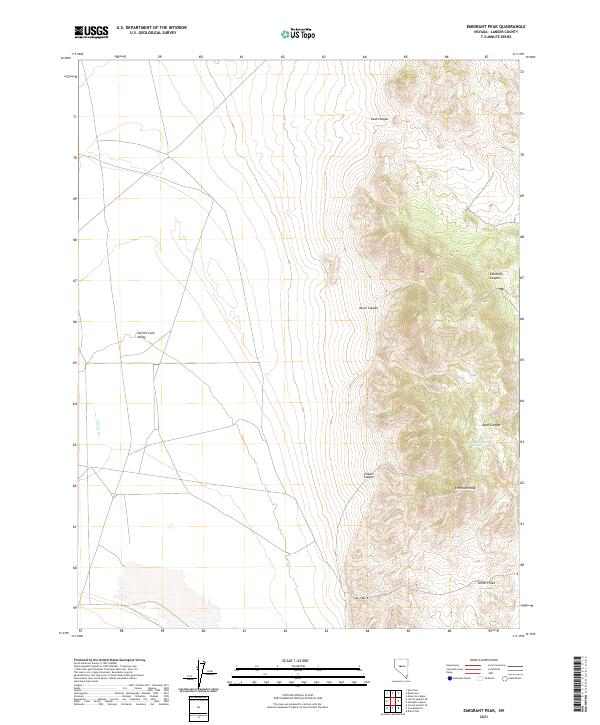
2021 Emigrant Peak
Lander County, NV
2021 Ferris Creek
Lander County, NV
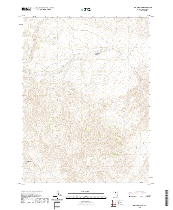
2021 Fish Creek Basin
Lander County, NV
2021 Galena Canyon
Lander County, NV
2021 Gandolfo Canyon
Lander County, NV
2021 Gilbert Creek NE
Lander County, NV
2021 Gilbert Creek NW
Lander County, NV
2021 Gilbert Creek SE
Lander County, NV
2021 Gilbert Creek SW
Lander County, NV
2021 Goat Peak
Lander County, NV
2021 Gold Park
Lander County, NV
2021 Grass Valley Ranch
Lander County, NV
2021 Hall Creek North
Lander County, NV
2021 Hall Creek South
Lander County, NV
2021 Hickison Summit
Lander County, NV
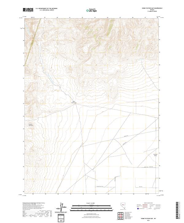
2021 Home Station Gap
Lander County, NV
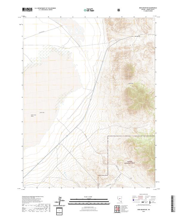
2021 Iron Mountain
Lander County, NV
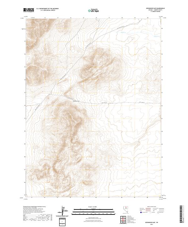
2021 Izzenhood Gap
Lander County, NV
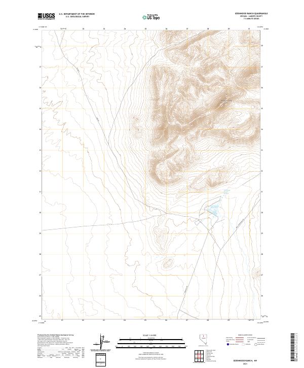
2021 Izzenhood Ranch
Lander County, NV
2021 Izzenhood Spring
Lander County, NV
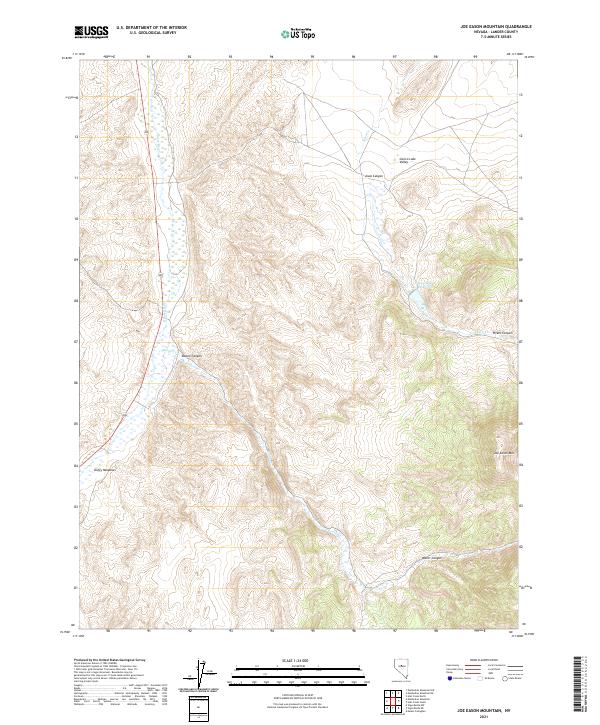
2021 Joe Eason Mountain
Lander County, NV
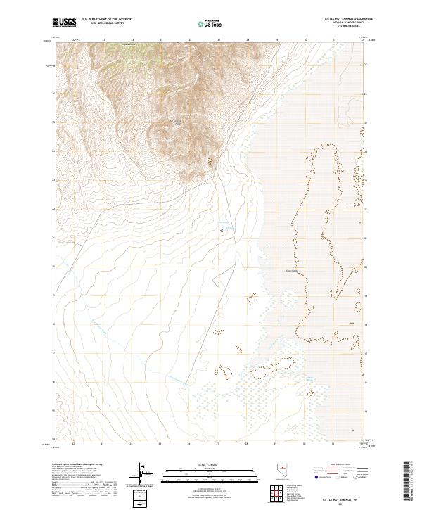
2021 Little Hot Springs
Lander County, NV
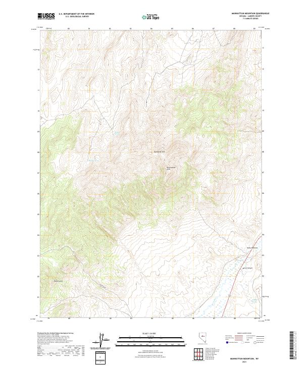
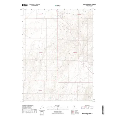
2021 Manhattan Mountain
Lander County, NV
2021 Manhattan Mountain NE
Lander County, NV
2021 Manhattan Mountain NW
Lander County, NV
2021 McCoy
Lander County, NV
2021 McCoy NE
Lander County, NV
2021 McCoy NW
Lander County, NV
2021 Moss Creek
Lander County, NV
2021 Mount Airy
Lander County, NV
2021 Mount Airy Mesa
Lander County, NV
2021 Mount Airy NE
Lander County, NV

2021 Mount Callaghan
Lander County, NV
2021 Mount Lewis
Lander County, NV
2021 Mount Moses
Lander County, NV
2021 Mount Moses SE
Lander County, NV
2021 Mud Spring Gulch
Lander County, NV
2021 Mule Canyon
Lander County, NV
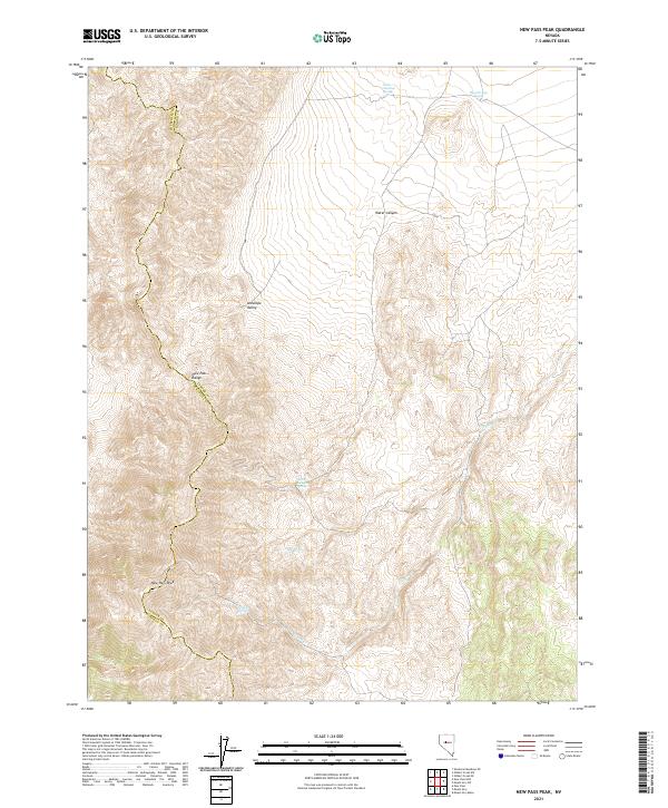
2021 New Pass Peak
Lander County, NV
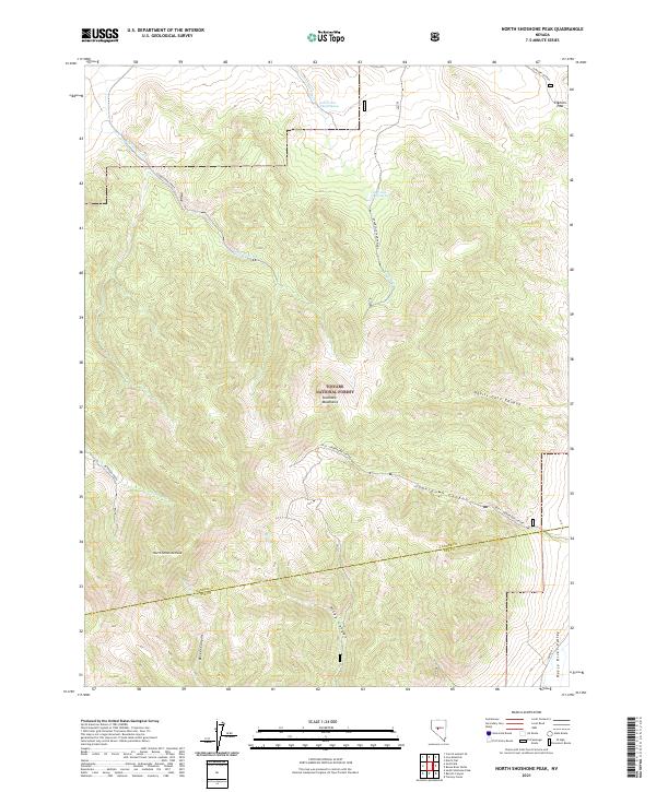
2021 North Shoshone Peak
Lander County, NV
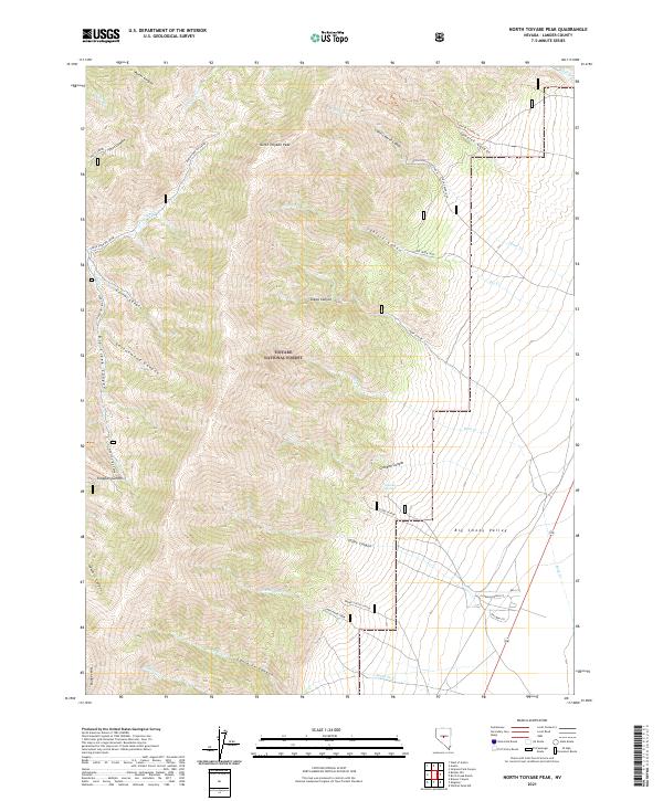
2021 North Toiyabe Peak
Lander County, NV
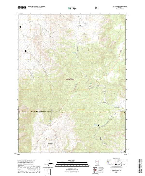
2021 Petes Summit
Lander County, NV
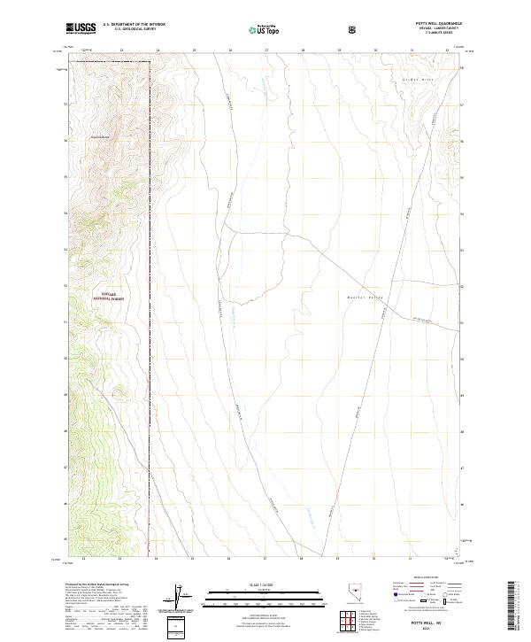
2021 Potts Well
Lander County, NV
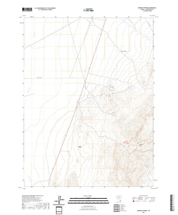
2021 Redrock Spring
Lander County, NV
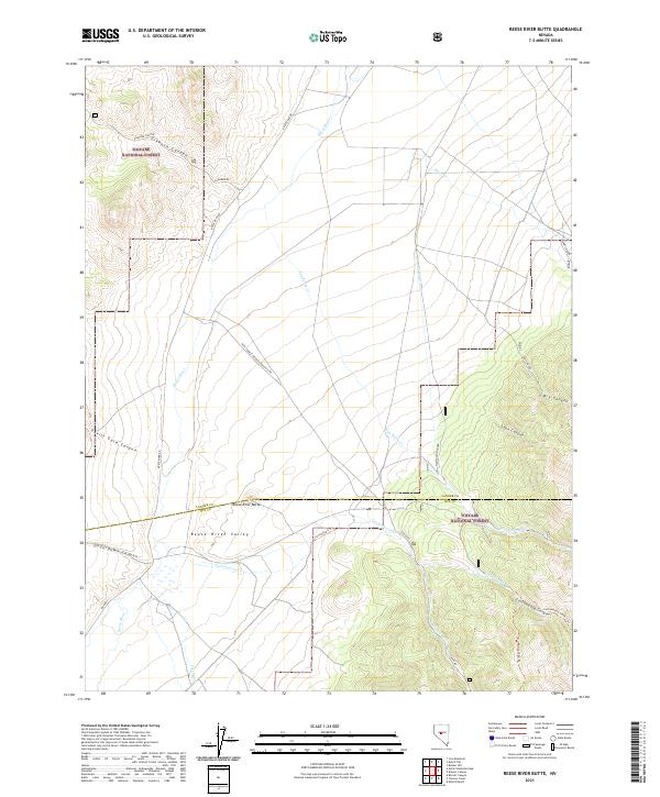
2021 Reese River Butte
Lander County, NV
2021 Rocky Pass
Lander County, NV
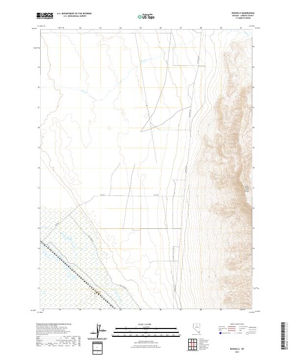
2021 Russells
Lander County, NV
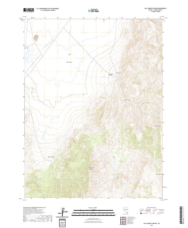
2021 Salt Marsh Canyon
Lander County, NV
2021 Sheep Creek Range NW
Lander County, NV
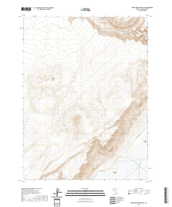
2021 Sheep Creek Range SW
Lander County, NV
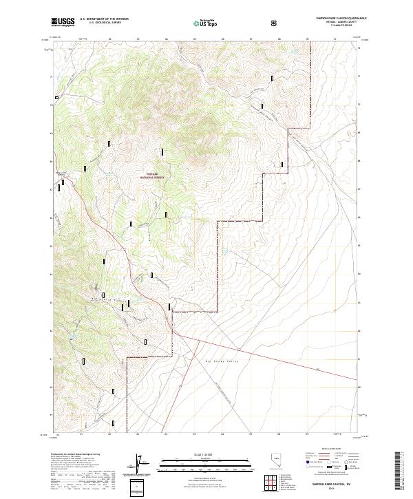
2021 Simpson Park Canyon
Lander County, NV
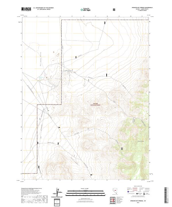
2021 Spencer Hot Springs
Lander County, NV
2021 Stony Point
Lander County, NV
2021 Tenabo
Lander County, NV
2021 The Cedars
Lander County, NV
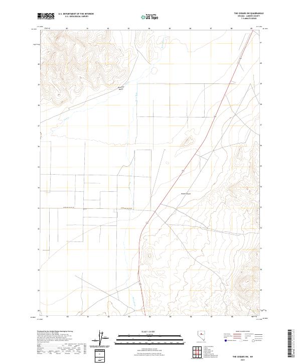
2021 The Cedars SW
Lander County, NV
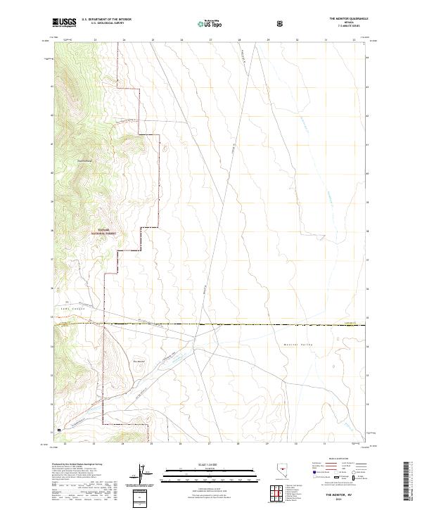
2021 The Monitor
Lander County, NV
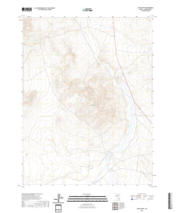
2021 Vigus Butte
Lander County, NV
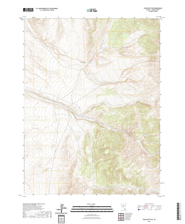
2021 Vigus Butte NE
Lander County, NV

2021 Vigus Butte NW
Lander County, NV
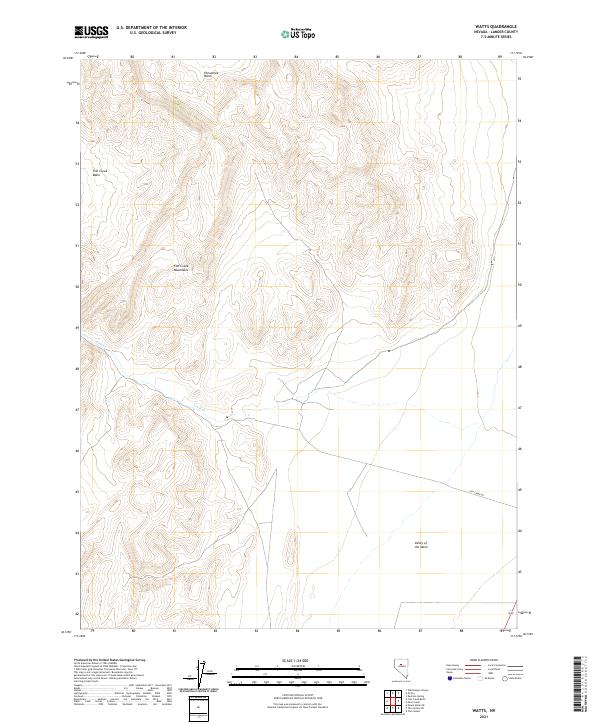
2021 Watts
Lander County, NV
2021 Wenban Spring
Lander County, NV
2021 West of Austin
Lander County, NV
2021 West of Fagin Mountain
Lander County, NV
2021 Wildcat Peak NW
Lander County, NV
2021 Wild Range Canyon
Lander County, NV
2021 Wood Spring Canyon
Lander County, NV

2021 Yankee Blade
Lander County, NV
2023 Rocky Pass
Lander County, NV