
1965 Map of Sheep Creek Range NE
USGS Topo · Published 1967About this map
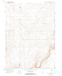
The Sheep Creek Range dominates this mid-1960s survey of central Nevada, where steep topography transitions into the broad Boulder Valley. This landscape is defined by its isolation and high-desert character, straddling the county line between Lander Co and Eureka Co. Evidence of human activity is sparse, marked primarily by a singular Landing Strip in the northwest corner and a network of Jeep Trails that navigate the high ridges and valley floors. This map provides a look at the region’s topography before significant modern development, showing the sheer relief of the interior ranges that dictated early ranching and mining access in the Great Basin.
Find a feature on this map
5 named features on this map. Tap any name to fly to it.
Don’t see what you’re looking for? This feature index may not catch every label — zoom into the map to look around manually.
Map Details
Editions of this 1965 Sheep Creek Range NE Map
2 editions found
Other maps of this area

1955 · McDermitt
USGS Topo · 1:250,000

1955 · Winnemucca
USGS Topo · 1:250,000

1958 · Winnemucca
USGS Topo · 1:250,000

1959 · McDermitt
USGS Topo · 1:250,000

1962 · Winnemucca
USGS Topo · 1:250,000

1965 · Sheep Creek Range SW
USGS Topo · 1:24,000

1965 · Sheep Creek Range SE
USGS Topo · 1:24,000

1965 · Sheep Creek Range NW
USGS Topo · 1:24,000

1965 · Rock Creek Ranch
USGS Topo · 1:24,000
1965 · Willow Creek Reservoir SE
USGS Topo · 1:24,000