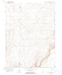
1965 Map of Sheep Creek Range NE
USGS Topo · Published 1967About this map
The high ridges of the Sheep Creek Range dominate this mid-1960s survey of the Nevada interior, where the high desert terrain meets the northern reaches of Boulder Valley. The landscape is defined by its isolation and utility, featuring a remote Landing Strip in the northwestern section and a network of rugged transportation routes labeled simply as Jeep Trail. Water is scarce in this environment, with the ephemeral flow of Boulder Cr in the southeast being one of the few named drainage features. This map also preserves the administrative division between Lander and Eureka counties, which cuts directly through the high-elevation country of the range, offering a precise view of the boundary lines before modern development or road improvements in the Great Basin region.
Find a feature on this map
6 named features on this map. Tap any name to fly to it.
Don’t see what you’re looking for? This feature index may not catch every label — zoom into the map to look around manually.
Map Details
Editions of this 1965 Sheep Creek Range NE Map
2 editions found
Other maps of this area

1955 · McDermitt
USGS Topo · 1:250,000

1955 · Winnemucca
USGS Topo · 1:250,000

1958 · Winnemucca
USGS Topo · 1:250,000

1959 · McDermitt
USGS Topo · 1:250,000

1962 · Winnemucca
USGS Topo · 1:250,000

1965 · Sheep Creek Range SW
USGS Topo · 1:24,000

1965 · Sheep Creek Range NE
USGS Topo · 1:24,000

1965 · Sheep Creek Range SE
USGS Topo · 1:24,000

1965 · Sheep Creek Range NW
USGS Topo · 1:24,000

1965 · Rock Creek Ranch
USGS Topo · 1:24,000